
Directions
From Moab, drive south on Highway 191 until you see signs for Ken’s Lake, approximately 8 miles. Turn left off the highway and follow signs to the lake. The campground is just beyond the turn to the lake. Group Site A is in the first campground loop and B is on the second loop.
Phone
435-259-2100
Activities
AUTO TOURING, BOATING, CAMPING, FISHING, HIKING, OFF HIGHWAY VEHICLE, RECREATIONAL VEHICLES, WATER SPORTS, DAY USE AREA, SWIMMING SITE, SWIMMING, HORSE CAMPING, OFF ROAD VEHICLE TRAILS, WATER ACTIVITIES, CANOEING, STAR GAZING, WATER ACCESS
Keywords
Related Link(s)
Overview
The Ken’s Lake Group Sites are ideal for those wishing to be close to Moab, but away from the local highways. The lake offers swimming, paddle-boarding, limited boating and fishing. Hiking and 4WD roads are accessible from the campground. Within close proximity to national parks and open space, outdoor enthusiasts will enjoy hiking, mountain biking, whitewater rafting, and four-wheel drive tours in the surrounding area. The town of Moab is approximately 15-20 minutes away and has dining, shopping, sports rentals, tour companies and museums.
Recreation
The town of Moab is a hub for recreation. Tour operators offer guided hikes, rentals and evening entertainment. The area abounds with trails, dirt roads and canyons waiting to be explored.
Facilities
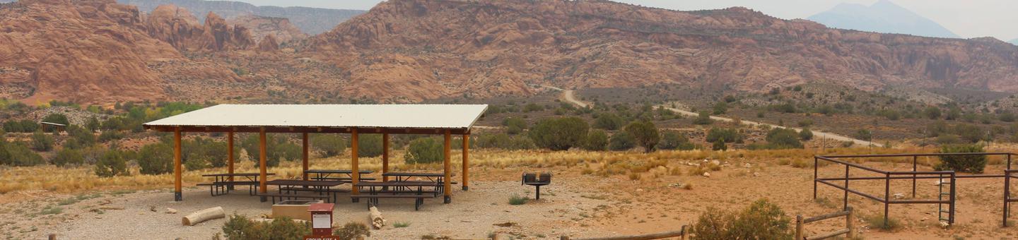
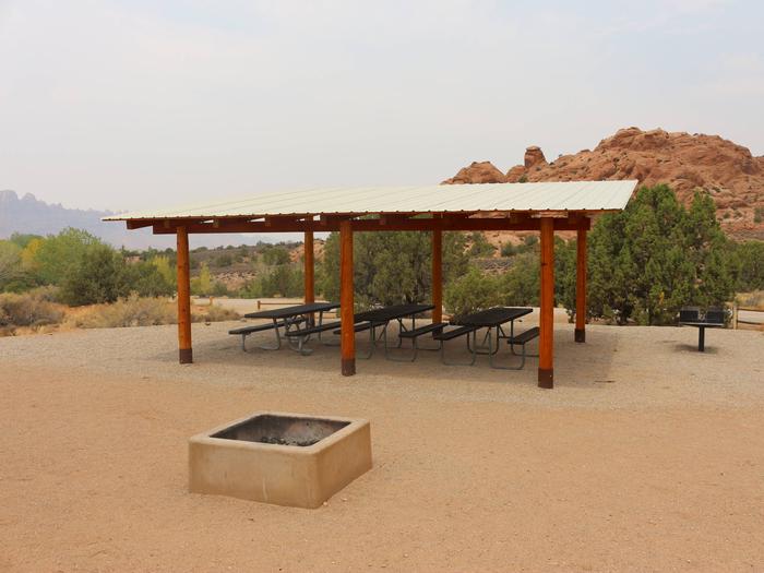
The group sites have fire grates, picnic tables, shade shelter and vault toilets. Group Site A has a horse corral. The group sites do not have water, dump stations or electric hook-ups. Site A is on the right as you enter the first loop and Site B is near the end on the left in the second loop.
Natural Features
Situated near Ken’s Lake, these group sites offer beautiful views of the Moab Valley and access to nearby swimming, boating and hiking opportunities. From the group sites, it is a short hike over to the lake or up to a man-made waterfall. Hiking trails from the campground and nearby four-wheel drive roads allow visitors to explore the beautiful red rock canyons.
Nearby Attractions
Arches and Canyonlands National Parks and Hovenweep and Natural Bridges National Monuments are nearby. Also in the area are the Manti-La Sal National Forest and the La Sal Mountain Loop Road, which provide interesting exploration opportunities and cooler temperatures during the summer months.