
Directions
From Bismarck, ND: travel north on US-83/ND-1804 approximately 55 miles, turn left onto ND-200/6th St. NW and travel approximately 7.5 miles, turn right onto 37th Ave NW and travel 1 mile then turn right onto 7th St. NW travel 1 mile and turn left onto 36th Ave NW, travel approximately 2 miles and arrive at campground.
From Minot, ND: travel south on US-83 for approximately 50 miles, turn right onto 32nd Ave NW and travel for 1 mile, turn right onto 8th St NW and travel 4 miles, turn right onto 36th Ave NW and travel for 1 mile and arrive at campground.
Phone
701-654-7411. FOR RESERVATIONS, PLEASE CALL 877-444-6777.
Activities
BIKING, BOATING, CAMPING, FISHING, HIKING, HUNTING, PICNICKING, DAY USE AREA, PHOTOGRAPHY, PADDLING, SWIMMING, MOTOR BOAT, KAYAKING, CANOEING, BIRDING, NON-MOTORIZED BOATING, WATER ACCESS, WATER SKIING, SAILING, TUBING, SKIING, ICE FISHING
Keywords
Related Link(s)
North Dakota State Road Conditions
Overview
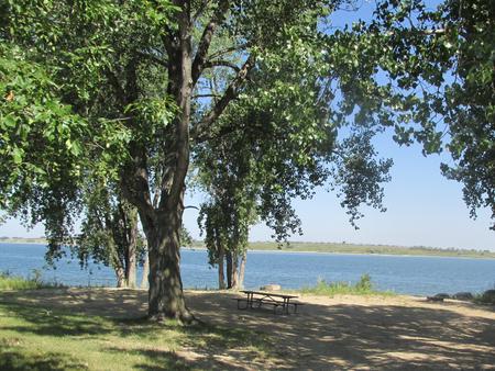
The Wolf Creek Campground is located along the southern shore of beautiful Lake Sakakawea. The recreation area offers a wide variety of recreational activities, including boating, fishing, hiking, mountain biking, sailing, scuba diving, bird watching, and hunting. In the winter the area offers great ice fishing access opportunites.
For more information about Lake Sakakawea, please visit the Garrison Project website here .
Recreation
Lake Sakakawea offers excellent boating, swimming, fishing and hunting opportunities. Several state record fish have been caught in Lake Sakakawea. Anglers fish for walleye, Sauger, northern pike, muskie, small and large mouth bass, bluegill and crappie. Chinook salmon can be also found in the lake, the only body of water in the state with this species and is very popular place to camp as a result. The best catfishing is found directly below Garrison Dam just 6 miles away.
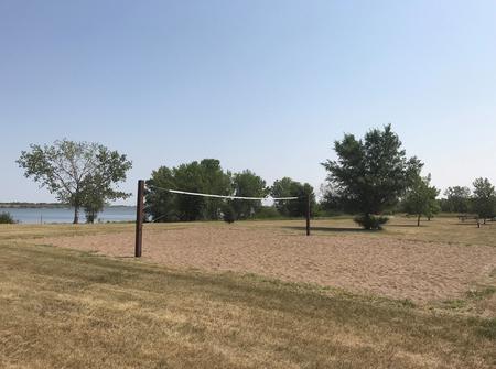
Younger visitors love the playground in the campground. While the volleyball courts, horseshoe pits are enjoyed by campers of all ages. There are showers available in our Downstream Campground just 5 miles down the road as well as amphitheater programs in the evenings on Saturdays.
The Wolf Creek Wildlife Management Area is located east and west of the campground and offers great hunting opportunities, its full of grass and wooded areas are open to the public for deer, pheasant, sharp-tail grouse, cottontail rabbits, and tree squirrels during open season.
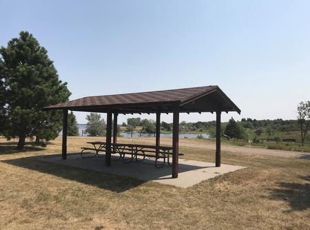
Facilities
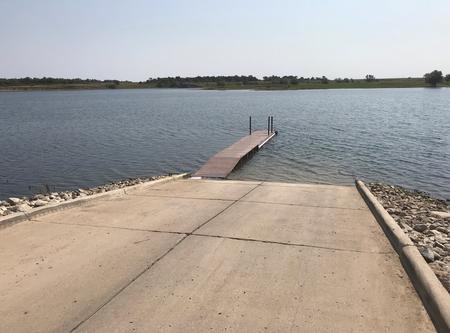
The campground consists of 67 primitive campsites, each with a picnic table and grill. Amenities include brand new vault toilets, fish cleaning station, a fill and dump station, boat ramp.
Natural Features
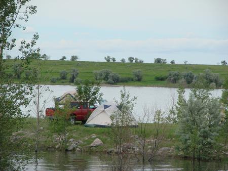
The campground is situated in a nice open grassy area with lake views from most of the campsites with the sites being right on the water.
Nearby Attractions
Garrison Dam National Fish Hatchery is minutes from the campground and is open to the public. It has a visitor center complete with five 400-gallon aquariums, provides great opportunities to view the fish of North Dakota in their environment.
The Garrison Dam Power Plant offers walking tours during the months of June, July, and first part of August on Thursday, Friday, and Saturday at 2pm.
The Audubon National Wildlife Refuge Visitor Center is located about 8 miles away on the south shore of Lake Audubon off Hwy. 83. The visitor center offers a variety of guided tours and environmental education programs.
Charges & Cancellations
For more information on reservation policies including changes and cancellations, please click here .