
Directions
- From Bismarck, ND: Travel north on US-83 for approximately 65 miles, turn right onto 14th St. NW and travel 0.5 miles until you reach the campground.
- From Minot, ND: Travel south on US-83 for approximately 44 miles then turn left onto 14th St. NW, travel 0.5 miles until you reach the campground.
Phone
701-654-7411. FOR RESERVATIONS, PLEASE CALL 877-444-6777.
Activities
BIKING, BOATING, CAMPING, FISHING, HIKING, HUNTING, PICNICKING, DAY USE AREA, PHOTOGRAPHY, PADDLING, SWIMMING, SNORKELING, MOTOR BOAT, MOUNTAIN BIKING, PADDLE BOATING, KAYAKING, CANOEING, BIRDING, NON-MOTORIZED BOATING, WATER ACCESS, CROSS COUNTRY SKIING, JET SKIING, WATER SKIING, SCENIC DRIVE, SAILING, SCUBA DIVING, TUBING, SNOWSHOEING, SLEDDING, SKIING, ICE FISHING, ICE SKATING, SAILBOARDING
Keywords
Related Link(s)
North Dakota State Road Conditions
Overview
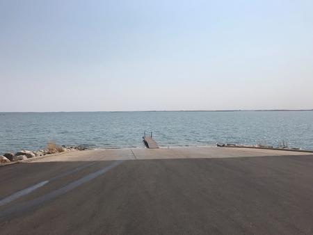
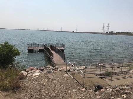
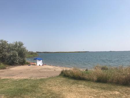
East Totten Trail Campground is located on the west banks of Lake Audubon. This is the only campground on the entire lake! This campground and day use area offers a wide variety of recreation activities, including boating, fishing, swimming, hiking, mountain biking, scuba diving, wildlife viewing, and bird watching. In the winter time the area offers excellent access for ice fishing and other outdoor recreational opportunites.
For more information, please visit the Lake Sakakawea / Garrison Project website here.
Recreation
Lake Audubon offers excellent boating, swimming, and fishing opportunities. Anglers fish for walleye, sauger, northern pike, muskie, white bass, small and large mouth bass, bluegill, crappie. Chinook salmon can be found in the neighboring lake of Lake Sakakawea only a stone’s throw away across the hwy from Lake Audubon. The area offers a wide variety of outdoor recreational opportunities. The campground is next to the Audubon Wildlife Management Area and offers hunting opportunities.
Audubon Lake, a sister lake to Lake Sakakawea, was also formed with the construction of the Garrison Dam near Riverdale, N.D. The two lakes are separated by an embankment, which carries US Highway 83. Audubon Lake makes up most of the U.S. Fish and Wildlife Service’s Audubon National Wildlife Refuge. The refuge and Audubon National Wildlife Complex are named in honor of John James Audubon, a naturalist and wildlife painter during the 19th century. Audubon spent the summer of 1843 collecting bird specimens and painting pictures of northern plains wildlife in the area.
Facilities
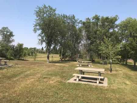
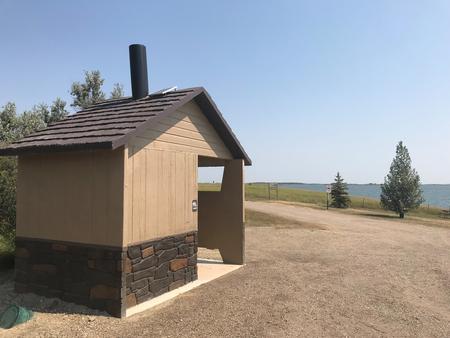
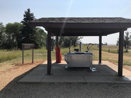
The campground consists of 30 campsites with electric hookups and developed concrete or gravel pads and 10 primitive campsites, each with a fire ring/grill. Amenities include new vault toilets, fish cleaning station, boat ramp, shoreline access area, fill and dump station, and paved roadways in the area.
Natural Features
The campground is situated in a nice grassy area with some trees with the beautiful lake view from almost every campsite.
Nearby Attractions
- The Audubon National Wildlife Refuge Visitor Center is located just 3 miles away on the south shore of Lake Audubon off Hwy. 83 The visitor center offers a variety of guided tours and environmental education programs.
- The Garrison Dam National Fish Hatchery is just a few minutes from the Campground near Riverdale, ND and is open to the public. It has a Visitor Center, complete with five 400-gallon aquariums, provides great opportunities to view the fish of North Dakota in their environment.
- The Garrison Dam Power Plant does offer walking tours during the months of June, July, and the first part of August on Thursdays, Fridays, and Saturdays at 2pm.