Directions
NPS VISITOR CENTER/FERRY CHECK-IN:
- Take Exit 3 from Interstate 95. At the exit stop light turn east on to Highway 40.
- Follow the signs traveling east into Historic St. Marys. Highway 40 East will become Osborne St.
- Once you reach the waterfront, turn right at the stop sign onto St Marys Street.
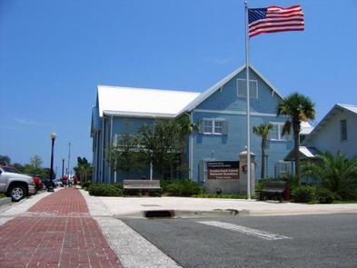
- The NPS Visitor Center is in the two story, blue building one block down on the left.
The Mainland Visitor Center is located at 113 St. Marys Street West, Marys, GA 31558. Use this address to arrive at the right location. Do not use “Cumberland Island National Seashore” as this will not guide you to the correct location.
Directions & Transportation page
Parking:
All visitors – day visitors and campers – must park in the Cumberland Island Parking Lot one block west of the Visitor Center.
Bus and RV parking is located in marked spots along the roadway along the western edge of the parking area (Seagrove St.).
Getting to the Island:
The only way to get to the island is by passenger ferry (not a car ferry) or private boat. For information about making a reservation with the National Park Service official concessionaire operated ferry visit our Reservations page or visit the Cumberland Island Ferry website.
Phone
912-882-4336 X254
Activities
BOATING, CAMPING, INTERPRETIVE PROGRAMS, FISHING, HIKING, WILDLIFE VIEWING, PHOTOGRAPHY, SWIMMING, MOTOR BOAT, RANGER STATION, KAYAKING, BEACHCOMBING, BIRDING, WATER ACCESS, BACKPACKING, SAILING
Keywords
Related Link(s)
Cumberland Island Ferry Reservations
Cumberland Island National Seashore on Facebook
Cumberland Island National Seashore Camping
Overview
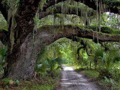
Whether you are looking to spend a night with family and friends around a campfire under the moss covered branches of the live oak trees, or looking for the rugged challenges and solitude of the wilderness, you will find it on Cumberland Island National Seashore. The park includes a designated Wilderness area, undeveloped beaches, historic sites, cultural ruins, critical habitat and nesting areas, as well as numerous plant and animal communities. The national seashore also offers a wide variety of camping opportunities.
Watch the “Camping on Cumberland Island” video for information to help you plan an d prepare for your trip.
Campgrounds
Cumberland Island offers five campgrounds , which include designated campsites at Sea Camp and Stafford Beach; and Wilderness campsites at: Hickory Hill, Yankee Paradise and Brickhill Bluff. Camping is only permitted in these five campgrounds. A permit is required to camp in any of these five camping areas.
Getting There
Visitors must take a boat to the island. Most visitors arrive via the Cumberland Island Ferry from St. Marys, Georgia (see Park Concessioner Services below).
- The ferry does not transport automobiles or RVs.
- Check the ferry schedule prior to reserving your Cumberland Island National Seashore Camping Permit unless you are traveling by private boat.
- The ferry does not operate on Tuesdays and Wednesdays from December through February.
Island Information
- Cumberland Island is 18 miles (29 km) long and .5 miles (.8 km) to 3 miles (5 km) wide.
- Bring your cell phone if possible. Use airplane mode to reserve battery power. There is electricity at the Sea Camp Ranger Station, Sea Camp Campground, and Stafford Beach Campground for recharging devices.
- Dial 911 to report emergencies and disturbances.
- There are no stores, restaurants or other amenities on the island.
- After arriving on the island, campers must hike, walk or bike from the dock to the campgrounds and transport all gear. There is no transporation service. The distance ranges from .5 miles (.8 km) to Sea Camp to 10.5 miles (17 km) to Brickhill Bluff.
- Carts of any kind and wheeled coolers are not allowed north of Sea Camp Campground.
- Be prepared for extreme weather, sun exposure, and a variety of insects. Ticks, no see-ums, and mosquitoes are prevalent during summer months; protect yourself accordingly.
- Understand your limitations; the island has no conveniences; be prepared for a remote setting and a harsh environment.
Bicycle and Carts
For information on using carts and camping with bicycles visit the Cumberland Island Camping Page
For information on bicycle and cart rentals, as well as transporting your bike to the island visit Cumberland Island Ferry webpage .
Ferry Reservations, Bicycle and Cart Rental, and Tour Reservations – Contact: Cumberland Island Ferry at www.cumberlandislandferry.com or call (877) 860-6787.
Cumberland Island Ferry passengers must check-in at the Cumberland Island Mainland Visitor Center in Saint Marys at least 30 minutes prior to their ferry departure time: https://www.nps.gov/cuis/planyourvisit/be-ready.htm
Campers must deboard the ferry at the Sea Camp Dock (not at the Dungeness Dock). Due to hurricanes, at this time only Sea Camp Dock is available for ferry operations.
Recreation
There are over 50 miles of trails and roads as well as 18 miles of beach. Hiking, biking, camping, birdwatching, and beachcombing are popular activities on the island.
Facilities
There are no amenities on the island beyond the restrooms and water fountains. You should bring lunch and water bottles to refill. Be Ready!
Natural Features
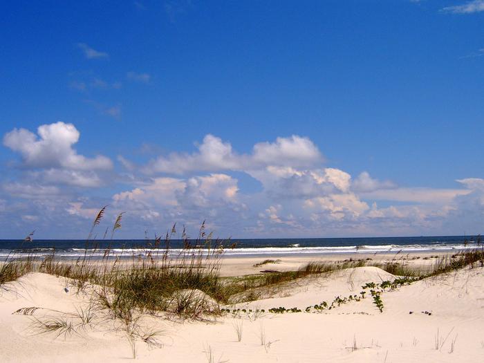
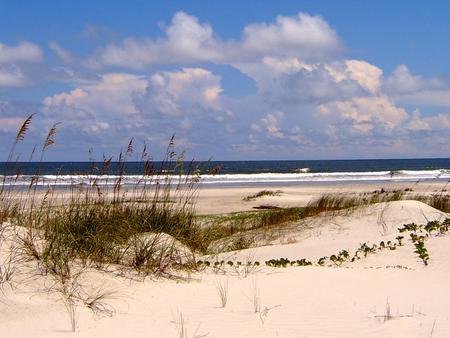
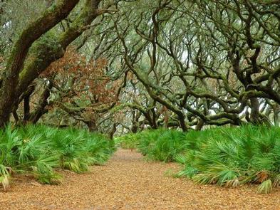
The island is home to more than 17 miles of undeveloped beach, a maritime forest of oak hammock and long leaf pine, tidal creeks, and marshland. Visitors can see an abundance of wildlife from deer, turkey, alligators, and bobcats, to snakes, tortoises, lizards, and hundreds of migratory birds.
Nearby Attractions
City of St. Marys, GA – St. Marys, Georgia, the gateway to Cumberland Island National Seashore, a small coastal village located in southeast Georgia remains one of Georgia’s best kept secrets, a place rich in history, natural beauty and Southern hospitality. St. Marys and Cumberland Island National Seashore provide a perfect escape from the hustle and bustle of everyday life.
Okefenokee National Wildlife Refuge – In southern Georgia and northern Florida there is a very special place, one of the oldest and best preserved freshwater systems in America. Native Americans called it Okefenoka, meaning Land of the Trembling Earth. Now this place, where earth, air, fire and water continuously reform the landscape, is preserved within the Okefenokee National Wildlife Refuge, created in 1937 to protect wildlife and for you to explore.
St. Marys Submarine Museum – This museum is a great place to learn about the “Silent Service”. A wide variety of Submarine artifacts, memorabilia and information are available for viewing, and you can view the beautiful St Marys waterfront through a real periscope.
Crooked River State Park – Located on Georgia’s Colonial Coast, this park offers cozy facilities in a beautiful setting. Campsites are surrounded by Spanish moss-draped oaks, while most cottages overlook the river. Hikers can explore the nature trail, which winds through a maritime forest and salt marsh. A boat ramp is popular with anglers who often take to the water before sunrise.
Fort Frederica National Monument
Timucuan Ecological & Historic Preserve
City of Jacksonville, FL
Charges & Cancellations
Refund and Cancellation Policy
- Cancellations 10 days or more before the start date of the reservation will result in a refund of the permit cost minus a 25% cancellation fee.
- Cancellations less than 10 days from the start date of the reservation will result in a refund of the permit cost minus a 50% cancellation fee.
- No refunds will be granted for cancellations one day prior to the start date of the reservation.
- When a reservation is cancelled, those dates will be made available for other campers at a random time within 24 hours.
Changes Before Permit is Printed:
- The Refund and Cancellation Policy will be applied to all changes to the reservation.
- The start date of the reservation cannot be changed without cancelling the reservation. A new reservation must be made. Cancellation fees apply and fees associated with making a new reservation apply.
- Changes may be made to the number of people (maximum 6 per site) with the same dates and trip itinerary. Changes can be made by logging accessing your reservation on recreation.gov or by contacting the Call Center.
- Reservations are non-transferable.
After Permit is Printed:
- Changes cannot be made to permit once it is printed.
- Changes will require a cancellation of the permit and reserving a new permit, if space is available. All cancellation fees and new reservation fees apply.
- Permits can only be printed within 10 days of the arrival date.
- You cannot change your site assignment. All permits must be honored as they are.
Ensure every person on the camping permit has reserved a round-trip ferry ticket or has transportation via private boat.
No-Show Policy
If you do not cancel and decide not to use your reservation, no fees will be refunded. Please cancel your reservation if you are unable to use it as this opens space for others.

