
Directions
From Interstate 380 (North Liberty, Iowa), take Exit 4 towards North Liberty. Travel East on W. Penn St. for 2.2 miles. At the four way stop sign, turn left onto N. Front St./Mehaffey Bridge Road NE. Continue traveling on Mehaffey Bridge Rd. NE for 2.9 miles. Right after crossing the Mehaffey Bridge, take a right hand turn onto the Sugar Bottom Campground Access Rd. Continue on the Sugar Bottom Campground Access Rd. for 1.1 miles. The entrance to the Sugar Bottom Day Use Area will be on the left. From Highway 1 (Solon, Iowa), turn west onto 180th St. NE/E 5th St. Travel west on180th St. NE for 2.3 miles, the road will then become Mehaffey Bridge Rd. NE. Continue traveling on Mehaffey Bridge Rd. NE for 2.4 miles. Right before the Mehaffey Bridge, take a left hand turn onto the Sugar Bottom Campground Access Rd. Continue on the Sugar Bottom Campground Access Rd. for 1.1 miles. The entrance to the Sugar Bottom Day Use Area will be on the left.
Phone
CORALVILLE LAKE PROJECT OFFICE (319) 338-3543 X.6300
Activities
FISHING, HIKING, PICNICKING, WILDLIFE VIEWING, SWIMMING, MOUNTAIN BIKING, WATER ACCESS, DISC GOLF
Keywords
Related Link(s)
Overview
Sugar Bottom Day Use Area is a day-use facility located on the shore of Coralville Lake. Coralville Lake is a multiple use project providing benefits in flood control and low flow augmentation, as well as recreation, fish and wildlife management and forest management. Coralville Lake provides many recreational opportunities, including boating, camping, hiking, mountain biking, lake and river fishing, swimming, water skiing, picnicking and hunting.
Recreation
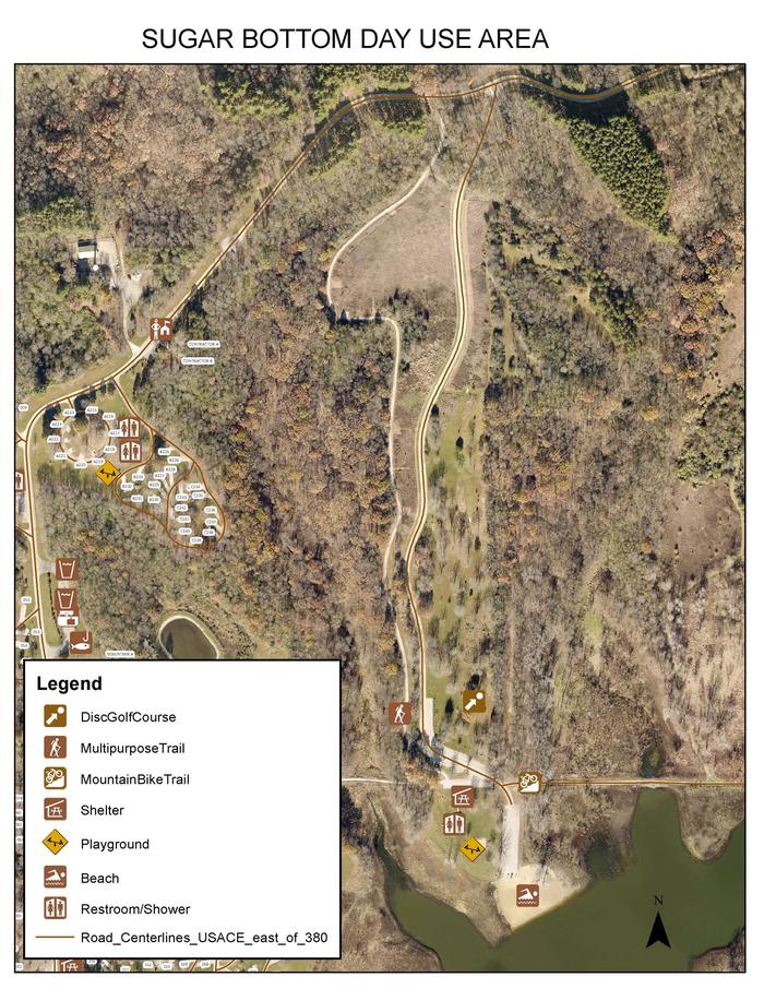
Visitors enjoy Coralville Lake for boating, fishing, swimming and water activities. Anglers will find large and smallmouth bass, crappie, walleye and catfish. Several trails are within Sugar Bottom, including the Cedar Valley Nature Trail and a barrier-free asphalt trail. The Devonian Fossil Gorge is just below the dam, offering a unique opportunity to explore a 375-million-year old sea floor and discover fossil remains of sea life that once inhabited this tropical marine environment. Twenty discovery points can be found throughout the site along with a cell phone audio tour. Sugar Bottom Disc Golf Course is located in the Sugar Bottom Day Use Area and offers 18 partially wooden and open holes. Sugar Bottom Mountain Bike Trail is located in the Sugar Bottom Day Use Area and offers beginner to expert trails.
Facilities
The day-use location offers a large group picnic area with drinking water and electricity. Amenities include flush toilets, playground, beach, disc golf course and mountain bike trail.
Natural Features
Coralville Lake is located in the Iowa River Valley, just north of Iowa City. Sugar Bottom Day Use lies among a heavily wooded forest of mixed hardwood species on the east side of the lake. Wildlife is abundant throughout the project. White-tailed deer, turkeys, pheasants, waterfowl, song birds and other species roam the lands around the lake.