
Directions
From Middlebury: Travel south on Route 7 to the junction of Route 125. Travel east on Route 125 for 6.8 miles, and turn right onto Forest Road 32. Follow FR 32 for 3.3 miles, and turn right onto Forest Road 24. The entrance to the campground loop is at 0.4 miles.
From Rochester: Travel north on Route 100 to the junction of Route 125. Travel west on Route 125 for 10.9 miles, and turn left onto Forest Road 32. Follow FR 32 for 3.3 miles, and turn right onto Forest Road 24. The entrance to the campground loop is at 0.4 miles.
Phone
802-767-4261
Activities
BIKING, BOATING, HISTORIC & CULTURAL SITE, CAMPING, FISHING, HIKING, HUNTING, WINTER SPORTS, VISITOR CENTER, WATER SPORTS, SWIMMING SITE
Keywords
Related Link(s)
Overview
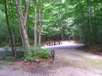
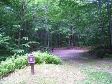
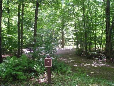
Moosalamoo Campground is a small remote campground located at the base of Mt. Moosalamoo, near Voter Brook. A large mowed grass field in the middle of the campground is good for a variety of activities, especially for groups with children. There are 19 campsites (including one host site), six vault toilets and potable water is available on site via a hand-pump.
Recreation
The Moosalamoo National Recreation Area consists of 16,000 acres abounding with recreation opportunities. With over 70 miles of well-maintained trails, mountain vistas, waterfalls, lakes and streams, it offers opportunities for hiking, mountain biking, kayaking, swimming, fishing, hunting and more. Two hiking trails (Mt. Moosalamoo and Voter Brook) are connected to the campground loop and less than a mile down the road is Voter Brook Overlook, featuring a picnic area and an accessible path leading to a western vista.
Facilities
The campground offers 18 overnight sites for tent and limited RV camping. Each site is equipped with a picnic table and fire ring (with grill). There are six accessible vault toilets located within the campground. The campground also offers first-come, first-served sites.
Natural Features
Moosalamoo Campground is set in a pleasant stand of sugar maple, American beech, yellow birch and many other hardwoods. Its assortment of trees and ample ferns and wildflowers add to its beauty and provide shade and privacy to the campsites.
Nearby Attractions
The nearest available shopping is in Ripton, located four miles from the campground. More extensive shopping and dining can be found in Middlebury or Brandon, both located 12 miles from the campground.