MOGOLLON CAMPGROUND, AZ Campground Reservation, Info, Images, Map, Directions

MOGOLLON CAMPGROUND, Arizona Campground Images, Info & Reservations

Directions

Located on Road 300 approximately 5 miles off of Highway 260.

Phone

928-535-9859

Activities

CAMPING, INTERPRETIVE PROGRAMS

Keywords

Related Link(s)

Rec Area Info & Images

Arizona State Road Conditions

Arizona State Tourism

Overview

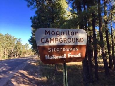
Mogollon Campground, although not directly in the Woods Canyon Recreation area, sits just outside and is only two miles from the lake. For those who like spectacular views, this campground is one of the closest to the Mogollon Rim.

Recreation

Fishing and boating are available at Woods Canyon Lake which is approximately three miles from the campground on Road 105.

Facilities

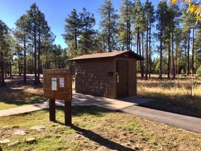
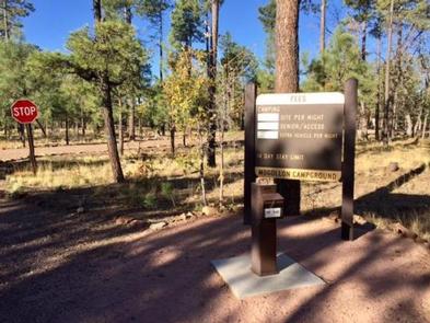
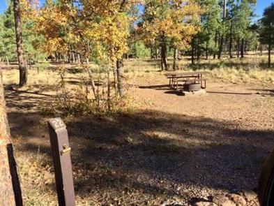
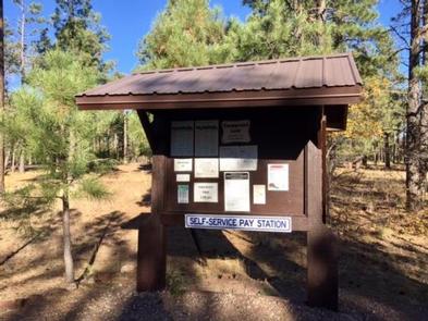
Mogollon Campground has 26 sites (of which sites 14 through 26 are available for advanced reservation). All sites are pull-outs and approximately 40 feet. Sites can accommodate tents, pop-up campers, trailers, and motorhomes. There are two loops which have 13 sites per loop. Each campsite offers a campfire ring, grill and picnic table. Additional amenities include accessible vault toilets, drinking water and trash service. A camp host is available at the site.

Natural Features

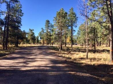
Mogollon Campground is surrounded by ponderosa pines. The road to Mogollon is a sandy road off of Road 300. The campground itself is also sandy and gravel.

Nearby Attractions

Some groceries are available at the Marina Store at Woods Canyon Lake which is approximately three miles from the campground. The store also offers boat and kayak rentals. Woods Canyon Lake is a great lake for fishing.

Reservation

More from CampingHiking.net:

CLEAR LAKE (TX), Texas Campground Images, Info & Reservations

Directions While traveling on US Highway 380 in Princeton, TX, take South 2nd Street (County Road 982) South. County Road 982 changes into County Road 735. At the 4 way stop sign (just past the Lavon Lake Camp and Conference Center), take a right on County Road 436. Watch for

ALTURAS LAKE PICNIC AREA (ID), Idaho Campground Images, Info & Reservations

Directions From Stanley, Idaho, take State Highway 75 south for about 22 miles. Turn right on Alturas Creek Road/Forest Road 205 and continue west for about 2.6 miles to the campground. Phone 928-537-8888 Activities BOATING, CAMPING, FISHING, HIKING, WATER SPORTS, SWIMMING SITE Keywords ALTU,SAWTOOTH NF – FS Related Link(s) Rec

Grandview Shelter 1, West Virginia Campground Images, Info & Reservations

Directions To reach Grandview from Beckley follow I-64 East five miles to Exit 129 B. From Lewisburg follow I-64 West forty miles to Exit 129. From either exit, turn right and follow Route 9 North six miles to Grandview. Phone 304-465-0508 Activities HIKING, PICNICKING, DAY USE AREA Keywords Grandview State

MOUNT FLEMER CABIN, Alaska Campground Images, Info & Reservations

Directions The cabin is located on the south shore of the Stikine River within the Stikine-LeConte Wilderness. It is two miles downriver from the border between the United States and Canada. Distance from Wrangell is 32 miles by shallow draft boat. Low river levels can affect access; consult local tide

PAULSON BAY CABIN, Alaska Campground Images, Info & Reservations

Directions To access the cabin by float plane: it is 40 minutes from Anchorage and 60 minutes from Cordova. By boat, the trip is 18 miles from Whittier. Note: the Bay is not obvious because the mouth is partially obscured by five small islands. Beware of submerged rock ledges between