HEBO LAKE CAMPGROUND, OR Campground Reservation, Info, Images, Map, Directions

HEBO LAKE CAMPGROUND, Oregon Campground Images, Info & Reservations

Directions

From the town of Hebo, OR at Highway 101, travel 1/4 mile south on Highway 22 to Forest Service Road 14, If you reach the Ranger Station you have gone too far. Turn left on FS Road 14 and travel east 4.5 miles to the entrance of the Hebo Lake Campground on the right.

Phone

503-392-5100

Activities

HISTORIC & CULTURAL SITE, FISHING, HIKING

Keywords

Related Link(s)

Rec Area Info & Images

Oregon State Tourism

Oregon State Road Conditions

Overview

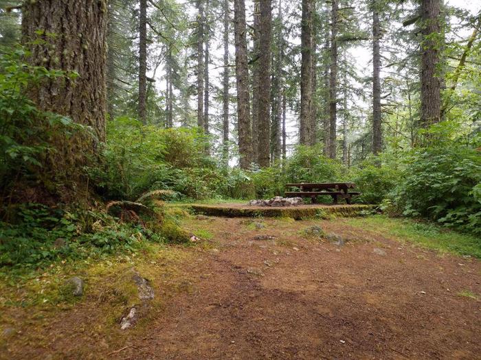
Hebo Lake campground is ideal for those wanting a secluded, quiet camping getaway in the forest. Located on Mt. Hebo, this small, family campground has 12 campsites, a historic picnic shelter, a three-acre lake, and access to hiking trails. This campground also has first come first serve sites that may be available outside the booking window, depending on weather. Contact Hebo Ranger District for more information.

Recreation

A historic picnic shelter built by the Civil Conservation Corps in 1937, and restored in 2016, is available for day use at the Hebo Lake Day Use site. The 1/2 mile Hebo Lake Loop Trail is a pleasant hike around the lake, and access to the Pioneer – Indian Trail is nearby. Anglers will find five accessible fishing docks around the popular three-acre lake, which is stocked with rainbow trout.

Facilities

Each site is equipped with a picnic table and campfire ring. Vault toilets are provided but there is no drinking water.

Natural Features

At an elevation of 1,650 feet, the surrounding forest of western hemlock, Douglas fir and red alder make the area quite enjoyable on a hot summer day.

Reservation

More from CampingHiking.net:

TOAD SUCK, Arkansas Campground Images, Info & Reservations

Directions From Conway, Arkansas, travel west for 7 miles on SR-60 and follow signs into the campground. Phone 501-759-2005 Activities BOATING, CAMPING, FISHING, BIRDING Keywords TOAD,TOAD SUCK FERRY LOCK AND DAM-A,TOAD SUCK FERRY Related Link(s) Rec Area Info & Images Arkansas State Road Conditions Arkansas State Tourism Overview Toad Suck

QUAKING ASPEN, California Campground Images, Info & Reservations

Directions From Porterville, California, take Highway 190 East to Springville. Continue from Springville approximately 28 miles to the Quaking Aspen Campground. Phone 559-539-5230 Activities BIKING, CAMPING, DAY USE AREA Keywords QUAK,QA,GIANT SEQUOIA NAT. MONUMENT,SEQUOIA NF – FS Related Link(s) Rec Area Info & Images California State Tourism California State Road

LOLETA RECREATION, Pennsylvania Campground Images, Info & Reservations

Directions From the west, take I-80 east to Clarion, Pennsylvania. Turn left onto State Route 66 and continue northeast to Marienville. Turn right on South Forest Street and go south 6 miles to the Loleta Campground entrance sign. From the north, take State Route 66 to Marienville, turn left on

SQUAW PEAK LOOKOUT, Oregon Campground Images, Info & Reservations

Directions Starting in Jacksonville, drive on Highway 238 west 8 miles to the town of Ruch. Turn left on Upper Applegate Road and proceed 10.2 miles to Forest Road 20, (Beaver Creek Road). Turn left and go 4.1 miles to the junction of Forest Road 20 and Forest Road 2010