


Directions
From Bend, OR: Travel about 58 miles southwest on Cascade Lakes Hwy (46), then 2 miles east on Forest Road 44.
Phone
541-323-1746
Activities
CAMPING
Keywords
Related Link(s)
Overview
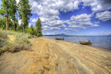
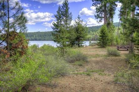
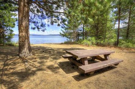
Reservoir Campground is located next to Wickiup Reservoir along the Cascade Lakes Highway.
Recreation
Campers enjoy boating, canoeing, swimming and fishing. Both motorized and non-motorized boats are allowed on Wickiup Reservoir. The reservoir’s relatively warm water and cooler deep channels generate excellent opportunities for fishing.
Facilities
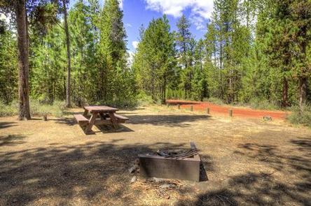
Reservoir Campground can accommodate RV, trailer or tent-campers, however, water and electric hookups are not available. Campers will need to bring their own water supply. All sites are equipped with a picnic table and campfire ring with grill and the campground has vault toilets available. This campground offers a boat ramp with access to Wickiup Reservoir.
Natural Features
Wickiup Reservoir is a popular fishing destination. Fish species include brown trout, kokanee and Coho salmon, rainbow and brook trout, whitefish and chub. Wetlands, diverse forests, and rocky slopes near the campground provide a necessary habitat for shorebirds, porcupine, deer, bats and the occasional black bear.
Nearby Attractions
Campers can explore wilderness areas, rivers, lakes and reservoirs and hundreds of miles of trails. Visitors can travel the Cascade Lakes Scenic Byway which climbs 66 miles through the Cascade Range, weaving past snow-capped peaks and alpine lakes.
Newberry National Volcanic Monument, approxiately 45 minutes by vehicle, is a great starting point for visitors to learn about the diverse landscape and history of the area through interpretive programs and exhibits. Visitors can explore Lava River Cave, the longest continuous lava tube in Oregon.