REREG DAM DAY USE AREA SHELTER, GA Campground Reservation, Info, Images, Map, Directions

REREG DAM DAY USE AREA SHELTER, Georgia Campground Images, Info & Reservations

Directions

From Atlanta: Take Interstate 75 North until Exit 293, turn right onto Georgia Highway 411 North, travel approximately 30 miles; take a right onto Georgia Highway 136 East; proceed across railroad tracks; turn left onto Old Highway 411 North, continue approximately 3/4 mile; turn right into Reregulation Dam Day Use Area.

Re-Reg
10493 Old Hwy 411
Chatsworth, GA 30705

Phone

706-334-2248

Activities

FISHING, HIKING, DAY USE AREA, BIRDING

Keywords

Related Link(s)

Rec Area Info & Images

Georgia State Road Conditions

Georgia State Tourism

Overview

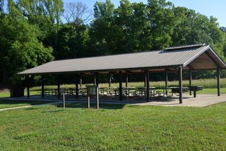
Reregulation Dam Day Use Area is actually two day use areas situated on the North and South Sides of the Coosawattee River. Both areas provide picnic sites, fishing piers and water access. The South Regulation Area encompasses an award winning nature trail that has an easy hike rating and can be enjoyed by all. The North Regulation Area contains a shelter that can be reserved.

Recreation

Fishing is a popular activity at the Reregulation Dam. Major species include bass (hybrid, striped and spotted) crappie, walleye, bream and catfish.

Facilities

The area provides picnic sites, restrooms, fishing piers, and water access. Shelter (CL-46) seating capacity is 100 people maximum and parking capacity of 50 vehicles.

Natural Features

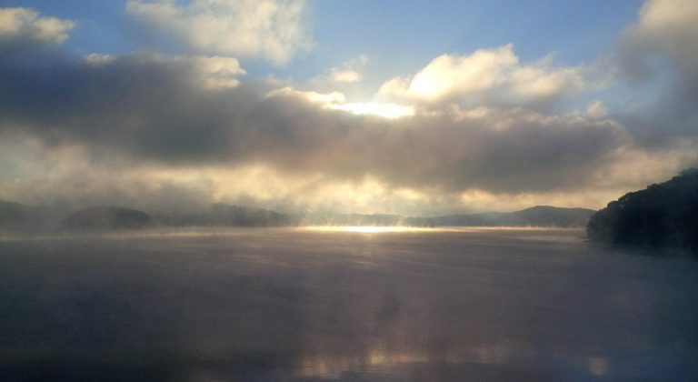
Carters Lake embraces a spectacular tract of foothills scenery in the Blue Ridge Mountains of North Georgia. It covers 3,200 surface acres and has 62 miles of undeveloped shoreline.

Nearby Attractions

The Cities of Ellijay and Chatsworth are about 30 minutes away, offering restaurants, grocery stores, and fuel, along with other amenities.

Reservation

More from CampingHiking.net:

PAINT CREEK DAM SITE, Ohio Campground Images, Info & Reservations

Directions From Chillicothe Ohio, take Route 50 west for 18 miles to Bainbridge. Ohio. Three miles past Bainbridge, turn right on Rapid Forge Road. Go 2 miles north and turn left into the Paint Creek Dam Site Area. Little Pond Shelter is located on the right just before crossing the

GREEN RIVER CAMPGROUND, Utah Campground Images, Info & Reservations

Directions Green River Campground is located approximately 12 miles north of US Highway 40. Take Utah State Route 149 from Jensen, Utah. Phone 435-781-7700 Activities BIKING, CAMPING, INTERPRETIVE PROGRAMS, FISHING, HIKING, WILDLIFE VIEWING, EVENING PROGRAMS Keywords GREEN RIVER CAMPGROUND,GREEN RIVER,DNM Related Link(s) Rec Area Info & Images Utah State Tourism

Monument Lake Campground, Florida Campground Images, Info & Reservations

Directions From Naples: Follow US HWY 41 east until you see the sign for campground (approximately mile marker 59). From Miami: Follow US HIWY 41 west until you see the sign for campground (approximately mile marker 59) Phone 1 (239) 695-1205 Activities CAMPING, FISHING, HUNTING, DAY USE AREA Keywords Big

Bumping Lake Campground, Washington Campground Images, Info & Reservations

Directions From Yakima, Washington, travel 25 miles on Highway 12 to the junction with Highway 410. Travel 29 miles on Highway 410 (Chinook Pass Highway) to milepost 88.4. Take Forest Road 18 (Bumping River Road) for 11.7 miles to campground. Phone 541-338-7869 Activities BIKING, BOATING, CAMPING, FISHING, HIKING, WATER SPORTS

ASPEN GROUP AREA, New Mexico Campground Images, Info & Reservations

Directions In southeast New Mexico, approximately 20 miles east of Alamagordo. From Alamagordo take US 82 east and go 16 miles. Just before Cloudcraft turn right (South) on NM 130. Go 1.4 miles. Turn left (east) on Forest Road 24B, go 0.5 miles. Aspen Group Area is on the left