

Directions
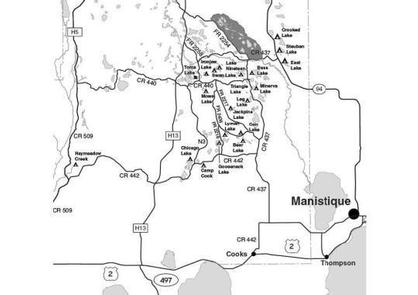
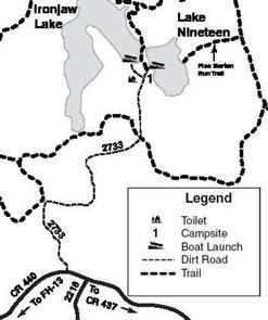
From the Intersection of US-2 and Forest Highway 13 (about 14 miles east of Rapid River) drive north 18.7 miles on Highway 13 to County Road 440. Turn right (east) on CR 440 and drive 4.6 miles to FR 2733. Turn left (north) and drive 1.3 miles to the parking area.
Phone
906-474-6442 OR 906-387-2512
Activities
CAMPING
Keywords
Dispersed campsites,Manistique,Rapid River,lyman lake,swan lake,bass lake,bear lake,camp cook,carr lake,chicago lake,clear lake,crooked lake,east lake,gooseneck lake,ironjaw lake,jackpine lake,lake nineteen,leg lake,little bass lake,minerva lake,mowe lake
Related Link(s)
Michigan State Road Conditions
Overview
The campsites on the Rapid River/Manistique Ranger District are located on inland lakes and are in a rustic forest environment with few, if any amenities. The rustic environment offers a wonderfully serene and peaceful setting for your next camping experience.
Recreation
Visitors will be able to enjoy swimming, berry picking, and fishing at these campsites. Licenses are required for fishing in Michigan waters. Some of these campsites offer only one site on these inland lakes allowing for a very peaceful and wilderness-like experience.
Facilities
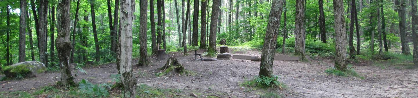
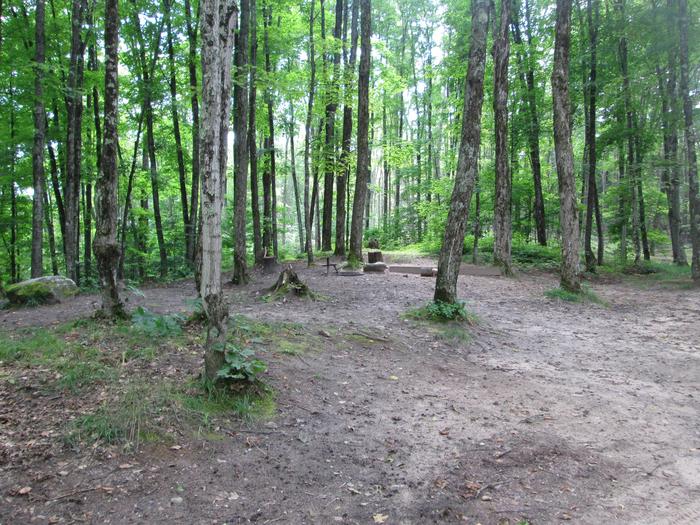
Ironjaw Lake is located in the heart of the Ironjaw Semi-Primitive Area, which is managed for both motorized and non-motorized uses. Our management efforts seek to provide for quiet, peaceful recreation opportunities in a semi-primitive setting. The campsite is also located on the non-motorized Pine Marten Run Trail, which is open to hiking, mountain biking and horseback riding. The campsite at Ironjaw is a pull-through site that also features a tent pad situated on a hill overlooking Lake Nineteen. This site is suitable for only one family with a small trailer. There is limited turnaround space. A primitive toilet is located across the road. There is no drinking water available at this site. The swimming area is poor. The boat access to Ironjaw Lake (62 acres) is down a steep hill but the surface is firm. Turn-around and back-in space at the base of the hill is very limited however, and 4-wheel drive vehicles are recommended. Parking is restricted to a small area located at the top of the hill. Ironjaw Lake is one of the better fishing lakes in the area. Crappie fishing is excellent in the spring. The lake also contains northern pike, largemouth bass, bluegill and bullheads. Horse camping is allowed at Ironjaw Lake. Groceries, gasoline, fishing and camping supplies, boat rentals, ice, MDNR licenses, deli, and restaurants are available approximately six miles west on Forest Highway 13. Lake Name Number of Sites Maximum number of people per site Toilets Boat Access Lake Size (acres) Ironjaw Lake 1 8 Yes Back in 62 Site Number of Horses Allowed Ironjaw Lake 2 horses
Natural Features
All of these sites are nestled in hardwood trees and pines. All of them are on small inland lakes, which offer a wide variety of fishing opportunities. There is one exception; Camp Cook, which is close to the Fishdam River and provides opportunities for good brook trout fishing.
Nearby Attractions
There are a number of horse, bike, and hiking trails within minutes of several of the sites. In over a mile from these campsites, visitors can expect to find: bait shops, general and grocery stores, gas, a pay phone, trailheads, a fishing pier, biking, and kayak/canoe rentals.