

Directions
From I-74 head west on Highway 52 for 15 miles to Brookville. Continue to State Route 101 North following signs to the Brookville Visitor Center for about a mile. For GPS usage, physical address is 10064 Overlook Rd. Brookville, IN 47012
Phone
(765) 647-6701
Activities
DAY USE AREA, OBSERVATION SITE
Keywords
Overlook
Related Link(s)
Overview
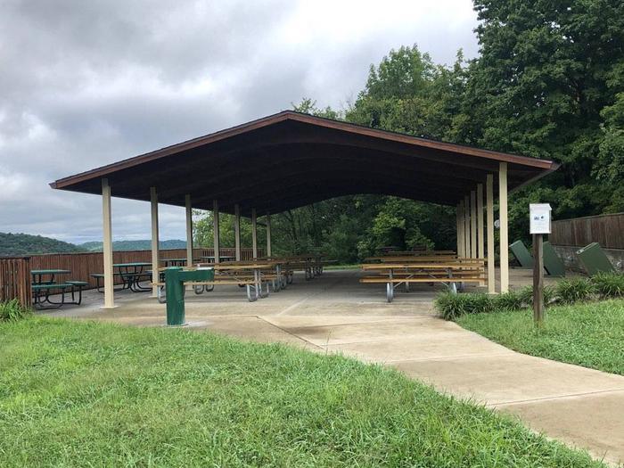
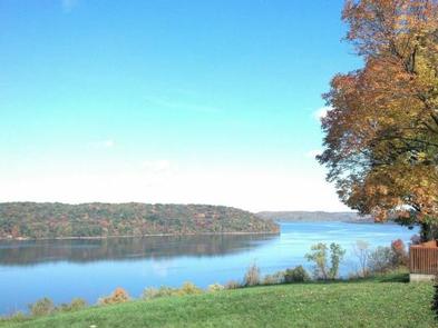
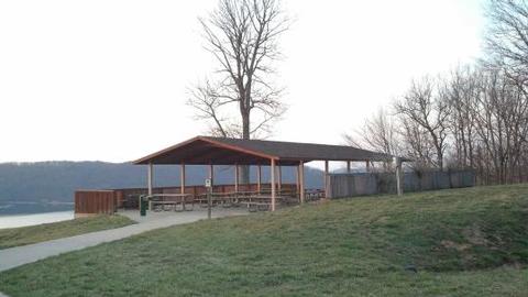
The Overlook Shelter is located near the Brookville Lake Dam and the Visitor Center. Visitors enjoy this site for the breathtaking view of Brookville Lake and the Dam. Visitors also enjoy the accessibility of a short walk to the Brookville Lake Visitor Center on the Overlook Trail. Capacity for parking at this site is limited to 76 available parking spaces. The Overlook is a day use area only. There is no camping allowed at this site.
Recreation
Brookville Lake offers excellent boating, water skiing, canoeing, and kayaking opportunities. Canoeing, kayaking, and rafting are popular recreation activities in the Whitewater River located directly below the dam. Other recreation opportunities at the lake include hiking, swimming, camping, fishing, hunting, cabin and boat rentals, gun and archery ranges, and horseback riding. The Overlook shelter is located a short drive away from the Brookville Visitor Center which offers exhibits, history, and information about the lake and the Corps missions in the Ohio Valley.
Facilities
The Overlook Shelter is located near a modern restroom. Electric plug-ins and a water spigot/fountain are available at the shelter There are two cooking grills and a popular playground spot near the site. By purchaisng a Special Activity Permit ($50) guests can also reserve the Overlook Pavilion for special events such as weddings.
Natural Features
The Overlook Shelter is located near the Brookville Dam. The view from the shelter is one of the best views in the state of Indiana. Visitors can enjoy a short nature hike to the Brookville Lake Visitor Center.
Nearby Attractions
Brookville Lake offers 51 miles of hiking, excellent boating, water skiing, canoeing and kayaking. Brookville’s recreation facilities include beaches, boat ramps, campgrounds, fishing piers, an 18- hole golf course, lodging, marinas, picnic areas, playgrounds, restaurants, shooting and archery ranges, and tailwater trout fishing.