
The Deschutes National Forest in Deschutes County offers countless year-round recreation opportunities.
Five wilderness areas fall within the Deschutes National Forest boundary – Diamond Peak, Mt. Jefferson, Mt. Thielsen, Mt. Washington and Three Sisters.
Drill down into the 12 Deschutes recreation areas below to learn more about each area, including stunning image galleries, maps, directions, and links to campground reservations.
74 Deschutes National Forest Camping Areas
Listen Activities Auto Touring, Biking, Boating, Camping, Interpretive Programs, Fishing, Hiking, Horseback Riding, Off Highway Vehicle, Picnicking, Winter Sports, Recreational Vehicles, Visitor Center, Wildlife Viewing, Fire Lookouts/cabins Overnight, Swimming, Horse Camping Located on the eastern slopes of the Cascades in Central Oregon, the Deschutes National Forest offers year-round recreation opportunities.
Lower Deschutes River Back Country Byway, Oregon Camping & Hiking
Listen Directions From Maupin, Oregon: On the east side of the Deschutes River drive either direction on the Deschutes River Access road. Phone 541-416-6700 Activities AUTO TOURING, BIKING, BOATING, HISTORIC & CULTURAL SITE, CAMPING, FISHING, HUNTING, PICNICKING, DAY USE AREA, PHOTOGRAPHY, PADDLING, WATER ACTIVITIES Camping Reservations Reserve your campsite at
Trout Creek Trail, Oregon Camping & Hiking
Listen Directions Mecca Flat Trailhead : From Madras, Oregon, drive 12.7 miles north on US highway 26. Immediately before the Deschutes River crossing, turn right on the unsigned Mecca Flat Road, a single-lane dirt road. Watch for the brown BLM directional sign announcing Mecca Flat Campground. Drive another 1.6 miles
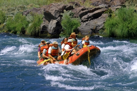
White Wild and Scenic River, Oregon Camping & Hiking
Listen Directions From Maupin, OR: Head southwest on US-197 N/Deschutes Ave toward 6th St continuing to follow US-197 N for 2.7 miles. Turn left onto OR-216 W for 4.8 miles, then take a slight right onto Kelly Cutoff for another 1.1 miles. Turn left onto Old Wapinitia Rd for 0.3
Lower Deschutes Wild and Scenic River, Oregon Camping & Hiking
Listen Directions The Deschutes River runs north through Central Oregon and meets the Columbia River east of The Dalles. The river can be accessed via U.S. 97, U.S. 197, and U.S. 26. Phone 541-416-6700 Activities AUTO TOURING, BIKING, CLIMBING, HISTORIC & CULTURAL SITE, CAMPING, FISHING, HIKING, HUNTING, PICNICKING, WILDLIFE VIEWING,
Middle Deschutes Wild and Scenic River, Oregon Camping & Hiking
Listen Directions Steelhead Falls Trail: From Terrebonne, turn west on Lower Bridge Road and proceed 2.2 miles to NW 43rd St. Turn right and drive 1.8 miles to NW Chinook Drive. Turn left at the 2nd cross street onto SW Badger Road and go 1.8 miles to SW Quail Drive
Crooked Wild and Scenic River, Oregon Camping & Hiking
Listen Directions North Fork: From Prineville, Oregon, drive southeast for 35 miles on the Post-Paulina Highway (OR 380). Turn left on Teaters Road and proceed 1.4 miles to an unnamed gravel road on the left. Drive approximately 6.2 miles to the seasonal gate at Telephone Springs. From here, you can
Millican Valley OHV Trail System, Oregon Camping & Hiking
Listen Directions From Bend, OR take US-20 east through the town of Millican. Continue past town about 1 mile, look for Millican Staging Area Signs. Phone 541-416-6700 Activities OFF HIGHWAY VEHICLE, OFF ROAD VEHICLE TRAILS Camping Reservations Reserve your campsite at these camping areas: Oregon Campgrounds Hiking Trails Looking for
Steelhead Falls Trail, Oregon Camping & Hiking
Listen Directions From Redmond, head north on Hwy 97 to Terrebonne and turn west on NE Lower Bridge Way. Go two miles and take a right on NW 43rd Street. Follow that 1.8 miles to Chinook Drive. Go almost a mile and take a left onto Badger Road. Travel one
Haystack Reservoir, Oregon Camping & Hiking
Listen Directions Site is 10 miles south of Madras, Oregon east off U.S. 97. Phone 541-383-5300 Activities BOATING, CAMPING, FISHING, HIKING, HUNTING, PICNICKING, RECREATIONAL VEHICLES, WATER SPORTS Camping Reservations Reserve your campsite at these camping areas: Oregon Campgrounds South Shore Group Campground Hiking Trails Looking for nice hiking areas to
Crane Prairie Reservoir, Oregon Camping & Hiking
Listen Directions Site is about 40 miles southwest of Bend, Oregon off U.S. 97. Phone 541-383-5300 Activities BOATING, CAMPING, FISHING, HUNTING, PICNICKING, RECREATIONAL VEHICLES, WATER SPORTS, WILDLIFE VIEWING, OTHER RECREATION CONCESSION SITE Camping Reservations Reserve your campsite at these camping areas: Oregon Campgrounds Hiking Trails Looking for nice hiking areas
Crescent Lake, Oregon Camping & Hiking
Listen Directions Site is located 70 miles southwest of Bend, Oregon. South on U.S. 97 for 60 miles to county road to lake. Phone 541-383-5300 Activities BOATING, CAMPING, FISHING, PICNICKING, WINTER SPORTS, RECREATIONAL VEHICLES, WATER SPORTS Camping Reservations Reserve your campsite at these camping areas: Oregon Campgrounds Hiking Trails Looking