BUMPUS MILLS, TN Campground Reservation, Info, Images, Map, Directions

BUMPUS MILLS, Tennessee Campground Images, Info & Reservations

Listen

Directions

From Nashville, Tenn: Take I-24 west to Clarksville, TN. Follow Highway 79 South for 20 mi. to Highway 120. Follow Highway 120 for 10 mi. to Bumpus Mills, turn left onto Tobaccoport Road (Hwy. 1830) for 2.8 mi., turn left onto Oak Hill Road for . 9 mi., turn left onto Forest Trail then turn right into the campground. From I-24 East Cadiz KY: Take 68 west for 6.2mi., turn left on to HWY. 139 south for 15.3mi., continue on to TN. HWY 120 for 2.7 mi. Turn left onto Tobaccoport Road, Hwy 1830 for 2.8 mi., thurn left onto Oak Hill Road for .9 mi., turn left onto Forest Trail then into the campground.

Phone

RESOURCE MANAGERS OFFICE: (270) 362-4236, BUMPUS MILLS CAMPGROUND: (931) 232-8831

Activities

BOATING, CAMPING, FISHING, HIKING, PICNICKING, SWIMMING SITE

Keywords

BUMP,LAKE BARKLEY,BARKLEY LOCK & DAM

Related Link(s)

Rec Area Info & Images

Tennessee State Road Conditions

Tennessee State Tourism

Overview

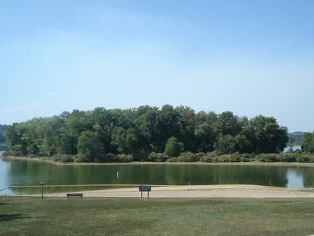
From fishing to boating and hiking, campers and day visitors at Bumpus Mills enjoy hours of fun on the upstream section of Lake Barkley.

Many bird species reside here, including golden and bald eagles. Don’t forget to pack binoculars and a camera to take advantage of the excellent opportunities for birding and wildlife photography.

Recreation

The recreation area is ideal for hiking, fishing, swimming, picnicking and boating. Abundant wildlife includes wild turkey and deer.

Facilities

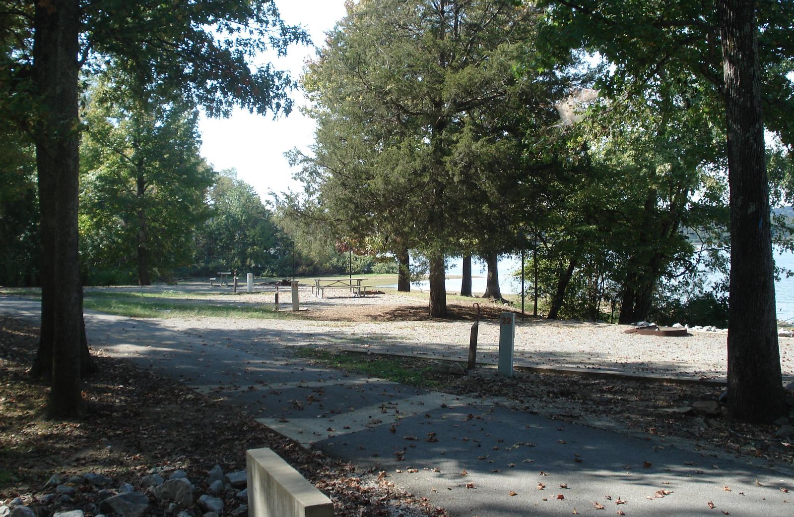
The small campground offers 15 sites with water and electric hookups. Other amenities include hot showers, a dump station, boat ramp and public marina.

Natural Features

Bumpus Mills is located on scenic Lake Barkley among wooded rolling hills. Lake Barkley is the westernmost lake on the Cumberland River, which flows westward to the Ohio River.

Barkley lies parallel to Kentucky Lake, a reservoir that stems from the Tennessee River. Between both lakes is the Land Between the Lakes National Recreation Area.

Nearby Attractions

Due east is Fort Donelson National Battlefield, which marks the site of the first Union victory of the Civil War. The Bear Creek Waterfowl Management Unit is a short drive south of Bumpus Mills.

Reservation

More from CampingHiking.net:

CEDAR POINT CAMPGROUND, North Carolina Campground Images, Info & Reservations

Listen Directions Take VFW Road off NC 58 approximately 1.25 miles north of the junction of NC 24 and NC 58. Follow signs to the campground on VFW Road. Phone 252-638-5628 Activities BOATING, HISTORIC & CULTURAL SITE, CAMPING, FISHING, HIKING, WATER SPORTS, SWIMMING SITE Keywords Croatan National Forest Related Link(s)

JIM CREEK GROUP CAMPGROUND, Oregon Campground Images, Info & Reservations

Listen Directions Travel north on Highway 62 for approximately 6 miles. Turn left on Forest Road 68 for approximately 2 miles. Immediately after crossing the Rogue River, turn left on Forest Road 64 for approximately 0.5 mile. Turn right on Forest Road 6470 for approximately 0.1 mile. Turn right into

ASPEN CABIN, Oregon Campground Images, Info & Reservations

Listen Directions From Lakeview, drive 6 miles north on Highway 395 and turn right (east) on Highway 140. Drive for 8 miles on Highway 140 and turn left on Forest Road 3615. Drive 7.5 miles on Forest Road 3615 to arrive at the cabin. The entire route to the cabin

LAKE HARRIET, Oregon Campground Images, Info & Reservations

Listen Directions From Estacada, Oregon, travel east on Highway 224 for about 25 miles. Keep left at the Y for NF-57 / Oak Grove Fork Rd for 5.4 miles. Follow signs and take a sharp left onto NF-4630 for 1.5 miles. Phone 503-464-8515 Activities CAMPING, FISHING, PICNICKING, DAY USE AREA,

DOGWOOD DAY USE, Utah Campground Images, Info & Reservations

Listen Directions Take exit 301 off I-15. Turn east and travel 6 miles on 7200 South to the mouth of Big Cottonwood Canyon. Travel 2 miles up Big Cottonwood Canyon to picnic area. Phone SALT LAKE RANGER DISTRICT OFFICE 801-733-2660 OR UTAH RECREATION COMPANY 385-273-1100 Activities BIKING, CLIMBING, CAMPING, FISHING,

TANNERS FLAT, Utah Campground Images, Info & Reservations

Listen Directions From I-215, take the 6200 South exit and travel a mile east to Wasatch Blvd. Take Wasatch Blvd 3 miles south to junction with Little Cottonwood Canyon/Highway 210. Take a left at the junction and travel up Little Cottonwood Canyon for 4.1 miles to the campground. Phone SALT