JIM HOGG PARK, TX Campground Reservation, Info, Images, Map, Directions

JIM HOGG PARK, Texas Campground Images, Info & Reservations

Listen

Directions

From I-35, take Farm to Market Road 2338 west for 6 miles to Jim Hogg Road. Turn south and continue 2 miles to the park entrance.

Phone

512-930-5253

Activities

BOATING, CAMPING, FISHING, HIKING, HUNTING, WILDLIFE VIEWING, PADDLING, MOUNTAIN BIKING, BIRDING

Keywords

JIMH,LAKE GEORGETOWN,GEORGETOWN LAKE,LAKE GEORGETOWN

Related Link(s)

Rec Area Info & Images

Texas State Road Conditions

Texas State Tourism

Overview

Jim Hogg Park sits on the north side of Georgetown Lake in the Hill Country of Texas, about 25 miles north of Austin.

Recreation

Boating is the most popular way to enjoy the lake, and a boat ramp is provided for guests. Fishing is excellent in the area, and the lake contains Black bass, White bass, Hybrid stripers, White crappie, Channel catfish and Flathead catfish, but its most known for its abundance of Smallmouth bass. The San Gabriel River Trail is a 26 mile rugged trail winding through dense juniper forest, hardwood bottomlands and prairie grasslands. The trail wraps completely around Georgetown Lake via the dam and is open to both hiking and biking. Hunting is available for for small game like dove, waterfowl, rabbit and squirrel, as well as white tail deer. Hunting is by permit only.

Facilities

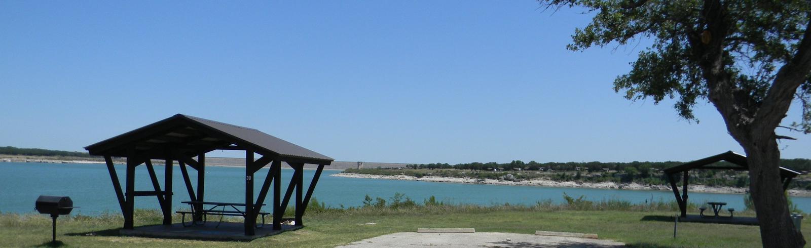
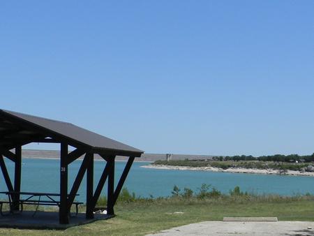
Jim Hogg Park has 142 reservable campsites, including five large group camping shelters, and convenient amenities like flush toilets and showers are provided. Picnic shelters are also available, allowing for large parties, cookouts and family trips.

Natural Features

Lake Georgetown is a reservoir on the north fork of the San Gabriel River in central Texas. The dam was completed in 1979 to provide flood control and water supply for the nearby community of Georgetown, and now provides countless recreation opportunities for outdoor enthusiasts.

Nearby Attractions

The nearby town of Georgetown offers gas, groceries and more. The historic downtown square district has shops and restaurants, and concerts and events are held on a regular basis.

Additionally, Austin is located just 25 miles from the lake, offering countless tourist attractions.

Reservation

More from CampingHiking.net:

BLACK ROCK, Idaho Campground Images, Info & Reservations

Listen Directions From Idaho City, travel north on State Highway 21 for about two miles, to the Granite Creek/Rabbit Creek Road No. 327. Turn right and travel east for 18 miles on Road No. 327, to the campground. Phone 208-392-6681 Activities BIKING, CAMPING, FISHING, HIKING, WILDLIFE VIEWING, SWIMMING SITE Keywords

Toto Creek Campground, Georgia Campground Images, Info & Reservations

Listen Directions Physical address is 154 Toto Creek Park Rd., Dawsonville, GA 30506 From Georgia Highway 400 North, exit left for Harmony Church Rd. heading east; stay straight onto Price Rd.; turn right on Toto Creek Park Rd.; turn right to continue on Toto Creek Park Rd.; road dead ends

MCCOWN VALLEY, Texas Campground Images, Info & Reservations

Listen Directions From I-35 in Hillsboro, take HWY 22 west 12 miles to Whitney, exit 933 north for 2.5 miles to FM 1713. Proceed 6 miles west, following signs into campground. Phone 254-622-3332 Activities BIKING, CAMPING, HIKING, HORSEBACK RIDING, SWIMMING SITE Keywords MCCO,WHITNEY LAKE,LAKE WHITNEY,WHITNEY LAKE Related Link(s) Rec Area

BLUEBILL CAMPGROUND, Oregon Campground Images, Info & Reservations

Listen Directions From Reedsport, Oregon, take Highway 101 south for 22 miles to the Horsfall Dunes and Beach road sign; turn right and follow signs. From Coos Bay/North Bend, Oregon, take Highway 101 north for about 2 miles to the Horsfall Dunes and Beach road sign, turn left and follow

WHITETAIL CAMPGROUND, Arizona Campground Images, Info & Reservations

Listen Directions From Tucson, Arizona, go north on Catalina Highway approximately 30 miles from Tucson until you reach Milepost 20. Turn Left on Whitetail Road. Phone 520-576-9198 Activities CAMPING, HIKING Keywords WHTE,WHITE TAIL,WHITE TRAIL,WHITETAIL,WHITE TALE,CORONADO NF – FS Related Link(s) Rec Area Info & Images Forest Service Concessionaire Arizona State

WENCH CREEK, California Campground Images, Info & Reservations

Listen Directions On Highway 50, go 21 miles east of Placerville to Riverton. Turn left on Icehouse Riverton Road. Go 19 miles north to Wench Creek turnoff, then turn left to campground. Phone 831-245-6891 Activities BIKING, BOATING, CAMPING, FISHING, HIKING, WATER SPORTS, WILDLIFE VIEWING, SWIMMING SITE, BIRDING Keywords WENC,ELDORADO NF