PINEY GROVE, MS Campground Reservation, Info, Images, Map, Directions

PINEY GROVE, Mississippi Campground Images, Info & Reservations

Directions

From Hwy 45 near Booneville, MS: take Highway 30 East for 15 miles to Burton, turn right on CR 3501. Follow for 3 miles and turn left on CR 3550 at the sign for Piney Grove Recreation Area. Go straight for 3 miles and you will arrive at Piney Grove Campground.

Phone

662-728-1134

Activities

CAMPING, DAY USE AREA, SWIMMING SITE

Keywords

PINE,TENNESSEE-TOMBIGBEE WATERWAY,TENN-TOM,BAY SPRINGS LAKE,TENNESSEE-TOMBIGBE

Related Link(s)

Rec Area Info & Images

Mississippi State Road Conditions

Mississippi State Tourism

Overview

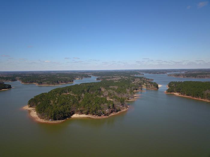
The Piney Grove Campground is on Bay Springs Lake, along the Tennessee-Tombigbee Waterway in northeastern Mississippi. It’s ideal for families and groups of friends looking for lots of water recreation.

Recreation

Boat, fish, swim, hike, bike or just sit back and relax on the nine-mile lake. Bay Springs Lake is dotted with recreation areas for a true sampling of the outdoors.

Facilities

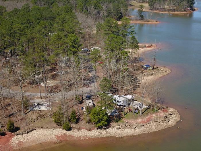
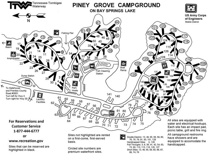
Each of the 141 sites come with electric hookups, a lantern post, impact pad, campfire ring and picnic table. The park also has a playground, two multi-use courts, laundry facilities and an ice machine.

Natural Features

The Tennessee-Tombigbee Waterway extends 234 miles from the Tennessee River to the junction of the Tombigbee River in Alabama. The man-made waterway connects the nation’s midsection of commercial water transportation with the Gulf of Mexico. The Tenn-Tom Waterway is the largest earth moving project in the history of the world! The Tenn-Tom Waterway has 180,000 acres of public land waiting for you to explore.

Nearby Attractions

Piney Grove Beach is just a short walk or bike ride from the campground. We also have several other recreational areas around the lake including the very popular, Old Bridge Beach.

Reservation

More from CampingHiking.net:

BOY SCOUT, Utah Campground Images, Info & Reservations

Directions From Salt Lake City, head west on I-80 for 36 miles. Take the Stansbury-Tooele/Route 35 exit and travel south 3 miles to Route 138 West. Follow it 10 miles to Grantsville. Go through Grantsville to Cooley Street and turn south; go 5 miles to the South Willow Canyon turnoff.

Mineral Park Campground, Washington Campground Images, Info & Reservations

Directions From Seattle, take I-5 north for about 42 miles. Exit onto WA-530 East, then continue east on Highway 20 for about 40 miles. At the town of Marblemount, cross the bridge over the Skagit River and continue east approximately 16 miles to the Mineral Park Campground. Phone 360-804-1103 Activities

OUTLET AT PRIEST LAKE, Idaho Campground Images, Info & Reservations

Directions Physical Address: Priest River, ID 83856 From I-90; Turn at Post Falls Highway 41 north to Newport, WA. Take Highway 2 east to Priest River. At the junction of Highway 57 and Highway 2, turn left. Drive 26 miles to Outlet Bay Road. Turn right for approximately 0.5 mile.

CHALLENGE CABIN, Montana Campground Images, Info & Reservations

Directions From Hungry Horse, travel east on Highway 2 for 51 miles, then 8 miles south on Skyland Road 569. Park in the plowed area along Highway 2, then hike, snowmobile, ski or snowshoe approximately 8 miles along the groomed trail. The cabin is not accessible by car. Phone 406-387-3800

BLOOMINGTON WEST, Kansas Campground Images, Info & Reservations

Directions From Lawrence, Kansas, take 6th Street/Highway 40 west for 4 miles. Take a left onto Douglas County Road 442 and go 5 miles to Stull, Kansas, then take another left onto Douglas County Road 1023 and go 6 miles to Douglas County Road 6. Make a left turn on