BOULDER GULCH, CA Campground Reservation, Info, Images, Map, Directions

BOULDER GULCH, California Campground Images, Info & Reservations

Listen

Directions

From Highway 99 in Bakersfield, California, take Highway 178 east to the town of Lake Isabella. Take Highway 155 around the west side of Lake Isabella for 4 miles to the campground entrance.

Phone

760-376-1815

Activities

CAMPING, HIKING

Keywords

BOGU,LAKE ISSABELLA,KERN VALLEY,SEQUOIA NF – FS

Related Link(s)

Rec Area Info & Images

California State Tourism

Forest Service Concessionaire

California State Road Conditions

Overview

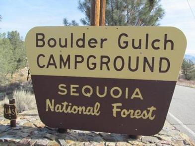
Boulder Gulch Campground is nestled in the foothills of the high desert at an elevation of 2,650 feet, just a short drive from Lake Isabella. The facility sits in the Giant Sequoia National Monument, offering countless recreational opportunities for visitors.

Recreation

At the nearby Lake Isabella visitors enjoy trout and bass fishing, boating, windsurfing, swimming and water skiing.

There are also hiking, horseback and mountain biking trails in the area.

Facilities

This campground consists of about 58 paved sites and includes a fish cleaning station and flush toilets.

The Giant Sequoia Mercantile offers a wide variety of books, maps, gifts, local art, camping supplies and other merchandise.

This facility is operated by Sequoia Recreation, a division of California Land Management and comments are welcome; comment forms are available from campground hosts or online.

Natural Features

The Sequoia National Forest, located at the southern end of the Sierra Nevada in central California, takes its name from the giant sequoia, the world’s largest tree, which grows in more than 30 groves on the Forest’s lower slopes.

The Forest comprises about 1.1 million acres, and elevations range from about 1,000 to 12,000 feet, creating precipitous canyons and mountain streams with spectacular waterfalls, such as Salmon Creek Falls near Fairview and Grizzly Falls on the Kings River.

Reservation

More from CampingHiking.net:

JENNINGS FERRY, Alabama Campground Images, Info & Reservations

Listen Directions From Demopolis, Alabama, take Highway 43 north towards Eutaw. At Highway 14, take a right. Proceed for approximately seven miles to the park. Phone 205-372-1217 Activities CAMPING, FISHING, HIKING Keywords JENF,BLACK WARRIOR Related Link(s) Rec Area Info & Images Alabama State Tourism Alabama State Road Conditions Overview Jennings

MINERAL LAKE, Wisconsin Campground Images, Info & Reservations

Listen Directions From Mellen, Wisconsin, take County Highway GG west for about 9 miles to the campground sign. Turn right and drive less than a mile to the campground. From Clam Lake, Wisconsin, take County Highway GG north for about 9 miles to the campground sign and turn left. Phone

COLD SPRINGS CAMPGROUND (OR), Oregon Campground Images, Info & Reservations

Listen Directions From Sisters, OR: Travel 4.2 miles west on Highway 242 (McKenzie Pass Highway). Phone 541-323-1746 Activities CAMPING Keywords Related Link(s) Rec Area Info & Images Oregon State Tourism Oregon State Road Conditions Overview A pleasant, small spring runs through the center of this popular, shaded campground. Located just

EAST SULLIVAN, Washington Campground Images, Info & Reservations

Listen Directions Campground is located 95 miles north of Spokane, Washington. From the junction of State Highway 20, follow State Highway 31 three miles north to the junction of the Sullivan Lake Road (County Road 9345). Follow the Sullivan Lake Road for 12.5 miles to the junction of Forest Road

RED IVES CABIN, Idaho Campground Images, Info & Reservations

Listen Directions From St. Maries, Idaho: Follow paved Forest Highway 50 (St. Joe River Rd) 47 miles to Avery. Continue 29 more miles along FH-50 to the Red Ives Road #218. Turn right (south) on road #218 and travel 10 miles upstream to the Red Ives Ranger Station. The Red