

Directions
From Yakima, travel 37 miles west on Highway 12 (White Pass Highway) to the campground entrance, about 16 miles west of the junction of 12 and 410.
From Packwood, travel east on Highway 12. The campground is about 20 miles east of White Pass.
Phone
541-338-7869
Activities
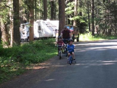
BIKING, BOATING, CAMPING, FISHING, HIKING, PICNICKING, SWIMMING SITE
Keywords
IND3,RIM ROCK LAKE,RIMROCK,TIETON RIVER,OKANOGAN – WENATCHEE NF -FS
Related Link(s)
Washington State Road Conditions
Overview
Indian Creek Campground is located at the edge of Rimrock Lake in the Wenatchee National Forest in Washington’s North Cascades Range. The campground’s proximity to high alpine lakes, lush forests and towering peaks in nearby wilderness areas make it a popular destination for outdoor enthusiasts.
Recreation
Indian Creek Campground offers outdoor enthusiasts the opportunity to hike, fish, ski, raft and enjoy a multitude of recreational activities throughout the year.
Beautiful rivers and streams, high elevation lakes and reservoirs provide an endless number of fishing opportunities for the experienced and beginning angler. Opportunities abound to pursue or view the legendary salmon and steelhead, several species of trout or a variety of warm-water fish.
River enthusiasts enjoy whitewater rafting trips on one of the many scenic rivers in the area. The Tieton River is especially exciting in September when the Bureau of Land Reclamation floods the Tieton Valley, releasing fast and furious water.
Facilities
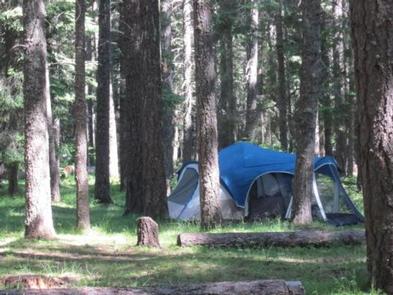
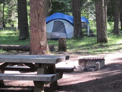
The campground offers several standard sites, perfect for both tent and RV camping. Picnic tables, vault toilets and drinking water are provided. No electrical hookups are available.
Natural Features
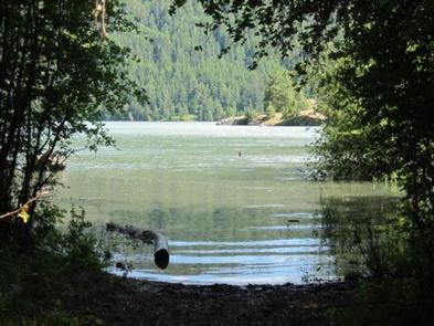
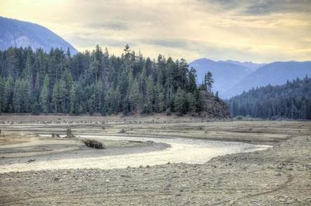
Rimrock Lake, adjacent to the campground and along the course of the Tieton River, is surrounded by rugged mountain terrain, wetlands and diverse conifer forests.
The area around the campground supports wildlife such as mountain goats, native fish and migratory birds. Endangered and threatened species, including American bald eagles, northern spotted owls, gray wolves and grizzly bears also find havens in nearby areas.
Precipitation varies greatly thoughout the area, ranging from approximately 140 inches along the Cascade Crest to only 10 inches along the eastern edge. Visitors to the area can expect many days of warm, sunny weather in the summer, and plenty of snow in the winter.
Nearby Attractions
Boulder Cave National Recreation Trail is one of the most popular places in the Naches District. Visitors can walk the accessible trail along the river or explore Boulder Cave. Interpretive signs along the trail explain the geology, plants, animals and fire history of the area.
Hikers may want to traverse a portion of the spectacular Pacific Crest Trail (PCT), one of the world’s premier National Scenic Trails. This trail showcases some of North America’s most fantastic scenery as it winds its way from Mexico to Canada through California, Oregon and Washington.