SMITH SPRINGS, TN Campground Reservation, Info, Images, Map, Directions

SMITH SPRINGS, Tennessee Campground Images, Info & Reservations

Listen

Directions

From downtown Nashville, TN, take I-40 east 5 miles to exit 219. Turn right on Stewarts Ferry Pike, then left on Smith Springs Road. The recreation area is on the left after about 2 miles.

Phone

615-889-1975

Activities

BOATING, FISHING, PICNICKING, WILDLIFE VIEWING

Keywords

SMSP,J. PERCY PRIEST,PERCY PRIEST LAKE,J PERCY PRIEST DAM

Related Link(s)

Rec Area Info & Images

Tennessee State Tourism

Tennessee State Road Conditions

Overview

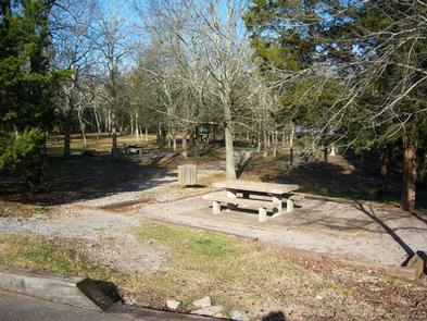
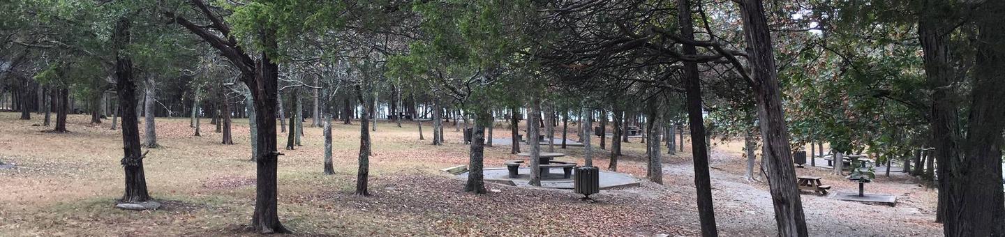
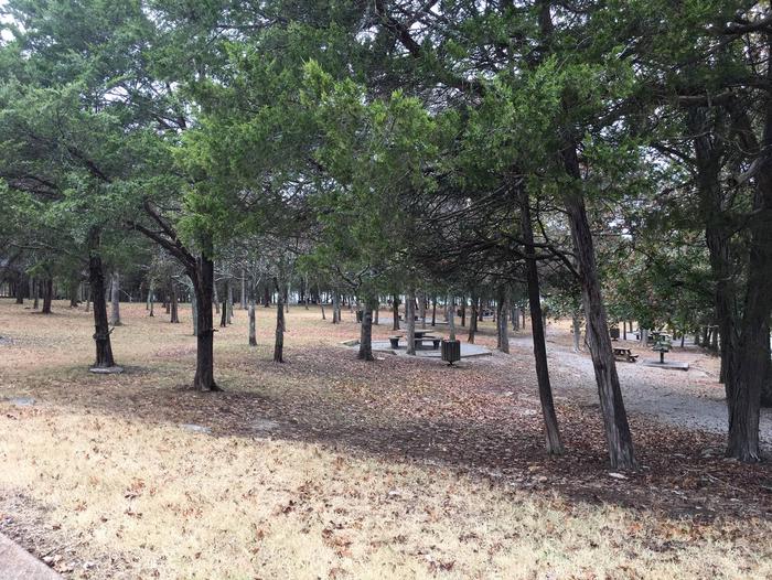
Smith Springs Recreation Area is a lakeside oasis in the hills of middle Tennessee, providing visitors with countless recreational activities on the lake and in the surrounding woods and grasslands.

Recreation

The lake provides a variety of outdoor recreational opportunities for millions of visitors each year. Because of the temperate climate and relatively long recreation season, visitors have numerous activities to choose from, including fishing, hunting, picnicking, boating, canoeing, hiking, horseback riding and wildlife viewing.

Fishing opportunities abound at J. Percy Priest Lake, with a wide variety of species available, including largemouth and smallmouth bass, crappie, striped bass, Cherokee bass, and white bass. Other species such as catfish, bluegill, bream and trout provide excellent opportunities for younger anglers.

Nearby Anderson Road Fitness Trail is a paved trail winding a little over a mile through the cedar glade area beside the lake.
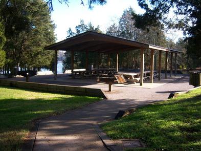
Facilities

Smith Springs Recreation Area offers a large group shelter for day use and can accommodate up to 50 guests. There is limited parking suitable only for 12 vehicles.

Natural Features

J. Percy Priest Dam and Lake was one of the first Corps of Engineers lakes to have recreation as part of its justification. The dam, completed in 1968, impounds 42 miles, with 14,200 surface acres of water.

In soothing contrast to the sparkling waters of the lake are the adjacent 19,087 acres of grasslands and woodlands.

A highlight of the region, the Cedar Glades Natural Area, is home to countless wildlife and plant species, including the Tennessee coneflower.

Nearby Attractions

J. Percy Priest Lake is conveniently located about 10 miles east of downtown Nashville, offering visitors countless cultural activities and the conveniences of a metro area.

Reservation

More from CampingHiking.net:

SOUTH CAMPGROUND, Oregon Campground Images, Info & Reservations

Listen Directions From Bend, travel 35.5 miles southwest on Cascade Lakes Hwy (46), then 1.3 miles east on Forest Road 4625. South Campground will come up on the right side first and then Mallard Marsh. Phone 541-323-1746 Activities CAMPING Keywords Related Link(s) Rec Area Info & Images Oregon State Tourism

LOWER TWIN LAKES AT BRIDGEPORT, California Campground Images, Info & Reservations

Listen Directions From Bridgeport, California, take Highway 395 and turn south at Twin Lakes Road and travel 9.6 miles. Turn left onto South Twin Road and travel approximately 0.6 miles across the bridge to the campground. Phone 760-932-7092 Activities CAMPING, FISHING Keywords LOTL,HUMBOLDT-TOIYABE NF-FS Related Link(s) Rec Area Info &

SHIRTTAIL CREEK, California Campground Images, Info & Reservations

Listen Directions From either east bound or west bound Interstate 80 take exit 121, Auburn Ravine Road to Foresthill. Continue east for 17 miles, to Foresthill. Travel through town, about 9 miles, to Forest Road 10/Sugar Pine Road. Turn left and continue 9 miles to the Sugar Pine Campgrounds road

DENT ACRES, Idaho Campground Images, Info & Reservations

Listen Directions From Hwy 12: Cross the bridge at Orofino and turn left onto Hwy 7.  Travel 200 yards and turn right on Dent Bridge Road and travel 19 miles.  At the sign for the campground, turn left.  Campground is 2 miles ahead. Phone 208-476-9029 Activities BOATING, CAMPING, FISHING, HIKING,

EVANS GROUP CAMP, Washington Campground Images, Info & Reservations

Listen Directions Take Washington state Highway 395 north from Spokane. Travel 83 miles to the town of Kettle Falls, take Highway 25 north and travel 11 miles. Follow signs to the campground. It is on the west side of the highway. Phone 509-754-7889 Activities BOATING, HISTORIC & CULTURAL SITE, CAMPING,

BELLE STARR, Oklahoma Campground Images, Info & Reservations

Listen Directions From Eufaula, Oklahoma, take Highway 69N to the OK-150 exit toward Texanna Road/State Park/Lake Eufaula.Turn right onto E1140 Rd/Texanna Rd. Travel east for 2 miles, turn right onto Belle Starr Rd/Northsouth 420, travel south for 2 miles and you will arrive at Belle Starr Campground. Phone 918-799-5843 Activities