
Directions
The campground is located north of Tofte, Minnesota. Travel to Tofte via Highway 61 along Lake Superior’s north shore. In Tofte, turn north (away from Lake Superior) on Sawbill Trail (CCHS 2). Follow Sawbill Trail 24 miles until it ends at the entrance to the campground.
Phone
218-663-7150
Activities
BIKING, BOATING, CAMPING, INTERPRETIVE PROGRAMS, FISHING, HIKING, HUNTING, WILDLIFE VIEWING, OTHER RECREATION CONCESSION SITE
Keywords
SAWL
Related Link(s)
Minnesota State Road Conditions
Overview
Sawbill Lake Campground has immediate access to the Boundary Waters Canoe Area Wilderness, a beautiful, peaceful and wild natural feature of Minnesota’s Superior National Forest. The campground acts as a convenient base camp for exploring the nearby wilderness.
Superior National Forest, located in northeastern Minnesota’s Arrowhead Region, is comprised of 3 million acres. The forest spans 150 miles along the United States-Canada border. Visitors can find recreation opportunities year-round, including travel in the famed Boundary Waters.
Recreation
This facility draws canoe enthusiasts who seek a quiet and convenient area from which to access the surrounding wilderness. Day and overnight use of the Boundary Waters requires a permit.
The campground concessionaire, Sawbill Canoe Outfitters, provides a one-stop shop for canoeists of all levels within walking distance of the campground. Canoe rentals, permits and guided canoe trips are available.
Campers who wish to spend time relaxing at the campground can fish for northern pike and bass; hike, bike, picnic and attend educational programs.
View recreation guides and maps of hiking trails and canoe routes in the national forest.
Facilities
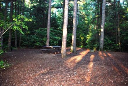
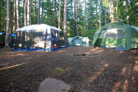
Sawbill Lake is comprised of two loops with a total of 51 campsites, 27 of which can be reserved (others are first-come, first-served). Campsites can easily accommodate large motorhomes and RVs. Some of the sites offer a partial lake view through the forest.
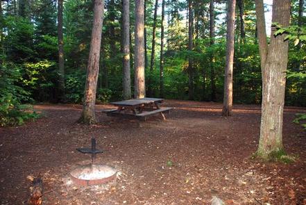
The campground is equipped with picnic tables and campfire rings with grills, as well as vault toilets, a dump station, drinking water and trash and recycling bins.
Natural Features
Sawbill Lake is nestled in a thick pine forest that gives campsites excellent privacy. Birds and wildlife are abundant, from moose and bear to bald eagles and loons. Wildflowers add bright colors to the landscape in warmer months.
The campground sits on a hill above Sawbill Lake. The 765-acre lake is within the Boundary Waters.
Nearby Attractions
Sawbill Canoe Outfitters maintains a store with showers, laundry, fishing licenses, bait and tackle, ice, grocery and convenience items, canoe and camping gear, rentals and a pay telephone.
Over 1 million acres in size, the Boundary Waters Canoe Area Wilderness contains over 1,200 miles of canoe routes, 12 hiking trails and over 2,000 designated campsites.
Boundary Waters Canoe Area Wilderness