
Directions
From Tucson: Take I-10 east to Exit #318 (Dragoon Road). Turn right onto Dragoon Road and travel for approximately 10 miles through the village of Dragoon to the Cochise Stronghold Road. Turn right on Cochise Stronghold Road and travel for approximately 6 miles to Ironwood Road. The paved road dead ends at Ironwood Road. Turn right, and travel for approximately 3 miles to the first creek crossing. The entrance to the Half Moon Ranch is on the left just beyond the crossing.
Phone
(520) 364-3468
Activities
CAMPING, HIKING, HORSEBACK RIDING, WILDLIFE VIEWING, MOUNTAIN BIKING, BIRDING, ROCK CLIMBING, MUSEUM
Keywords
HMRC
Related Link(s)
Overview
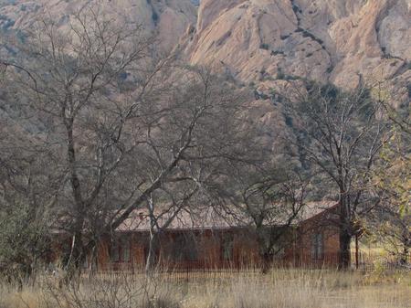
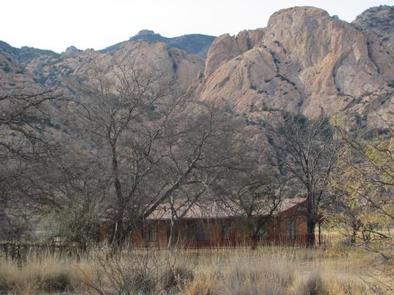
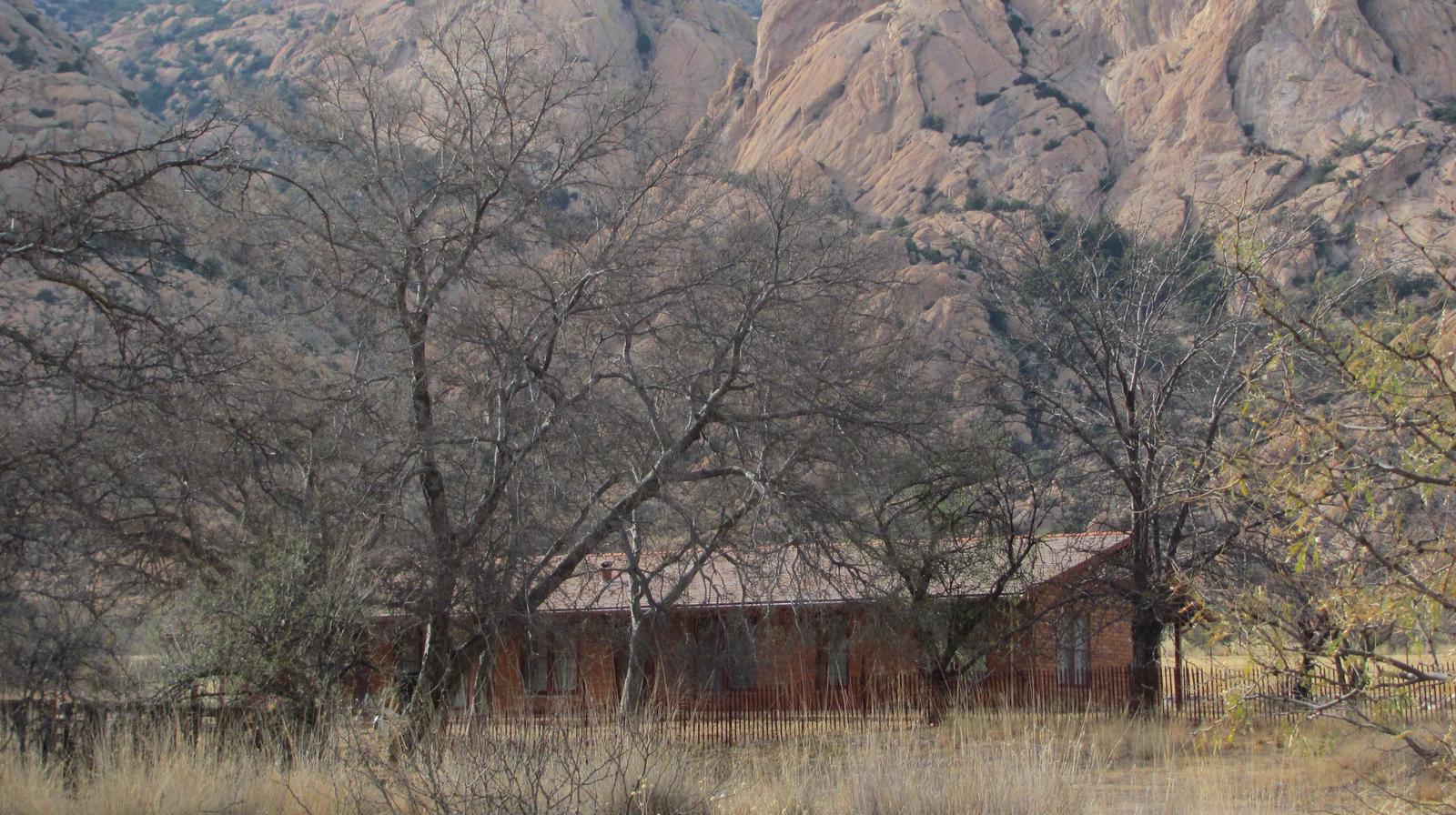
Half Moon Ranch is a ranch style house located in East Cochise Stronghold in the Dragoon Mountains of the Coronado National Forest, approximately 1-1/2 hours east of Tucson. The house is situated in a dramatic canyon that provides excellent rock climbing, hiking, mountain biking, and horseback riding opportunities.
Recreation
The area around Half Moon ranch has long been considered a bouldering and rock climbing paradise, boasting backcountry and protected routes ranging from one to seven pitches in length, and from 5.6 to 5.12 in difficulty. Most approaches are 30-60 minutes in length, although there are a number of known areas that are easily accessible from the roads. In addition, the nearby Cochise Stronghold Campground has interpretive tales for both natural and cultural resources and history.
Facilities
Half Moon Ranch is a seven-room ranch style house, suitable for groups of up to 10 people. The house has two bedrooms, two full bathrooms, a living room, a dining room and a kitchen. The master bedroom has a queen-size bed; the second bedroom has a twin-over-double bunk bed and a single bed. The living room contains two double futons and a wood stove (firewood is provided). The dining room has a table and chairs that seats six. A small dinette set with seating for four is located in the kitchen. The kitchen is equipped with a stove, oven, microwave and refrigerator, pots, pans, utensils, dishes, coffeepot. The house has electricity and running water. Outside, guests will enjoy using the propane grill and picnic table for outdoor cooking and dining. Although the cabin has amenities for comfortable lodging, guests do need to provide some of their own supplies, including food, sleeping bags, linens, pillows, towels, dish soap, matches, a first aid kit, toilet paper and garbage bags. Although electricity is available, it is recommended that guests bring an additional light source in case of emergencies. A barn and corrals are located to the east of the main house. There is a covered storage area for hay.. Up to six horses/mules are permitted in the corrals, and feed for the horses must be certified weed-free.
Natural Features
Half Moon Ranch is surrounded by the rugged beauty of the Dragoon Mountains and Cochise Stronghold. At an elevation of 5,000 feet, the sparsely wooded area is a protective rampart of granite spires, sheer cliffs, and balanced rocks and boulders which were once the refuge of the Apache Chief, Cochise. The ranch house lies in a mountain range or “sky island” in the Coronado National Forest, rising dramatically from the desert floor and supporting abundant and biologically diverse plant and animal communities.
Nearby Attractions
The Half Moon Ranch is located approximately 9 miles west of Sunsites, Arizona. Attractions in the area include the Chiricahua National Monument, Fort Bowie National Historic Site, the Amerind Foundation, the ghost towns of Gleeson, Dos Cabezas, and Courtland, and the Willcox Playa.