
Directions
From Bend go south 23.5 miles on Hwy 97 to Road 21. Take Road 21 east for about 12.9 miles.
From La Pine go north 5 miles on Hwy 97 to Road 21. Take Road 21 east for about 12.9 miles.
Phone
541-383-5300
Activities
BIKING, BOATING, CAMPING, FISHING, HIKING, SWIMMING SITE
Keywords
PAUL,Paulina,Paul,Paulina Lake,Paulina Lake Campground,Paulina Lake Campground (OR)
Related Link(s)
Overview
Paulina Lake Campground is located 6,350 ft. above sea level in the caldera of Newberry Volcano, on the edge of the beautiful Paulina Lake. Conveniently located within Newberry National Monument, visitors to this area are taken aback by the incredible views this has to offer, highlighting volcanic landscapes intermixed with diverse forests, typical of central Oregon.
Popular for both its geological significance and multitude of recreational activities, Paulina Lake Campground is ideal for individual and family camping excursions.
Recreation
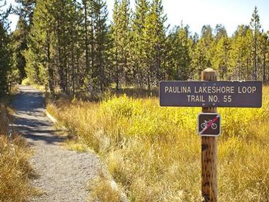
The unique location of Paulina Lake Campground offers visitors opportunities to hike shoreline trails and alpine vistas.
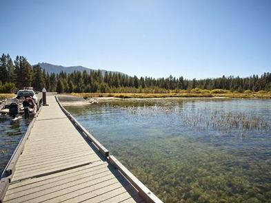
Visitors can also take advantage of time on the lake, boating, kayaking, swimming and fishing.
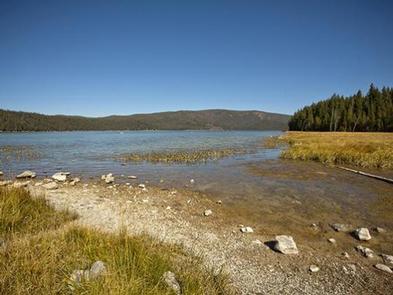
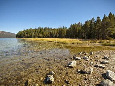
For anglers, this lake offers fantastic fishing opportunities. Spanning a surface area of 1,531 acres, the lake supports rainbow trout, brown trout and Kokanee salmon.
In September, the outlet of Paulina Lake may be choked with Kokanee moving to spawn in Paulina Creek.
Facilities
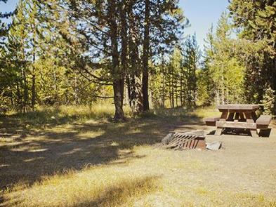
Paulina Lake campground has excellent sites for all forms of camping and plenty of large sites for RVs.
Picnic areas, boating, shoreline trails, and stunning views of the lake, along with the conveniences of drinking water and flush toilets, give visitors the opportunity to enjoy the outdoors while still having many of the conveniences of home.
Natural Features
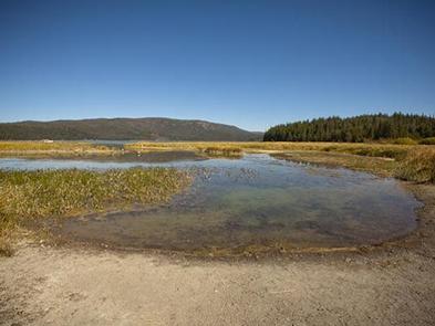
Paulina Lake is located within the collapsed crater, or “caldera” of Newberry Volcano. Nearly five miles in diameter, this caldera encircles the basins of Paulina Lake, and its twin, East Lake.
Neither lake receives water from an inlet stream, but instead, rely on rain, snowmelt and hot springs for water. Paulina Creek drains the lake and has chiseled a narrow gorge through the caldera’s west wall creating a remarkable twin waterfall. Thermal vents and hot springs along the lake’s northeast edge help create a highly productive ecosystem.
Wetlands, diverse forests, and rocky slopes near the campground provide a necessary habitat for shorebirds, porcupine, deer, bats and the occasional black bear.
Nearby Attractions
Lava Lands Visitor Center in nearby Bend, Oregon, is a great starting point for visitors to learn about the diverse landscape and history of the area through interpretive programs and exhibits.
Visitors can explore the Lava River Cave, also located in the Newberry National Volcanic Monument. At 5,211 feet (1,588 m) in length, the northwest section of the cave is the longest continuous lava tube in Oregon.
A rustic lodge near the campground, operating under a special use permit from the Deschutes National Forest, offers visitors lodging, last minute essentials and a cafe.