EWING POINT DISPERSED CAMPSITE, MI Campground Reservation, Info, Images, Map, Directions

EWING POINT DISPERSED CAMPSITE, Michigan Campground Images, Info & Reservations

Listen

Directions

From Munising, Michigan, take State Route 28 to Wetmore and turn south on Highway 13. Travel about 15 miles, then turn left on Forest Service Road 2173 at the Petes Lake Campground sign. Turn right at the sign for McKeever Lake. The campsite is accessed through the boat launch area.

Phone

906-387-2512

Activities

BIKING, CAMPING, HIKING, SWIMMING SITE

Keywords

McKeever Lake,D115,EWING POINT DISPERSED CAMPSITE (MI),Ewing Point Dispersed Campsite

Related Link(s)

Rec Area Info & Images

Michigan State Tourism

Michigan State Road Conditions

Overview

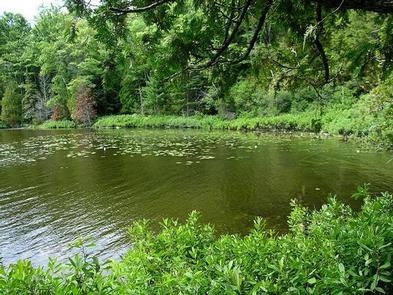
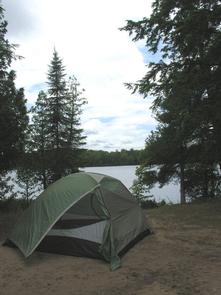
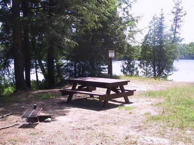
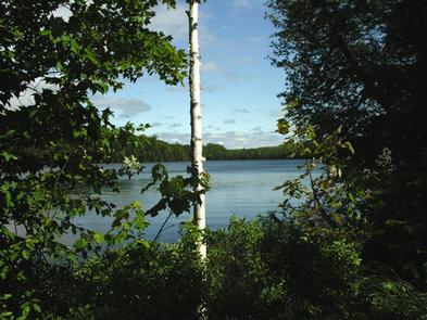
Ewing Point is located on the beautiful, 132-acre McKeever Lake in the forests of Michigan. This spacious campground provides a rustic environment in a secluded setting.

Recreation

Bruno’s Run Hiking Trail weaves throughout the Ewing Point area, offering 9 miles of adventure for hikers. The trail is accessible at various locations, two of which are near the Ewing Point parking area. One section of the trail leads to Grassy Lake, while the other heads along the southeastern portion of McKeever Lake.

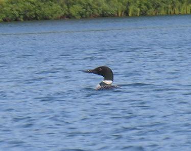
McKeever Lake offers great fishing for musky, pike, bass and pan fish, and there is boat access in the parking area. Boats must be carried to the site by hand or through the water. Because the water is quite shallow, large boats are not recommended.

Facilities

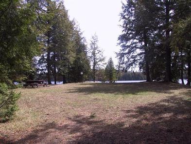
The campsite is equipped with tables and a campfire ring with a grill. A lantern post and pit toilet are also available.

Natural Features

There is one walk-in campsite on Ewing Point, accessible by a primitive foot trail. The site lies in a grassy area, surrounded by cedar and hemlock.

Reservation

More from CampingHiking.net:

TWIN LAKES CABIN (MT), Montana Campground Images, Info & Reservations

Listen Directions From Wisdom, MT, travel south on Highway 278 approximately 6 miles. If coming from Jackson, MT travel north on Highway 278 for approximately 12 miles. Turn west onto the Twin Lakes Road, follow for 8 miles, turn left Forest Road 945 continuing approximately 5 miles to Forest Road

PACKERS CABIN, Oregon Campground Images, Info & Reservations

Listen Directions From Portland take 1-5S to US 199 South to Brookings. From Brookings, Oregon, take U.S. Highway 101 and turn onto County Road 784 (North Bank Chetco River Road). This becomes Forest Road 1376. Follow this Forest Road 1376 to the junction with Forest Road 1917. Follow Forest Road

MATHER CAMPGROUND, Arizona Campground Images, Info & Reservations

Listen Directions Mather Campground is located within the park in Grand Canyon Village on the South Rim. From the south entrance station, proceed for about three miles and turn left on Center Road. Travel 1/4 mile and turn right onto Market Plaza Road. The campground is about one mile down

KENTS LAKE CAMPGROUND, Utah Campground Images, Info & Reservations

Listen Directions Travel east of Beaver approximately 10 miles on SR 153, then turn right on to Forest Road 137 for about 5 miles. Phone 435-438-2436 Activities CAMPING, FISHING, WILDLIFE VIEWING Keywords Middle Kents Lake,Kents Lake,Kent’s Lake Related Link(s) Rec Area Info & Images Utah State Road Conditions Utah State

POTWISHA CAMPGROUND, California Campground Images, Info & Reservations

Listen Directions Potwisha Campground is easily accessed from Visalia, California, and Highway 99. Follow Highway 198 east from Visalia for 36 miles, until you reach the Ash Mountain Entrance Station. The campground is located 4 miles beyond the entrance station on the left, or north, side of the road. Please

KENNEL CREEK CABIN (AK), Alaska Campground Images, Info & Reservations

Listen Directions Kennel Creek Cabin is located approximately 19 air miles southeast of the City of Hoonah, Alaska on the south shore of Freshwater Bay. Access is by vehicle, float plane, or boat. Total distance by gravel road is approximately 27 miles. By road travel south from Hoonah past the