


Directions
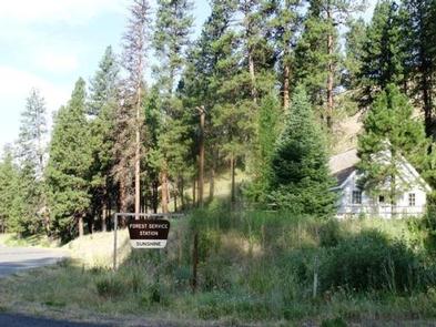
From Prairie City, OR., travel east on US Highway 26 approximately 13 miles to the junction of US Highway 7. Turn left on US Highway 7, travel one mile to the junction with County Road 20/ Middle Fork Road. Turn left and follow County Road 20 approximately 13 miles, the guard station will be on the right.
Phone
541-820-3800
Activities
BIKING, CAMPING, FISHING, HIKING, HUNTING
Keywords
None
Related Link(s)
Overview
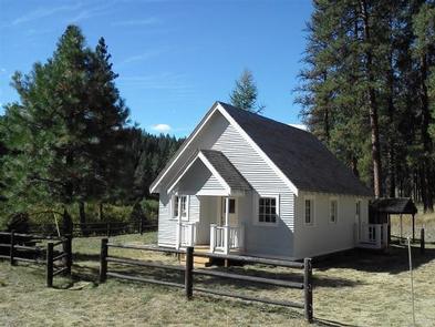
Sunshine Guard Station is situated along John Day River in the Malheur National Forest at an elevation of 3,700 feet, about 43 miles northeast of John Day, Oregon. The former guard station was built in 1936 and until the 1990s was used alternatively as a bunkhouse or a work station for fireguards.
The guard station can be accessed by vehicle. Guests are responsible for their own travel arrangements and safety, and must bring several of their own amenities.
Recreation
Recreational options include fishing for steelhead and rainbow trout in the John Day River. Restrictions apply; visitors should refer to Oregon State regulations.
There are hiking trails and back roads to the north of the guard station that lead into the nearby Vinegar Hill / Indian Rock Scenic Area.
Wildlife viewing is popular, as is scenic driving.
Facilities
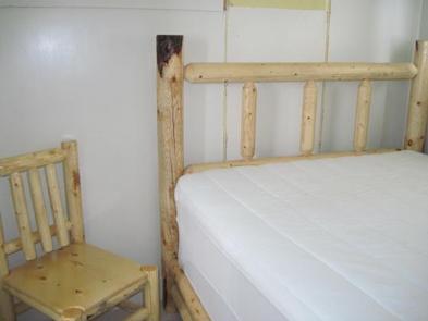
This rustic four-room cabin sleeps up to six and has a kitchen, living room, and two bedrooms. The living room is furnished with a futon, two chairs, a coffee table and an end table. The larger bedroom is furnished with a queen-sized bed and a closet, while the smaller bedroom offers a queen-sized bed and a chair.
The kitchen is furnished with a table and four chairs, electric refrigerator, and stove. Electric heat and lights are provided, and a vault toilet is located next to the cabin.
There is no water in the cabin. Guests must bring their own water for drinking, cooking and washing.
Roads to the guard station are paved and maintained for summer and winter access.
Natural Features
The guard station has a view of the Middle Fork of the John Day River. The Vinegar Hill Forest/Indian Rock Scenic Area is nearby. The 25,000-acre area includes a 10 mile ridgeline that comprises the summit of the Greenhorn Range in the Blue Mountains of eastern Oregon. Outcrops of serpentine, rhyolite, basalt, granite, and shale can be seen. Agates can also be found on some of the rocky slopes.
Wildlife includes elk and deer, songbirds and, in the river, steelhead and trout. Nearly every type of alpine wildflower found west of the Rockies can be blooming at different times in this area.
Magone Lake is about 20 miles west of the guard station.