HURRICANE CAMPGROUND, VA Campground Reservation, Info, Images, Map, Directions

HURRICANE CAMPGROUND, Virginia Campground Images, Info & Reservations

Directions

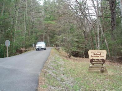
From I-81: Take Marion exit 45 onto Virginia State Route 16 South. Follow SR 16 for 15 miles to SR 650 (5 miles south of Sugar Grove). Turn right on gravel SR 650, and follow for 2 miles to the paved campground entrance road.

Phone

276-783-5196

Activities

BIKING, CAMPING, FISHING, HIKING, HUNTING

Keywords

huricane

Related Link(s)

Rec Area Info & Images

Virginia State Road Conditions

Virginia State Tourism

Overview

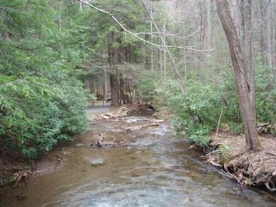
Hurricane Campground is one of the best kept secrets in southwest Virginia. Located along a rushing mountain stream under the shade of hemlock and rhododendron, this campground offers a peaceful setting for those looking to relax as well as visitors looking for outdoor adventure.

From the campsite, hikers can access many trails including the Appalachian Trail. This well-known trail extends more than 2,189 miles throughout the Appalachian Mountains across 14 states. It is a protected greenway and owns the title as the first National Scenic Trail.

Recreation

Visitors frequently explore the Hurricane Knob Trail. The loop trail, at 1.1 miles, parallels Hurricane Creek for about half a mile, crosses two wooden bridges and ascends to the picturesque Hurricane Knob. The creeks are stocked with trout for a relaxing day of fishing.

Facilities

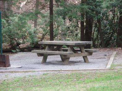
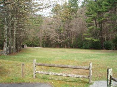
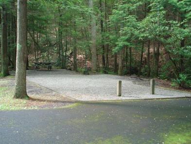
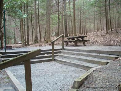
Hurricane has drinking water, flush toilets, hot showers and a playing field. Large RVs are not recommended. Each site comes with a lantern pole, picnic table and campfire ring.

Natural Features

The campground is perched along Hurricane Branch and Comers Creek, among colorful rhododendron. Several groomed, grassy fields unfold at the campground, but the campsites are nicely shaded by mixed woods of oak and hemlock. Hurricane Knob is nearby with an elevation from 2800 to 3050 feet.

Nearby Attractions

Virginia Creeper Trail, Grayson Highlands State Park and Hungry Mother State Park.

Reservation

More from CampingHiking.net:

SHOUSE FORD, Arkansas Campground Images, Info & Reservations

Directions From Interstate 30, take exit 78 and merge onto State Highway 7 north to Bismarck. Turn left on State Highway 84 and go 9 miles west to Point Cedar. Turn left onto Shouse Ford road and continue 4 miles to the campground. Phone 870-246-5501 Activities BOATING, CAMPING, FISHING, HIKING,

MAPLE GROVE, Utah Campground Images, Info & Reservations

Directions From Scipio, Utah, take U.S. 50 south. Turn west at Maple Grove Campground sign/Forest Road 101 at milepost 146. Travel 4 miles to the campground. Phone 435-743-5721 Activities CAMPING, HIKING Keywords MAPL,FISHLAKE NF – FS Related Link(s) Rec Area Info & Images Utah State Tourism Utah State Road Conditions

ASPEN HOLLOW GROUP, California Campground Images, Info & Reservations

Directions From Fresno, California, take Highway 180 east to Grants Grove. Drive approximately 12 miles, then take a right onto Hume Road and continue 4 more miles, passing Christian Camps. Take a right at the Aspen Hollow sign. Go 3/4 mile reaching the entrance of the campground. Phone 559-335-2232 Activities

VERMILLION, California Campground Images, Info & Reservations

Directions From Clovis, take Highway 168 east to Shaver Lake. Continue through Shaver Lake to Huntington Lake. At the east end of Huntington Lake, turn right on the Kaiser Pass Road (at Eastwood Visitor Center). Travel 17 miles to the Edison Lake Road. Turn left toward Edison Lake and travel

POPLAR SPRINGS, Georgia Campground Images, Info & Reservations

Directions From GA 77/State Route 366, take the first right onto Knox Bridge Crossing Road/GA 59. After two miles make a slight right onto Powers Road. Turn right onto GA 398 North, follow for 3.5 miles, then follow the brown directional signs to the site. 2195 POPLAR SRPINGS RD Lavonia,