MINERSVILLE CAMPGROUND, CA Campground Reservation, Info, Images, Map, Directions

MINERSVILLE CAMPGROUND, California Campground Images, Info & Reservations

Directions

From Weaverville: take Highway 3 north for 15 miles. Turn right on Minersville/Bushtail Road for 1 mile.

Phone

530-623-2121

Activities

BOATING, CAMPING, FISHING, HIKING, WATER SPORTS, SWIMMING SITE

Keywords

Trinity Lake,Clair Engle Lake,Minersville

Related Link(s)

Rec Area Info & Images

California State Road Conditions

California State Tourism

Forest Service Concessionaire

Overview

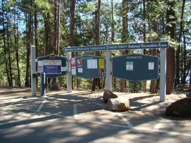
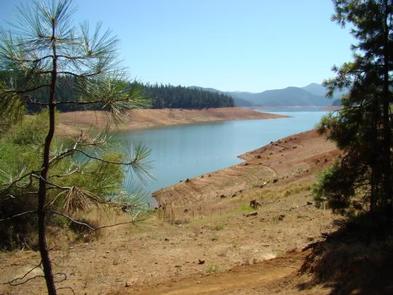
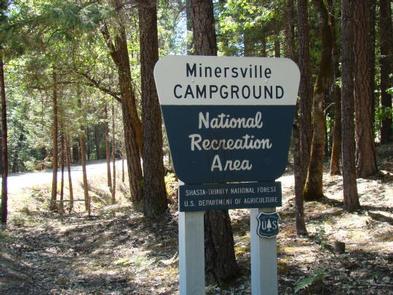
This campground, located 17 miles north of Weaverville, CA, off Highway 2, is situated on the Stuart Fork Arm of Trinity Lake. Minersville is one of the more popular campgrounds on Trinity Lake due to its easy access to the lake and scenic views. At 2,400 foot elevation, it is nestled in a stand of mixed conifers and deciduous trees.

Trinity Lake is one of three Forest Service-managed lakes in the Shasta-Trinity National Recreation Area, offering excellent opportunities for houseboating, water skiing, tubing and wakeboarding.

Recreation

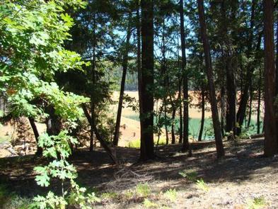
The area offers excellent opportunities for fishing, kayaking, hiking and wildlife viewing. Directly adjacent to the campground is the Minersville Boat Ramp. Informal mooring of boats is possible off some of the campsites.

Rainbow trout are abundant, and brown and brook trout are common. This is a good lake for a float tube and excellent fly fishing.

The area offers wonderful wildlife viewing opportunities. Hikers can access the 4-mile Trinity Lakeshore Trail at nearby Clark Springs Campground.

Facilities

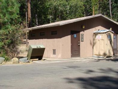
The first section of the campground is well-developed with paved, level parking aprons and amenities. The second section is mostly walk-in with good privacy between campsites, and more primitive with a wilderness feel. There are six walk-in campsites (four single, two double). In addition, there are two accessible campsites 8 & 4 . Sites have picnic tables and campfire rings with grills. Two flush toilets and one vault toilet are available. Drinking water is provided, and bear-proof containers are available. Showers are available at the neighboring Bushy Tail Campground.

Natural Features

Minersville Campground is noted for a “campground with a view.” Many campsites are located on the bank of Trinity Lake with views of the Trinity Alps, noted for their scenic views and alpine environment.

The Trinity Alps are situated within the Klamath Mountains, which lies between the Pacific Coast Ranges to the west and the Cascade Range farther to the east.

Reservation

More from CampingHiking.net:

FALL RIVER CAMPGROUND, Oregon Campground Images, Info & Reservations

Directions From Bend, OR: Travel 17.3 miles south on Hwy 97, then 12.2 miles southwest on County Road 42. Phone 541-323-1746 Activities CAMPING Keywords Related Link(s) Rec Area Info & Images Oregon State Tourism Oregon State Road Conditions Overview Fall River Campground is located along Fall River within the Deschutes

KATY BRANCH, Tennessee Campground Images, Info & Reservations

Directions From Greeneville travel east to 11E to TN State Road 107. Travel approximately 14.5 miles to the gate at Katy Branch located on the right. (Landmarks will include Clark Creek Road on the right and Jackson Bridge Road on the left.) Unlock the gate and travel about .5 miles

RIVERSIDE CAMPGROUND, Oregon Campground Images, Info & Reservations

Directions From Sisters, OR: Travel 9.6 miles northwest on Highway 20, then 4.4 miles north on Forest Road 14. Phone 541-323-1746 Activities CAMPING Keywords Related Link(s) Rec Area Info & Images Oregon State Tourism Oregon State Road Conditions Overview Located on the upper Metolius River, Riverside Campground is one of

FRENCH PETE CAMPGROUND, Oregon Campground Images, Info & Reservations

Directions From Blue River, Oregon, travel four miles east on Highway 126 to Aufderheide Drive (Forest Service Road 19). Continue on Aufderheide Drive for 11 miles to French Pete Campground. Phone 801-226-3564 Activities HIKING Keywords Related Link(s) Rec Area Info & Images Oregon State Tourism Forest Service Concessionaire Oregon State

ST. MARY CAMPGROUND, Montana Campground Images, Info & Reservations

Directions Located a half-mile west of the St. Mary entrance near St. Mary, Montana. Access is from U.S. Highway 89 approximately 33 miles northwest of Browning, Montana or over Logan Pass when open. Vehicle restrictions are in effect. Phone 406-732-7708 Activities CAMPING, INTERPRETIVE PROGRAMS, FISHING, HIKING, DAY USE AREA Keywords

PROMONTORY, Texas Campground Images, Info & Reservations

Directions From Comanche, Texas, HWY 16 north for 12 miles to the town of Downing. Turn right on FM 2318 and continue for five miles to the park entrance. Phone 254-893-7545 Activities BOATING, CAMPING, FISHING, HIKING, HUNTING Keywords PROM,PROCTOR LAKE,LAKE PROCTOR,PROMONTORY POINT,PROCTOR LAKE Related Link(s) Rec Area Info & Images