LEECH LAKE REC AREA, MN Campground Reservation, Info, Images, Map, Directions

LEECH LAKE REC AREA, Minnesota Campground Images, Info & Reservations

Listen

Directions

From Grand Rapids, Minnesota, take Highway 2 west for 33 miles to Bena. Turn south onto County Road 8 and proceed 8 miles to Federal Dam. From Bemidji, Minnesota, take Highway 2 east for 35 miles to Bena, Turn south onto County Road 8 and proceed 8 miles to Federal Dam. From Walker, Minnesota, take Highway 200 east for 20 miles to County Road 8. Turn north onto County Road 8 and proceed 14 miles to Federal Dam. LEECH LAKE REC AREA 01217 FEDERAL DAM DR. NE FEDERAL DAM  MN  56641

Phone

218-654-3145

Activities

BOATING, CAMPING, INTERPRETIVE PROGRAMS, FISHING, PICNICKING, VISITOR CENTER, DAY USE AREA, RANGER STATION, WATER ACCESS, BADMINTON, SHUFFLE BOARD

Keywords

LEEL,FEDERAL DAM,LEECH LAKE,MISSISSIPPI HEADWATER

Related Link(s)

Rec Area Info & Images

Minnesota State Road Conditions

Minnesota State Tourism

Overview

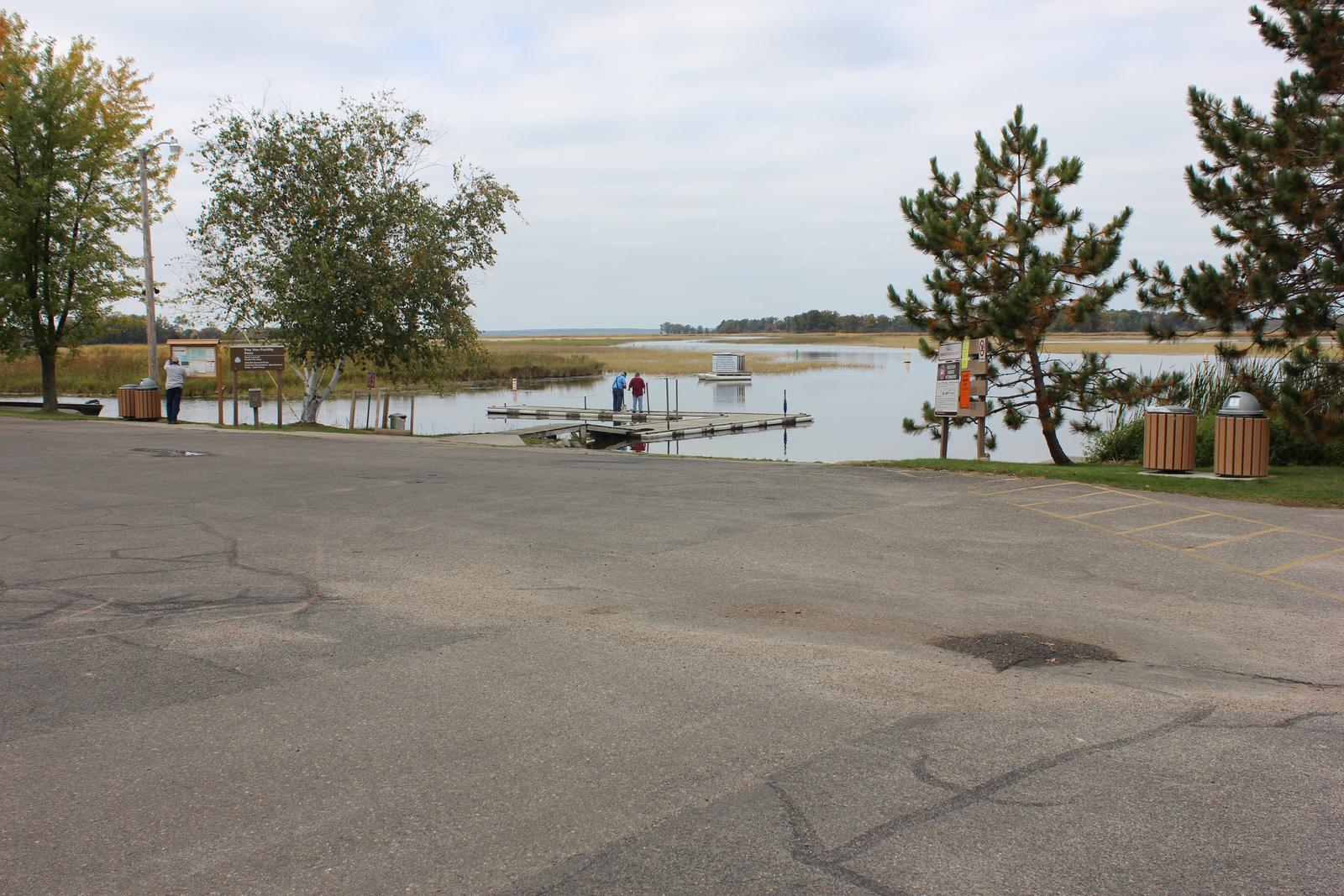
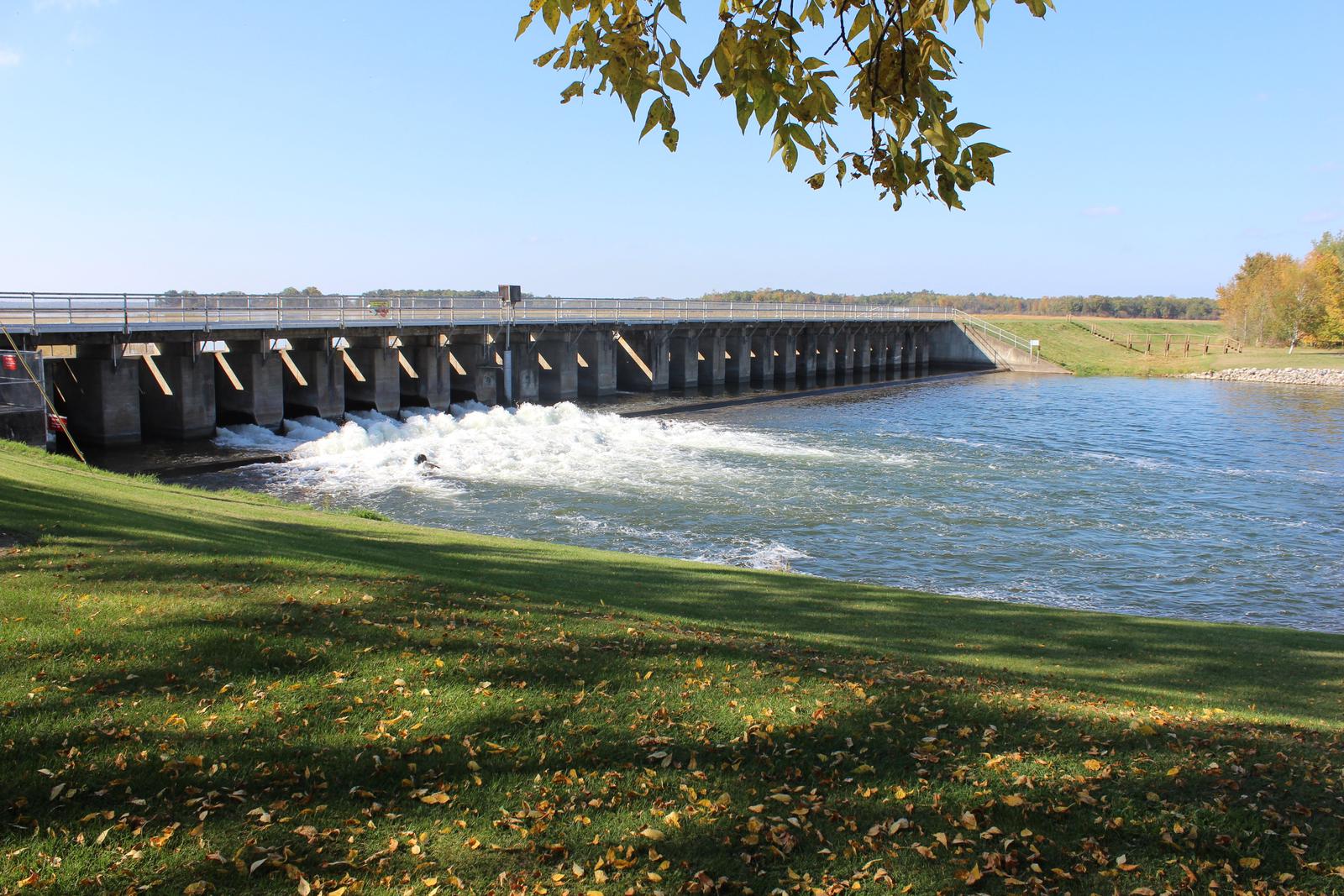
Leech Lake Recreation Area is located in the heart of the Chippewa National Forest in Federal Dam, Minnesota on the Leech Lake River. The area is best known for its fishing and boat access to Portage Bay on Leech Lake, a famous perch, walleye and musky fishery.

Recreation

Boating, canoeing and fishing are very popular activities. Anglers will find walleye, perch, bass, northern pike and musky, where every cast has the potential to yield a trophy. Miles of scenic hiking trails meander around Leech Lake, including the Soo Line, Heartland and North Country National Scenic Trails.

Facilities

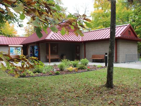
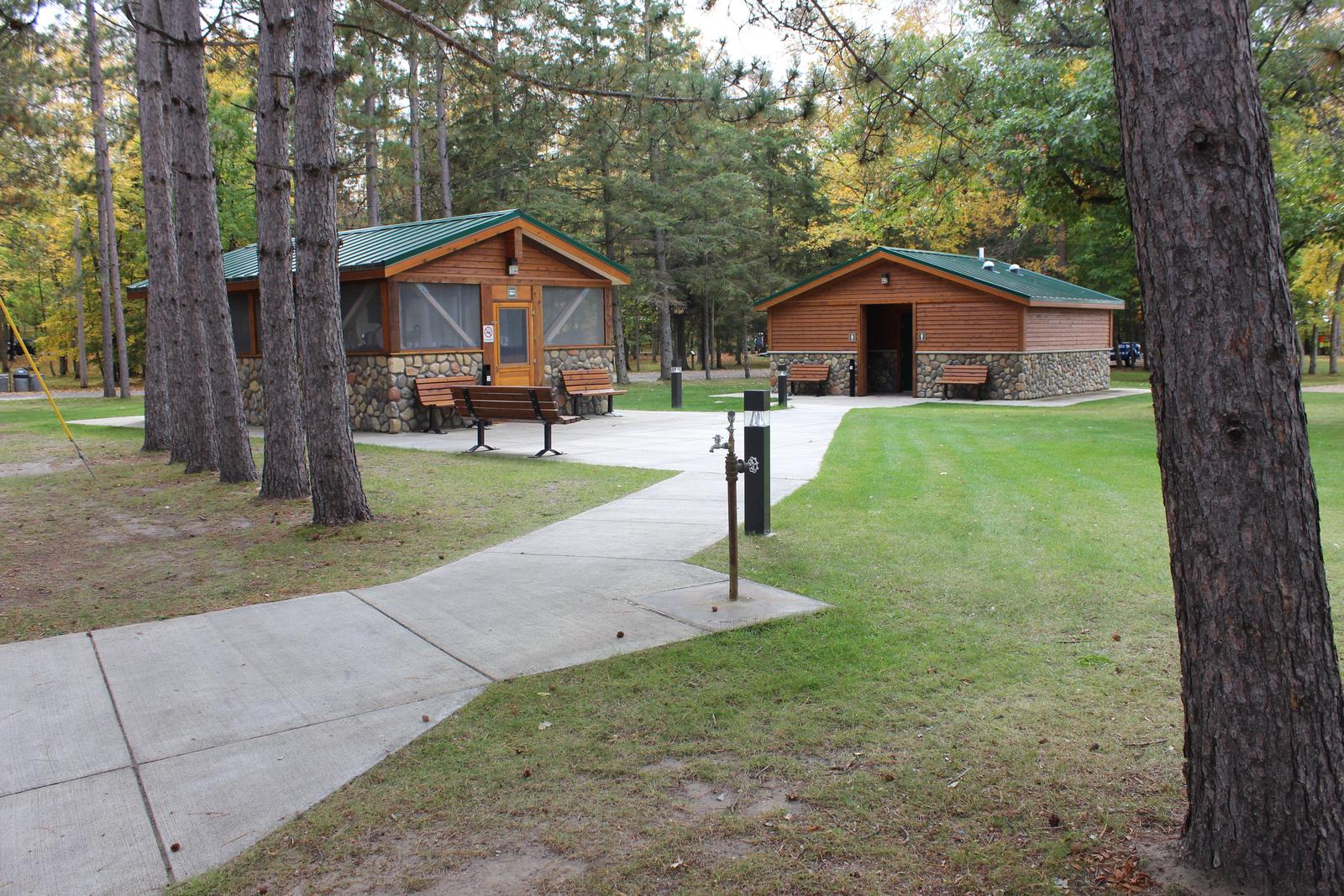
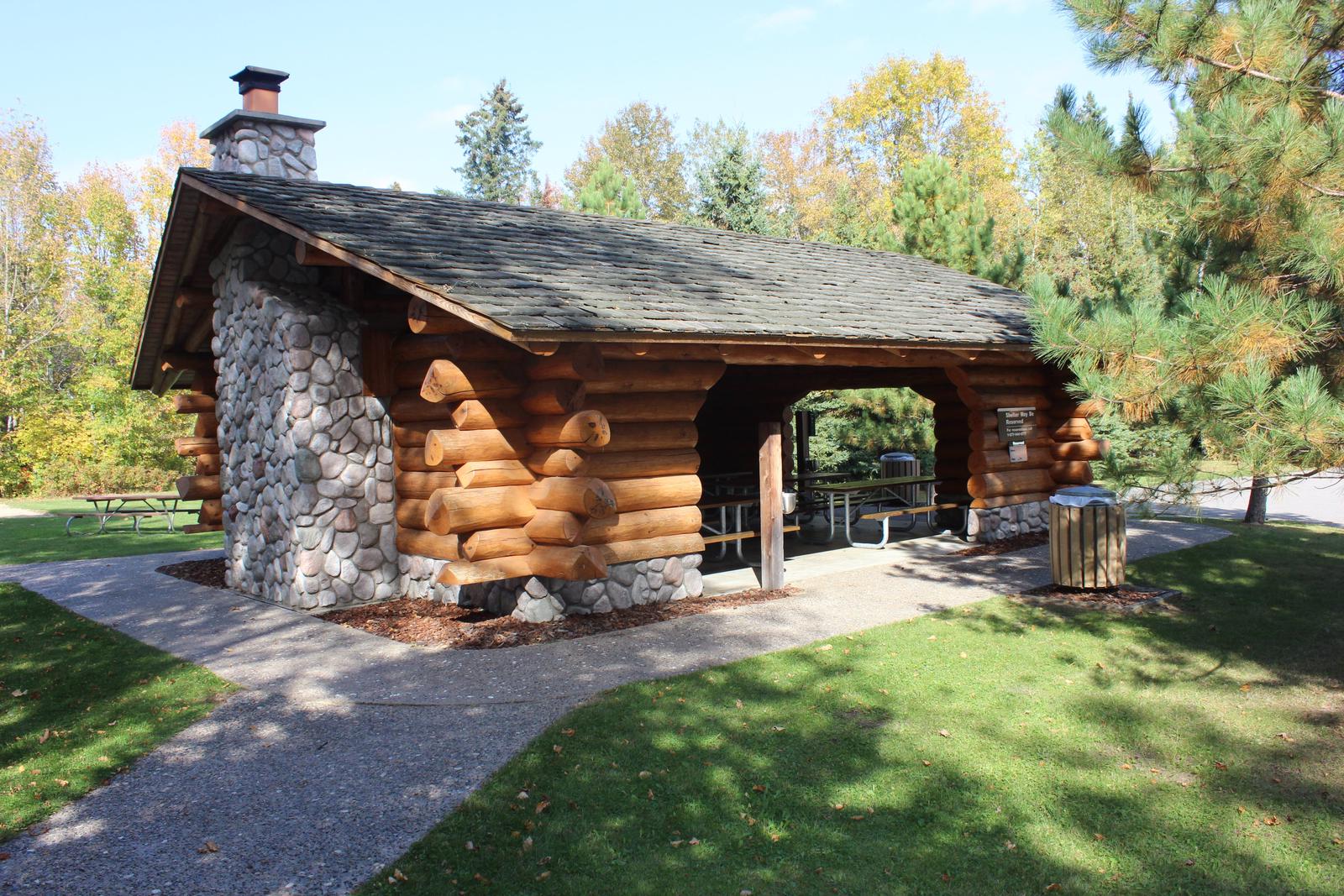
This campground offers 73 wooded sites with electric hookups, including five sites with full hookups. Additionally, there are four primitive walk-to tent sites. A group day-use picnic shelter with electric is available, as well as two mini-picnic shelters. Amenities include flush toilets, showers, drinking water, laundry facilities, a dump station, boat ramps and overnight boat mooring. Campers enjoy the park’s basketball, volleyball, badminton and shuffleboard courts, as well as the horseshoe pits. Younger campers love the playground areas.

Natural Features

Leech Lake has 316 miles of shoreline and encompasses 14 natural lakes. A mixed forest of elm, ash, maple, basswood, birch, aspen and pine covers the area. Wildlife is abundant around the lake, where campers commonly hear the tell-tale call of loons out on the water.

Reservation

More from CampingHiking.net:

RUARK BLUFF EAST, Missouri Campground Images, Info & Reservations

Listen Directions From Greenfield, Missouri, take State Highway H. north for 6.4 miles and turn right onto the park access road. Follow signs into the park area. Phone 417-637-5303 Activities BOATING, CAMPING, FISHING, WILDLIFE VIEWING, SWIMMING SITE Keywords RUAR,STOCKTON LAKE,TWIN BRIDGES,STOCKTON LAKE Related Link(s) Rec Area Info & Images Missouri

BELTON LAKEVIEW PARK, Texas Campground Images, Info & Reservations

Listen Directions From Interstate 35 in Belton, Texas take exit onto Road 317 (North Main Street). Turn left onto Farm-to-Market Road 439 (Lake Road), and travel west about four miles to the park. Phone 254-939-2461 Activities BOATING, CAMPING, FISHING, PICNICKING Keywords BELT,OVERLOOK PAVILION (BELTON LK),BELTON GROUP USE AREA,FRANKS PAVILION,BELTON PARK,BELTON

BELLE STARR, Oklahoma Campground Images, Info & Reservations

Listen Directions From Eufaula, Oklahoma, take Highway 69N to the OK-150 exit toward Texanna Road/State Park/Lake Eufaula.Turn right onto E1140 Rd/Texanna Rd. Travel east for 2 miles, turn right onto Belle Starr Rd/Northsouth 420, travel south for 2 miles and you will arrive at Belle Starr Campground. Phone 918-799-5843 Activities

HORSFALL SAND CAMPING, Oregon Campground Images, Info & Reservations

Listen Directions From North Bend Oregon, travel north on Highway 101 for 1 1/2 miles to Trans Pacific Parkway. Turn west (left) on Trans Pacific Pkwy, proceed 1 mile and turn right onto Horsfall Beach Road. For access via Horsfall Campground drive ½ mile on Horsfall Beach Road, the campground

DEER GROUP CAMP, California Campground Images, Info & Reservations

Listen Directions Travel I-10 east (State Highway 330) to Running Springs. Turn onto State Highway 18 and continue to Big Bear Lake Dam. Continue 3 miles on State Highway 18 and turn right on Tulip Lane. Turn right onto Mill Creek Road (Forest Route 2N10) for 1.6 miles, turn left