OYSTER POINT CAMPGROUND, NC Campground Reservation, Info, Images, Map, Directions

OYSTER POINT CAMPGROUND, North Carolina Campground Images, Info & Reservations

Listen

Directions

From Newport, take SR 1154 to Forest Road 181 and turn right.

Phone

252-638-5628

Activities

BOATING, CAMPING, FISHING, HIKING

Keywords

Related Link(s)

Rec Area Info & Images

North Carolina State Road Conditions

North Carolina State Tourism

Overview

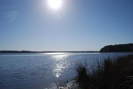
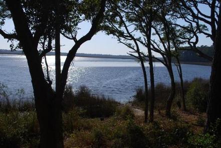
Oyster Point Campground is located on the banks of the Newport River, near the town of Newport, NC. The campground is just a short drive to the beaches of Atlantic Beach, NC and other coastal fishing destinations.

Recreation

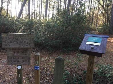
Canoeing and fishing are popular options. Power boating is allowed on the Newport River. The Croatan Saltwater Trail weaves south between the barrier islands of the Bogue Sound and north on Adams Creek connecting to the Neuse River. This campground is also the trailhead for the Neusiok trail which is a 21-mile hiking trail that meanders through cypress swamps, loblolly pines and vast bogs of thick vegetation.
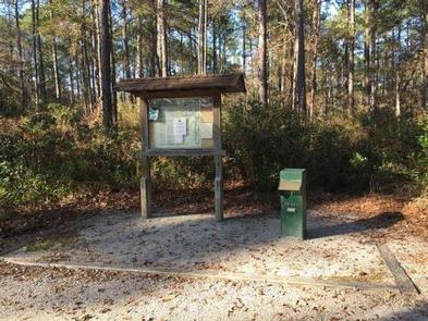
Facilities

The campground features 15 campsites and two vault toilets. Each site has a picnic table, fire grill, parking spur, tent pad and lantern post.

Natural Features

Situated in the coastal pine forest and intercostal waterway of the Croatan National Forest, which encompasses 160,000 acres in eastern North Carolina, the Newport River is 12 miles long and opens into the Bogue sound. It is popular with anglers and flatwater paddlers.

Nearby Attractions

The campground is just a short drive to the towns of Newport, NC and Morehead City, NC. These towns offer full service grocery, retail, and an abundant selection of restaurants.

Reservation

More from CampingHiking.net:

FOURMILE CABIN, Montana Campground Images, Info & Reservations

Listen Directions From Big Timber, travel 25 miles south on Highway 298 to the National Forest Boundary. At this point, the paved road becomes county-maintained gravel road (Main Boulder Road or Forest Road 6639). Continue on this gravel road another 17 miles. The cabin is on the west (right) side

COBB RIDGE, Missouri Campground Images, Info & Reservations

Listen Directions From Chadwick, Missouri, take Highway 125 south about 2 miles, then turn right onto Highway H and continue past Camp Ridge day-use area, turning right onto Lookout Road (the first portion of lookout road is paved – if you get to the gravel you have gone to far)

PINEY POINT, Texas Campground Images, Info & Reservations

Listen Directions From Texarkana, take Highway 59 south to Wright Patman Lake. Just south of Sulphur River Dam, turn right into the park area, following signs. Proceed one mile to the park. Piney Point is just north of Rocky Point Park. Phone 903-796-0684 Activities BOATING, CAMPING, FISHING, HIKING, WATER SPORTS

SAN MIGUEL ISLAND, California Campground Images, Info & Reservations

Listen Directions Boat transportation can be arranged with Island Packers from Ventura Harbor. Air transportation can be arranged with Channel Islands Aviation from Camarillo airport. To park headquarters in Ventura, California: Highway 101, exit Victoria or Seaward to Ventura Harbor. Phone 805-658-5730 Activities BOATING, HISTORIC & CULTURAL SITE, CAMPING, INTERPRETIVE

RIPPLEBROOK, Oregon Campground Images, Info & Reservations

Listen Directions From Estacada, travel east on Highway 224 for 26 miles to the campground, which is just past the Ripplebrook Camp Store. Phone 503-630-5721 Activities CAMPING, FISHING, WATER SPORTS Keywords RIPP,MT. HOOD NF – FS Related Link(s) Rec Area Info & Images Oregon State Tourism Forest Service Concessionaire Oregon