YELLOWSTONE GROUP CAMPGROUND, UT Campground Reservation, Info, Images, Map, Directions

YELLOWSTONE GROUP CAMPGROUND, Utah Campground Images, Info & Reservations

Listen

Directions

From Duchesne, Utah: Take Highway 87 north to Mountain Home, then travel on Uinta and Ouray Indian Reservation Road to Forest Road 131 to Forest Road 119. FR 119 is rough and rocky in places.

Phone

435-722-5018

Activities

BIKING, CAMPING, FISHING, HIKING, WILDLIFE VIEWING

Keywords

YELL,ASHLEY NF – FS

Related Link(s)

Rec Area Info & Images

Utah State Road Conditions

Utah State Tourism

Overview

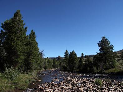
Yellowstone Group Campground lies along its pretty namesake river on the southern slope of the Uinta Mountains, about 40 miles from Duchesne, Utah. Visitors come to the area to enjoy its extensive off-road trail system and great fishing opportunities.

Recreation

The Yellowstone River offers fishing for rainbow, brown, brook and cutthroat trout.

The Yellowstone ATV Trail System is conveniently close, with over 50 miles of trail on the Petty Mountain and Dry Gulch Loops. Hiking and biking are also allowed on these trails.

Facilities

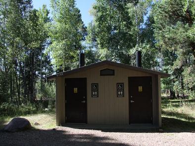
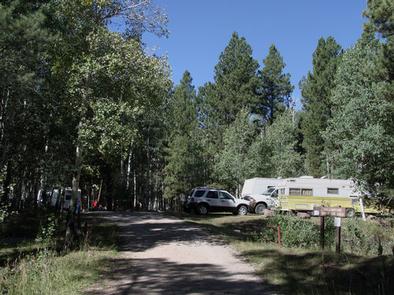
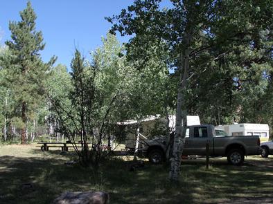
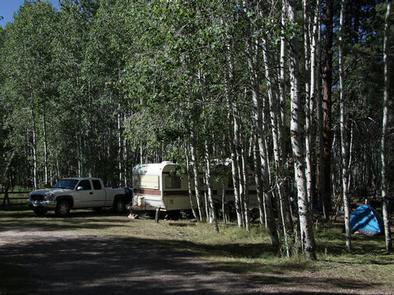
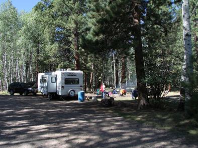
The campground contains one group site with picnic tables and campfire rings. Forty people, four vehicles and four camp trailers/RV units can be accommodated. Vault toilets, drinking water and trash collection are provided. Roads and parking spurs are gravel. Several first come, first served single sites are available as well.

Natural Features

The campground sits on the banks of the Yellowstone River at an elevation of 7700 feet. A forest of aspen, maple and Ponderosa pine covers the area. Wildlife and summer wildflowers are abundant.

Nearby Attractions

Yellowstone Canyon offers beautiful mountain scenery, additional first come, first served campgrounds, a small reservoir and trailheads with access to the High Uintas Wilderness.

Hiking, backpacking and horseback riding are popular in the wilderness area and numerous sparkling lakes provide great backcountry fishing opportunities.

Reservation

More from CampingHiking.net:

Twelvemile Beach Campground, Michigan Campground Images, Info & Reservations

Listen Directions Phone 906-387-3700 Activities CAMPING, HIKING, BEACHCOMBING, BACKPACKING, ACCESSIBLE SWIMMING Keywords Related Link(s) Rec Area Info & Images Overview Twelvemile Beach Campground is a beautiful campground along Lake Superior located within the Pictured Rocks National Lakeshore, just 15 miles west of Grand Marais. There are 36 sites total, including

MANZANITA LAKE, California Campground Images, Info & Reservations

Listen Directions From Redding, California drive 48 miles east on State Highway 44. Turn right into Lassen Volcanic National Park and continue one mile south to Manzanita Lake Campground. Phone 530 595-6121 Activities BOATING, HISTORIC & CULTURAL SITE, CAMPING, INTERPRETIVE PROGRAMS, FISHING, HIKING, PICNICKING, VISITOR CENTER, DAY USE AREA, SWIMMING

BELLE STARR, Oklahoma Campground Images, Info & Reservations

Listen Directions From Eufaula, Oklahoma, take Highway 69N to the OK-150 exit toward Texanna Road/State Park/Lake Eufaula.Turn right onto E1140 Rd/Texanna Rd. Travel east for 2 miles, turn right onto Belle Starr Rd/Northsouth 420, travel south for 2 miles and you will arrive at Belle Starr Campground. Phone 918-799-5843 Activities

GOOSEBERRY RESERVOIR, Utah Campground Images, Info & Reservations

Listen Directions From Fairview, Utah, travel north about a mile on Highway 89, to the junction with Highway 31. Travel east on Highway 31 for about nine miles, to the junction with Forest Development Road 124. Go north on Forest Development Raod 124 for three miles, to the campground. Phone

UPPER TWILIGHT GROUP SITE, Arizona Campground Images, Info & Reservations

Listen Directions From Safford, Arizona: Take State Route 191 south for 6 miles. Turn right onto State Route 366/Swift Trail and travel 14.5 miles to the Twilight Campground entrance (MM 128.4), following the road for 1 mile to the Upper Twilight Group Site.  From Tucson, Arizona: Take I-10 East for