ALBERT MOSER, ID Campground Reservation, Info, Images, Map, Directions

ALBERT MOSER, Idaho Campground Images, Info & Reservations

Listen

Directions

From Preston, Idaho, head approximately 3 miles south on U.S. Highway 91. Turn east on Cub River Road (Forest Road 406). Proceed to the Cache National Forest Boundary. Campground is found just inside the boundary on Forest Road 406. The facility is approximately mile 7 on Cub River Road.

Phone

541-351-1182

Activities

CAMPING, FISHING, HIKING, HORSEBACK RIDING, HUNTING, WILDLIFE VIEWING

Keywords

ALBT,COMMUNITY CAMPGROUND,CARIBOU-TARGHEE NF – FS

Related Link(s)

Rec Area Info & Images

Idaho State Road Conditions

Idaho State Tourism

Overview

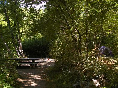
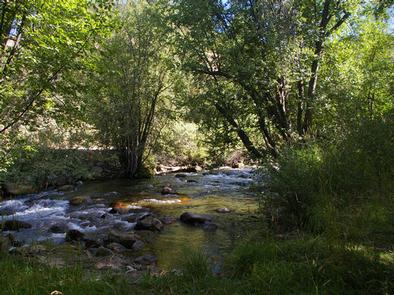
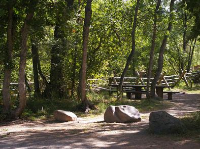
Albert Moser Campground is situated on the banks of the Cub River about nine miles from Preston, Idaho. Built by the Civilian Conservation Corps in the late 1930s, the campground is just off Cub River Road, at an elevation of 6,000 feet. Visitors enjoy trout fishing in the river and exploring local trails.

Recreation

The Cub River provides excellent trout fishing. Anglers enjoy fly-fishing for wild cutthroat and hatchery rainbows.

Numerous hiking, biking, horse and off-road vehicle trails crisscross the Cub River area, offering great opportunities to get out and see the beautiful surroundings.

Facilities

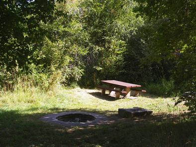
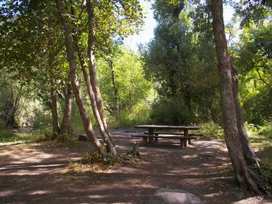
The campground contains six single-family and three double-family sites, all with picnic tables and campfire rings. Some sites also have grills. Vault toilets and drinking water are provided. Roads and parking spurs throughout the campground are dirt. A host is located five miles up Cub River Road at Willow Flat Campground.

Natural Features

The banks of the gentle Cub River are lined with dense stands of cottonwood trees, which offer pleasant shade in the summer and bright autumn color.

Reservation

More from CampingHiking.net:

DRAKE PEAK LOOKOUT, Oregon Campground Images, Info & Reservations

Listen Directions From the Lakeview Ranger District Office, travel 6 miles north on Highway 395, and turn right on Highway 140. Take Highway 140 east for 8 miles, then turn left on Forest Road 3615. Continue on Forest Road 3615 for 7.5 miles and turn right on Forest Road 019.

COCHITI AREA, New Mexico Campground Images, Info & Reservations

Listen Directions From Albuquerque, New Mexico, take Interstate 25 north to exit 259. Turn west on State Route 22 and proceed through Pena Blanca to the park office and recreation area. Phone 505-465-2557 Activities BIKING, CAMPING, FISHING, HIKING, WILDLIFE VIEWING, DAY USE AREA, SWIMMING SITE, PADDLING Keywords COCA,COCHITI LAKE Related

OLD FOLKS FLAT, Utah Campground Images, Info & Reservations

Listen Directions The campground is located 21 miles from Huntington, Utah, along Highway 31. Phone 435-384-2372 Activities BIKING, CAMPING, HIKING, WILDLIFE VIEWING Keywords OLFF,MANTI-LASAL NF -FS Related Link(s) Rec Area Info & Images Utah State Road Conditions Utah State Tourism Overview Old Folks Flat Campground is nestled in beautiful Huntington

HENDERSON PARK, Arkansas Campground Images, Info & Reservations

Listen Directions From Mountain Home, Arkansas, travel east on US Highway 62/412 10 miles to the town of Henderson. Look for park signs for the park entrance on the left. Phone 870-425-2700 Activities BOATING, CAMPING, FISHING, HUNTING, WATER SPORTS, DAY USE AREA, HOTEL/LODGE/RESORT PRIVATELY OWNED Keywords Related Link(s) Rec Area