

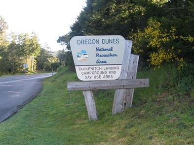

Directions
From Reedsport, travel north 7.5 miles on Highway 101. Campground is on east (right) side of Highway 101.
Phone
541-271-6000
Activities
BOATING, CAMPING, FISHING, HIKING, WILDLIFE VIEWING
Keywords
TAHL,REEDSPORT,OREGON DUNES,GARDINER,SIUSLAW NF – FS
Related Link(s)
Overview
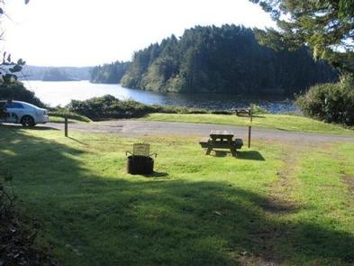
On the shores of Tahkenitch Lake sits Tahkenitch Landing Campground, 9 miles north of Reedsport, Oregon. The lake welcomes boating, swimming and fishing for bass and trout. Hiking trails are nearby, providing rewarding walkst hrough the dunes, and to the Pacific Ocean.
Recreation
Bird watching and fishing are among the activities along the lake. Fishing may reap cutthroat and steelhead trout, largemouth bass and yellow perch.
For a change of scenery, campers can cross the road to the start of the Tahkenitch Dunes Trail, which weaves through a conifer forest and across an open section of dunes to a beach along the Pacific.
Facilities
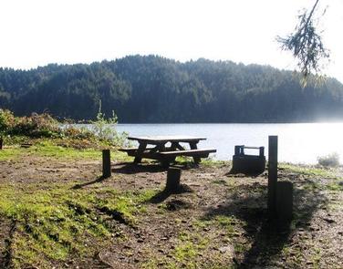
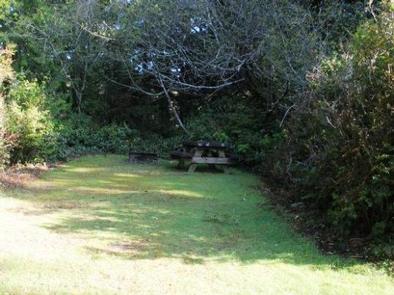
A boat ramp is provided and each campsite comes with a picnic table and a fire ring with grill. Vault toilets are onsite and families enjoy picnicking in the day-use picnic area. Sites 2 – 8 have no turnarounds and are limited to tent camping or small campers. No water is available, so campers should bring a sufficient amount for drinking and washing.
Natural Features
Tahkenitch Lake spans 1,674 acres. Sites that fit tents or small campers sit on the rim of the lake, while larger sites that accommodate RVs are up the hill overlooking the lake. The grassy campground is hugged by coastal trees and shrubbery, including mixed pine and cedar.
Wildlife watching is a popular pastime for campers. Portions of the nearby estuary are protected nesting areas for the snowy plover, a small shorebird with a tan tail and snowy white underside.
Nearby Attractions
Nearby off-road vehicle trails provide hours of fun for off-road enthusiasts.