BUCKHORN CAMPGROUND (OK) CHICKASAW NRA, OK Campground Reservation, Info, Images, Map, Directions

BUCKHORN CAMPGROUND (OK) CHICKASAW NRA, Oklahoma Campground Images, Info & Reservations

Listen

Directions

From I35, take Exit #55 and drive towards the city of Davis, OK. Once in Davis, go east on Highway 7 to the Chickasaw National Recreation Area you desire. Watch for the Chickasaw National Recreation Area signs to direct you to your selected area: Buckhorn Campgrounds, Pavilion, and Picnic Area – Drive approximately 8 miles east of Davis to the only 4 way STOP (Jct Hwy 7 and Hwy 177) in the city of Sulphur. Turn south (right) for approximately 5 miles on Hwy 177. Turn west (right) at Buckhorn Road and drive approximately 3 miles west. Follow the directional signs. This loop is the southeast corner of Arbuckle Lake.

Phone

580-622-7234

Activities

BIKING, BOATING, CAMPING, INTERPRETIVE PROGRAMS, FISHING, HIKING, HUNTING, VISITOR CENTER, WATER SPORTS, DAY USE AREA, SWIMMING SITE

Keywords

BKCG,CHICKASAW NATIONAL REC. AREA,PLATT NATIONAL PARK,ARBUCKLE LAKE,LAKE ARBUCKLE,LAKE OF THE ARBUCKLES,CHICKASAW

Related Link(s)

Rec Area Info & Images

Oklahoma State Tourism

Oklahoma State Road Conditions

Overview

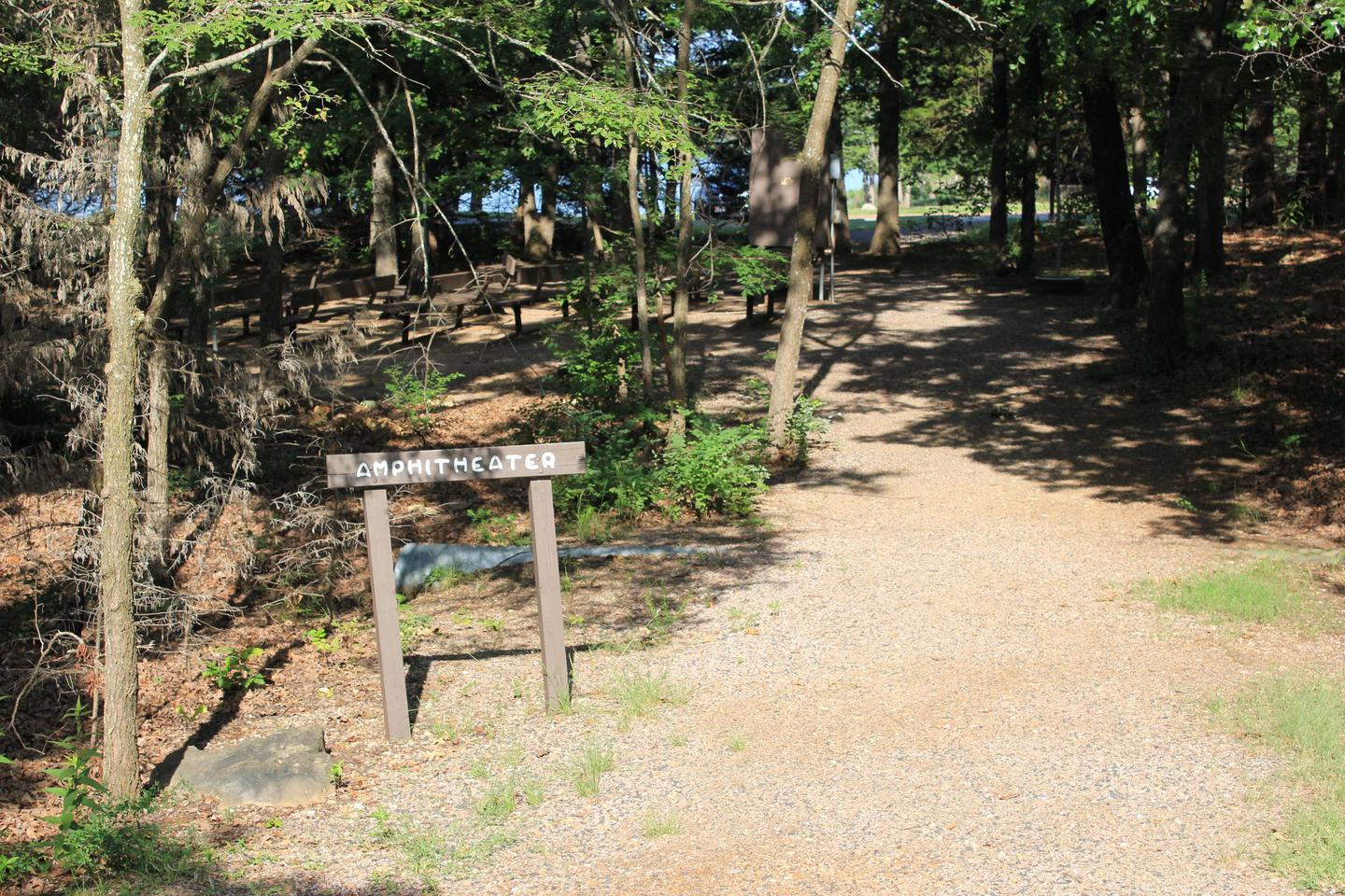
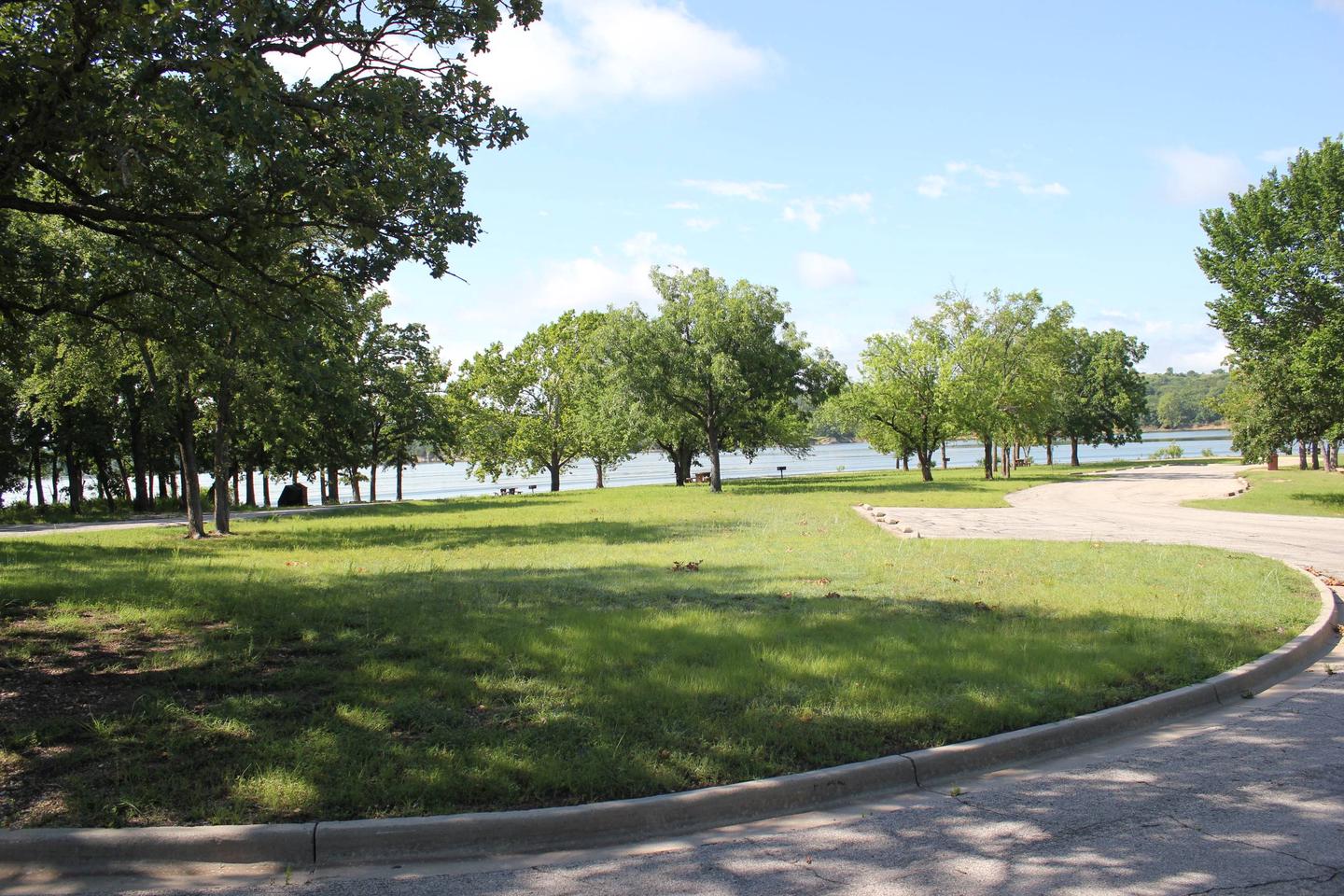
Buckhorn area campgrounds are within close proximity to the Lake of the Arbuckles. Comfortable campsites and a lighthearted atmosphere makes this site an excellent place to camp.

The Lake of the Arbuckles was built in 1966 by the Bureau of Land Reclamation, and has been voted the best bass fishing in Oklahoma.

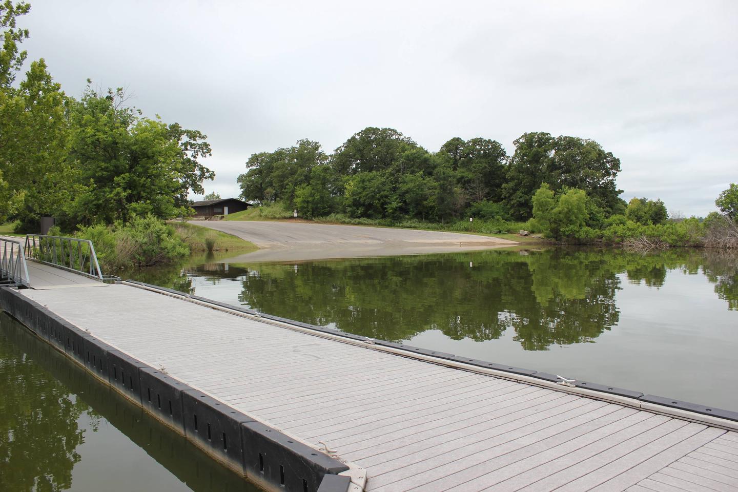
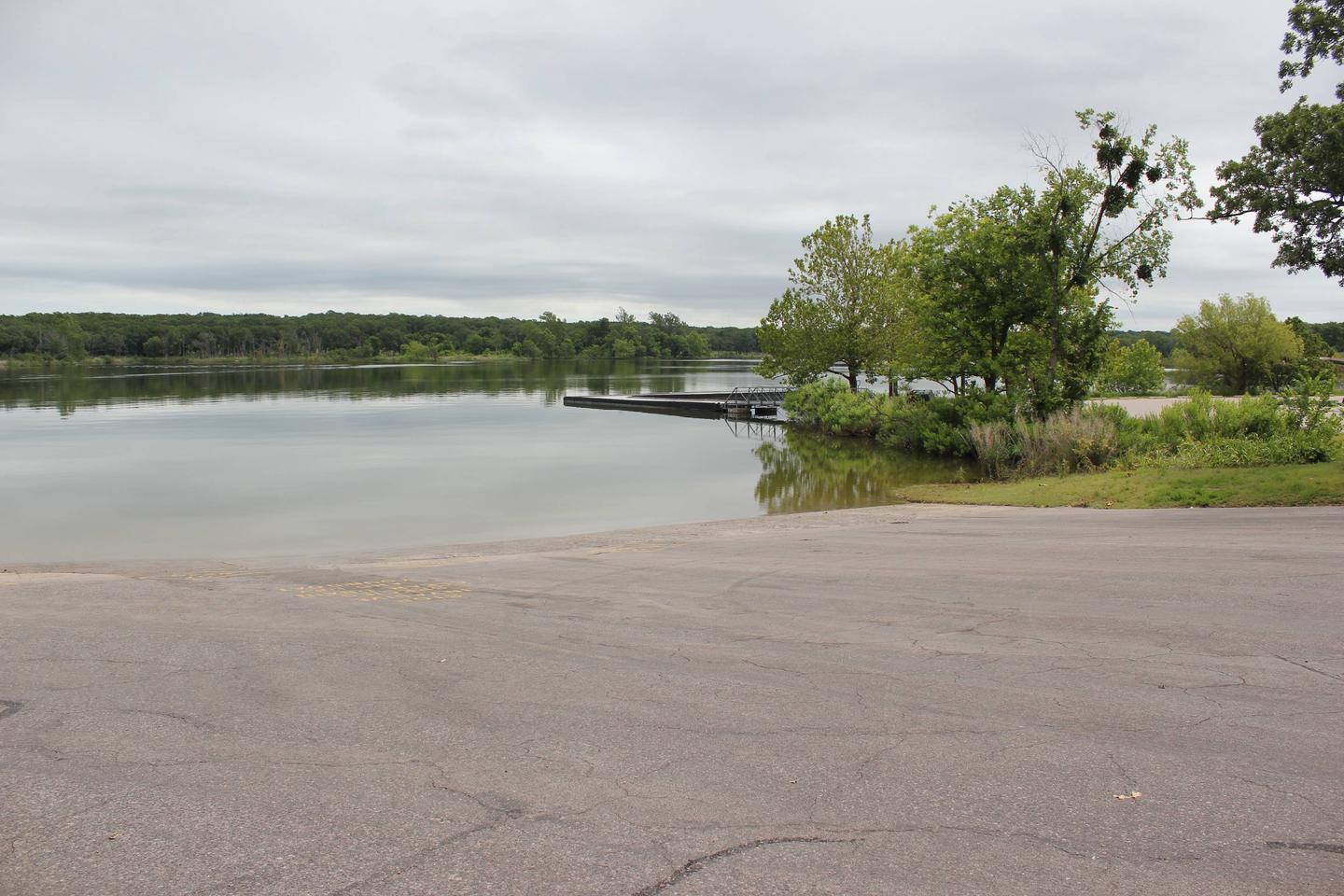
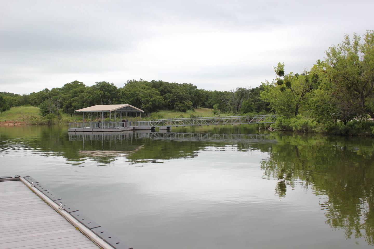
Boat ramps and docks are available throughout the 36 miles of shoreline. Look for wildlife like the red fox, bobcat, and opossum, and watch the trees for glimpses of flying squirrels.

Recreation

Bring your boat or jet skis and cruise the lake, or pack your fishing rods to catch some of the state’s finest bass, perch and crappies.

The area is most popular for water sports, but hiking and biking is a great way to explore the land and take in views of the lake.

Facilities

Buckhorn is one of only two campsites in Chickasaw with electric hookups and water. It’s an ideal location for families and friends ready for a mix of camping and boating. The C Loop of the campsite is open year-round.

Natural Features

Set in the naturally diverse Chickasaw National Recreation Area, Buckhorn Campground is surrounded by unique flora, fauna and geological formations.

The hilly land is covered with partial prairie and partial forest, with natural springs cutting through spectacular rock formations.

Nearby Attractions

Hike or bike on the unpaved Rock Creek Multi-Use Trail or head up Rock Creek for a visit to the Chickasaw Cultural Center. There, you can learn all about the Native Americans of the region through exhibits, videos and interactive displays.

Reservation

More from CampingHiking.net:

KENDALL CAMPGROUND, Kentucky Campground Images, Info & Reservations

Listen Directions From Jamestown, Kentucky, take US Highway 127 south for 10 miles and turn right just before crossing the dam. Campground is on Kendall Road. Phone 270-343-4660 Activities BOATING, CAMPING, FISHING, HIKING Keywords KEND,LAKE CUMBERLAND,DAMSITE,TAILWATER,WOLF CREEK DAM Related Link(s) Rec Area Info & Images Kentucky State Road Conditions Kentucky

KENDRICK CABIN, Arizona Campground Images, Info & Reservations

Listen Directions From Interstate 17 or Interstate 40 in Flagstaff, follow signs to Highway 180 toward the Grand Canyon. From Flagstaff, drive approximately 20 miles north on Fort Valley Road/Highway 180 and look for the Watchable Wildlife Trail on the left and a roadside chapel on the right. Continue less

LIVE OAK, California Campground Images, Info & Reservations

Listen Directions From Bakersfield, take Highway 178 east to the town of Lake Isabella. From Lake Isabella take Highway 155 north approximately 6 miles to the Live Oak campground. Phone 760-376-1815 Activities CAMPING Keywords LIVO,LAKE ISABELLA,KERN VALLEY,SEQUOIA NF – FS Related Link(s) Rec Area Info & Images California State Road

Lodgepole Campground (MT), Montana Campground Images, Info & Reservations

Listen Directions From Philipsburg travel 10.75 miles south on State Highway 1. The campground is directly across the highway from Georgetown Lake and Red Bridge Boat Launch. Phone 406-210-8199 Activities BIKING, BOATING, CAMPING, FISHING, HIKING, HUNTING, WATER SPORTS, WILDLIFE VIEWING, SWIMMING SITE Keywords LODB,BEAVERHEAD-DEERLODGE NF -FS Related Link(s) Rec Area

BOCA CAMPGROUND, California Campground Images, Info & Reservations

Listen Directions 2019 Season Access Due to Boca Dam Closure – From Truckee, start up Highway 89 north and turn right onto Prosser Dam Road at the last roundabout. Go through neighborhood, keep right at Y and go over Prosser Dam. At next 4-way intersection, turn right onto Rd 73.

MCCART LOOKOUT, Montana Campground Images, Info & Reservations

Listen Directions From Missoula, Montana, travel south on Highway 93 for approximately 90 miles to Sula. Go east on Highway 472 for about 15 miles and then south on Forest Road 5765/McCart Road for about 6 miles to the Johnson Peak Trailhead. Hike about 1.5 miles to the lookout tower.