SUNGLOW CAMPGROUND, UT Campground Reservation, Info, Images, Map, Directions

SUNGLOW CAMPGROUND, Utah Campground Images, Info & Reservations

Directions

Travel a half-mile south of Bicknell, Utah, on Highway 24, then turn east on Forest Road 143 and travel 1.5 miles to the campground.

Phone

435-836-2811

Activities

CAMPING, HIKING

Keywords

SUNG,FISHLAKE NF – FS

Related Link(s)

Rec Area Info & Images

Utah State Road Conditions

Utah State Tourism

Overview

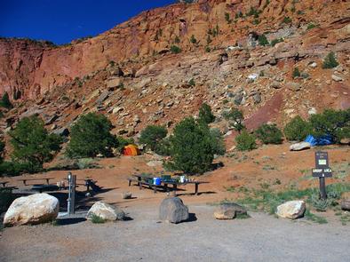
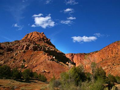
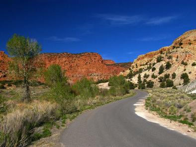
Sunglow Campground is located in a scenic red rock box canyon just 2 miles from Bicknell, Utah. Visitors enjoy exploring local trails and day-tripping to Capitol Reef National Park.

Recreation

Many miles of trails for hiking, biking and off-road vehicles are in the area. The Great Western Trail passes nearby.

Facilities

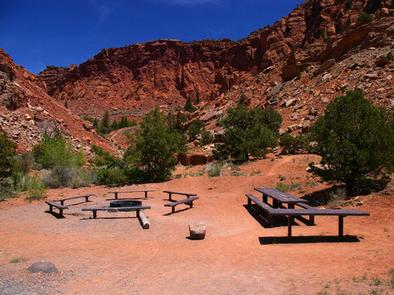
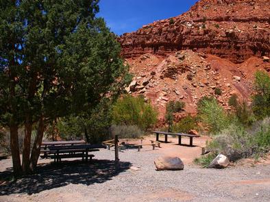
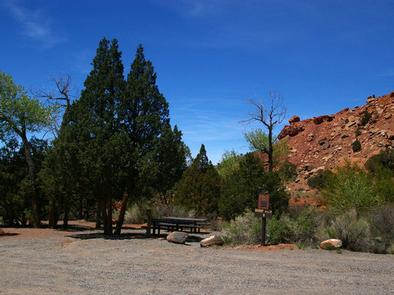
The campground contains two group sites that can accommodate up to 20 people each. Flush toilets and drinking water are provided. A large parking area can accommodate trailers. The road to the campground is paved, but the road and parking spurs within are gravel.

Natural Features

The canyon sits at an elevation of 7,200 feet. Cottonwoods and junipers provide very limited shade. Sagebrush and summer wildflowers dot the landscape.

Nearby Attractions

The Ke Bullock Waterfowl Management Area is nearby, just south of Bicknell, with wildlife viewing and fishing opportunities.

Capitol Reef National Park is approximately 20 miles away, offering excellent hiking trails, historic sites, scenic driving and breathtaking scenery.

Sightseeing along Utah Highway 12, a National Scenic Byway, is very popular. Travelers visit from every corner of the world to gaze upon stunning red rock canyons and desert landscapes.

Reservation

More from CampingHiking.net:

LOWER PENSTEMON, Idaho Campground Images, Info & Reservations

Directions Travel south on Twin Falls County Road G3 which becomes Forest Road 515, commonly known as Rock Creek Road, for approximately 27 miles from Hansen. Phone 208-678-0430 Activities BIKING, CAMPING, HIKING, HORSEBACK RIDING, HUNTING, WILDLIFE VIEWING Keywords LOWP,SAWTOOTH NF – FS Related Link(s) Rec Area Info & Images Idaho

KELLY DAHL, Colorado Campground Images, Info & Reservations

Directions From Denver, go north on Interstate 25 to US Highway 36 west to Boulder. Take Colorado Highway 119 (Canyon Boulevard) west for 22 miles to Nederland. Continue south for 4 miles to the campground. Phone 303-541-2500 Activities CAMPING, HIKING, HORSEBACK RIDING Keywords KELD,KELLY DAHL,ARAPAHO AND ROOSEVELT NF – FS

JACKASS MEADOW, California Campground Images, Info & Reservations

Directions From Clovis, California: Take Hwy 168 north for 70 miles to Huntington Lake Campground office at Eastwood. Turn right and follow Kaiser Pass Road approximately 21 miles to Jackass Meadow campground. Phone 559-893-2111 Activities BOATING, HISTORIC & CULTURAL SITE, CAMPING, FISHING, HIKING, HORSEBACK RIDING, DAY USE AREA Keywords JAAS,FLORENCE

NORTH RIM CAMPGROUND, Arizona Campground Images, Info & Reservations

Directions North Rim Campground is 210 driving miles (4.5 hours) north of Mather Campground on the South Rim. This facility is located at the end of State Highway 67, about 41 miles south of Jacob Lake, Arizona, 87 miles south of Kanab, Utah and 120 miles southwest of Page, Arizona.