


Directions
Late spring, summer, and fall access by regular vehicle (May to November): From Bozeman, MT: Drive north on 19th Ave. to West Oak St. Turn right onto West Oak and drive east to N. Rouse Ave. Turn left onto US Highway 86 and drive for 20 miles. Remain on Highway 86 towards Battle Ridge Pass by staying left at the Brackett Creek Y. The cabin access road is about 0.9 miles more and is on the left (east) side of the highway 1/4 mile before the Battle Ridge Trailhead and Battle Ridge Pass. Open the gate using the cabin combination and drive another 1/2 mile to the cabin. Winter Route, December to April (depending on snow conditions): Winter parking is only available at the Battle Ridge Trailhead. Parking along Highway 86 is prohibited so that highway snow plows can work. Please park at the Battle Ridge Trailhead. Please leave room for trucks with trailers in the parking area. You may ski, snowshoe (or walk), and snowmobile from the Battle Ridge Trailhead on a marked ski and snowmobile trail which begins on the south end of parking area. Look for the trail marker near the entrance to the parking lot. It is about a half mile to the cabin from the trailhead. Follow the orange and blue diamond trail markers.
Phone
406-522-2520
Activities
HIKING, HUNTING, OFF HIGHWAY VEHICLE, WINTER SPORTS, WILDLIFE VIEWING, FIRE LOOKOUTS/CABINS OVERNIGHT, MOUNTAIN BIKING, CROSS COUNTRY SKIING, SNOWSHOEING, SLEDDING, DOWNHILL SKIING, SNOWMOBILE TRAILS
Keywords
BATR,BATTLE RIDGE,BRACKETT CREEK,BATTLE,RIDGE,GALLATIN NF – FS
Related Link(s)
Overview
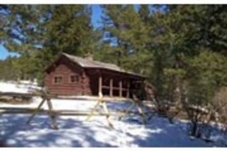
Battle Ridge Cabin is a rustic dwelling located north of Bozeman, in southwestern Montana. The cabin was built in 1938 and is open year-round. It can be reached by vehicle in the summer, but guests visiting during winter must hike or ski a quarter-mile from the highway to reach the cabin. Guests are responsible for their own travel arrangements and safety, and must bring several of their own amenities.
Recreation
This is a popular destination in winter for cross-country skiers and snowshoers. Hikers can find nearby trails. Hunting is a popular activity in the area. This is also an ideal spot for birding and watching other wildlife species.
Facilities
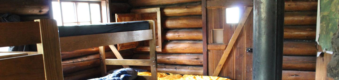
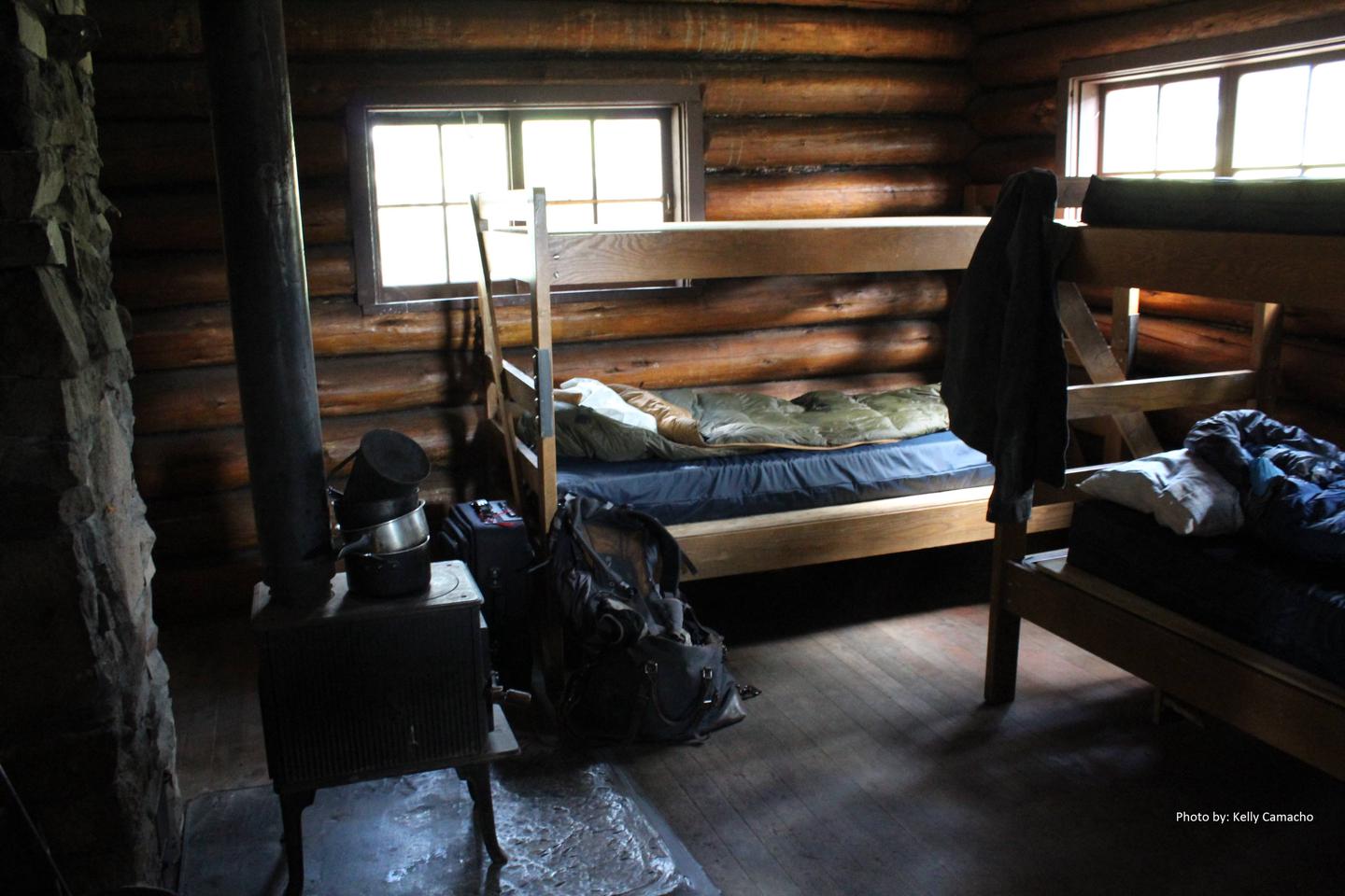
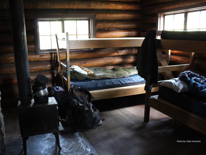
Battle Ridge Cabin is wheelchair accessible and has a capacity of up to four to five people. Two sets of bunk beds with mattresses and one cot are provided. A wood cook stove, propane lantern, table and chairs are also provided. A vault toilet is located in an outhouse nearby. A campfire ring is just outside the cabin. No electricity or running water is provided. A spring is located about 500 yards away, but the water should be treated or boiled prior to consumption. Guests need to bring garbage bags to pack out their trash, and they are expected to clean the cabin before leaving. Items such as bedding, dishes, dish soap, dish towels, lanterns or flashlights, extra toilet paper, extra propane and first aid supplies are not available.
Natural Features
The cabin sits in a meadow surrounded by the evergreen-forested slopes of the Bridger Mountains, including the 9,004-foot Ross Peak, one of the better-known mountains in the range. The Custer Gallatin National Forest provides habitat for species such as grizzly and black bear, gray wolf, mountain lion, deer, elk, moose, bighorn sheep and the Canada lynx. Birders may see a wide variety of bird species.
Nearby Attractions
Bozeman is approximately 20 miles away, offering various dining, shopping or opportunities to get necessary supplies.