TREE OF HEAVEN CAMPGROUND, CA Campground Reservation, Info, Images, Map, Directions

TREE OF HEAVEN CAMPGROUND, California Campground Images, Info & Reservations

Directions

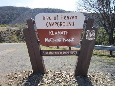
Take I-5 to exit 786 for Highway 96 (Klamath River Highway). Follow Highway 96 for 4 miles until you see the sign for Tree of Heaven Campground. Turn left into the campground on road 46N90.

Phone

530-493-2243

Activities

CAMPING, FISHING, HIKING, WILDLIFE VIEWING, DAY USE AREA, SWIMMING, WHITEWATER RAFTING

Keywords

TREE,KLAMATH NF – FS

Related Link(s)

Rec Area Info & Images

California State Tourism

California State Road Conditions

Overview

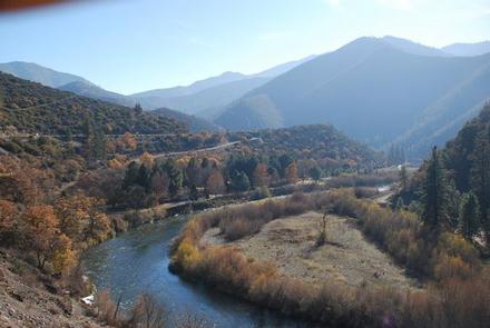
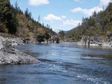
Tree of Heaven Campground is situated next to the Klamath Wild and Scenic River, making it popular with whitewater boaters and anglers. Visitors also enjoy birding and hiking along an interpretive trail.

Recreation

Fishing, birding, and whitewater boating on the class II-III Klamath River are popular options. The campground contains a quarter-mile interpretive trail and a large group day use area with a volleyball net and horseshoe pit.
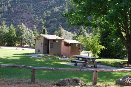
Facilities

The campground has 21 sites. Vault toilets and drinking water are provided. A paved boat ramp provides access to the Klamath River.

Natural Features

The campground sits at an elevation of 2,100 feet on the Wild and Scenic Klamath River, a short distance from the State of Jefferson Scenic Byway.

The Klamath National Forest encompasses a vast array of mountains, streams and lakes straddling the California and Oregon border. The nearly 2-million acre forest includes five wilderness areas, one scenic byway, 200 miles of wild and scenic river and 1,100 miles of hiking and equestrian trials. Elevations range from 450 to 8,900 feet, making for varied topography and diverse plant and animal life.

Reservation

More from CampingHiking.net:

WHITETAIL CAMPGROUND, Arizona Campground Images, Info & Reservations

Directions From Tucson, Arizona, go north on Catalina Highway approximately 30 miles from Tucson until you reach Milepost 20. Turn Left on Whitetail Road. Phone 520-576-9198 Activities CAMPING, HIKING Keywords WHTE,WHITE TAIL,WHITE TRAIL,WHITETAIL,WHITE TALE,CORONADO NF – FS Related Link(s) Rec Area Info & Images Forest Service Concessionaire Arizona State Road

LONGHORN, Texas Campground Images, Info & Reservations

Directions From Interstate 20 or 820, take exit 432A for Bryant Irvin Road, and go 3 miles (1.8 km) south to the intersection with Dirks Road / Altabesa Boulevard. Turn right or west and go 1 mile (1.2 km) to the park and Lake Office which will be on the

BLACKHAWK PARK, Wisconsin Campground Images, Info & Reservations

Directions From DeSoto, WI, travel 3 miles north on HWY 35 and turn left on County Road BI. From LaCrosse, WI, travel 25 miles south on HWY 35 and turn right on County Road BI. Phone 608-648-3314 Activities BOATING, CAMPING, INTERPRETIVE PROGRAMS, FISHING, DAY USE AREA, SWIMMING, KAYAKING, CANOEING Keywords

WAITSBORO CAMPGROUND, Kentucky Campground Images, Info & Reservations

Directions From Somerset Kentucky, take Highway 27 south for 5 miles. Turn right on Waitsboro Road and follow signs to the campground. Phone 606-561-5513 Activities BOATING, CAMPING, FISHING, DAY USE AREA Keywords WAIT,LAKE CUMBERLAND,WOLF CREEK DAM Related Link(s) Rec Area Info & Images Kentucky State Road Conditions Kentucky State Tourism