STOVE PRAIRIE, CO Campground Reservation, Info, Images, Map, Directions

STOVE PRAIRIE, Colorado Campground Images, Info & Reservations

Listen

Directions

From Fort Collins, take Highway 14 northwest for 26 miles, to the campground.

Phone

970-295-6700

Activities

BIKING, BOATING, CAMPING, FISHING, HIKING, WATER SPORTS, WILDLIFE VIEWING, MOUNTAIN BIKING, KAYAKING, CANOEING, BIRDING, RAFTING, WHITEWATER RAFTING

Keywords

STOV,STOVE PRAIRIE,STOVE,ARAPAHO AND ROOSEVELT NF – FS

Related Link(s)

Rec Area Info & Images

Colorado State Road Conditions

Colorado State Tourism

Forest Service Concessionaire

Overview

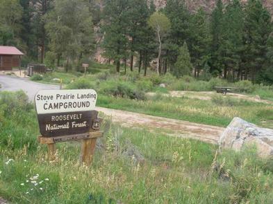
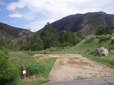
Stove Prairie Campground is located on the Cache la Poudre River, 26 miles northwest of Fort Collins, in north central Colorado. Visitors enjoy the area for its great rafting, fishing and hiking opportunities.

Recreation

The Cache la Poudre River offers whitewater rafting and fishing. Anglers cast for brown, cutthroat and rainbow trout.

Hiking, biking and horseback riding trails are in the surrounding area, including the Mt. McConnel Trail, William R. Kreutzer National Recreation Trail and Young Gulch Trail.

Other popular activities include birding and wildlife viewing.

Facilities

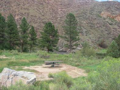
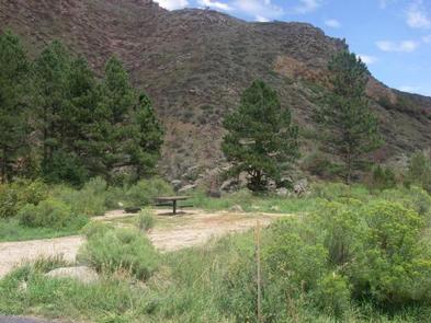
The campground offers eight accessible, single-family campsites. Four sites are walk-to tent sites. Each site is equipped with a 12-by-15 tent pad, table and campfire ring with grill.

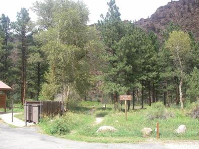
Accessible vault toilets are provided. Dead and downed firewood may be gathered in the surrounding forest, or purchased from the campground host.

Natural Features

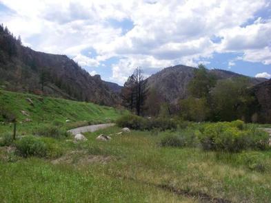
The canyon’s vegetation varies from dense forests to open meadows, surrounded by steep mountains. The campground is situated among ponderosa pine and aspen trees on the banks of the Cache la Poudre River, Colorado’s first National Wild and Scenic River.

Reservation

More from CampingHiking.net:

MT. TIMPANOGOS, Utah Campground Images, Info & Reservations

Listen Directions From I-15, take exit 272 for 800 north toward Orem and proceed east on Highway 52 to the mouth of Provo Canyon. Go east on Highway 189 for 7 miles to the Sundance Resort turnoff. Take Highway 92 for 6 miles. Campground will be on your right, past

LAVA LAKE CAMPGROUND, Oregon Campground Images, Info & Reservations

Listen Directions From Bend, travel 38.4 miles southwest on Cascade Lakes Hwy (46), then 1.0 miles east on Forest Road 4600 500. Phone 541-323-1746 Activities CAMPING Keywords Related Link(s) Rec Area Info & Images Oregon State Tourism Oregon State Road Conditions Overview Lava Lake Campground is located along the Cascade

Silver Springs Campground, Washington Campground Images, Info & Reservations

Listen Directions From Enumclaw, Washington, drive approximately 33 miles southeast on State Highway 410 toward Mount Rainier National Park. Phone 360-804-1103 Activities BOATING, CAMPING, FISHING, HIKING Keywords SILS,MT. BAKER-SNOQU NF – FS Related Link(s) Rec Area Info & Images Washington State Tourism Washington State Road Conditions Forest Service Concessionaire Overview

WARNER LAKE, Utah Campground Images, Info & Reservations

Listen Directions From Moab, the fastest access (about 1 hour) to Warner Lake Campground is by driving south on Highway 191. Drive 6 miles south of Moab and turn east (left) onto Old Airport Road (sign has arrow to La Sal Loop Road, National Forest Access). Turn south (right) at

GENTRY CREEK, Oklahoma Campground Images, Info & Reservations

Listen Directions From Checotah, Oklahoma, travel 9 miles west on Highway 266. Follow the signs to the campground entrance. Phone 918-799-5843 Activities BOATING, CAMPING, FISHING, HIKING Keywords GENT,EUFAULA LAKE,EUFAULA LAKE Related Link(s) Rec Area Info & Images Oklahoma State Tourism Oklahoma State Road Conditions Overview Gentry Creek Campground sits along

DIAMOND LAKE, Oregon Campground Images, Info & Reservations

Listen Directions From Roseburg, OR, turn onto OR-138 east / NE Diamond Lake Boulevard, drive 80 miles east on Highway 138. Turn right onto Forest Road 4795/ Diamond Lake Loop at the north entrance to Diamond Lake Recreation Area. Proceed 2.5 miles to the campground entrance on the right. From