CAVE POINT GROUP USE AREA, MT Campground Reservation, Info, Images, Map, Directions

CAVE POINT GROUP USE AREA, Montana Campground Images, Info & Reservations

Listen

Directions

If heading north along MT highway 12/287 from Townsend, MT, turn right onto Spokane Creek Rd. Follow Spokane Creek Rd for 4.6 miles and turn right onto Co Rd 430/Canyon Ferry Rd and continue 16 miles to Kim’s Marina. Turn right into Kim’s Marina and continue straight to Cave Point. If heading east along Co Rd 430/Canyon Ferry Rd from Helena, MT, continue for 16 miles to Kim’s Marina. Turn right into Kim’s Marina and continue straight to Cave Point.

Phone

406-475-3921

Activities

BOATING, CAMPING, FISHING, HUNTING, WINTER SPORTS, WATER SPORTS, WILDLIFE VIEWING, SWIMMING SITE

Keywords

CAVE POINT GROUP USE AREA,Canyon Ferry Reservoir

Related Link(s)

Rec Area Info & Images

Montana State Road Conditions

Montana State Tourism

Overview

Cave Point Group Use Shelter is located at the very north end of Canyon Ferry Reservoir, 30 miles east of Helena, Montana, along Highway 284. Cave Point offers year-round access to a wide range of recreational opportunities. The Canyon Ferry area has a rich mining history. Cave Point is named for one of the first settlements in the area, Cavetown. Visitors to the shelter can envision the original horse drawn ferry crossing that transported miners across the mighty Missouri River to work the mining camps.

Recreation

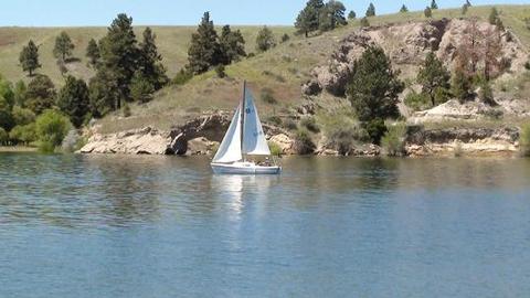
Canyon Ferry Reservoir offers a wide range of year-round recreational opportunities. Water related activities include everything from swimming and fishing to sailing and motor-boating. Canoeists and kayakers explore the many quiet backwater bays. Jet skiers, windsurfers and water skiers skim the summer waves, while winter draws ice fishermen, ice boaters and skaters.

Facilities

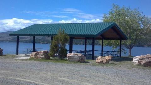
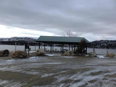
Cave Point Group Use Shelter is a small 30′ X 36′ shelter with six picnic tables and an accessible vault toilet and can accommodate up to 50 people. Access is shared with a road through Kim’s Marina.

Natural Features

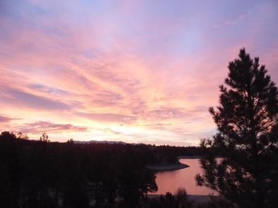
Cave Point Group Use Shelter sits at the north end of Canyon Ferry Reservoir between the Big Belt and Elkhorn Mountain ranges.

Reservation

More from CampingHiking.net:

LONESOMEHURST CAMPGROUND, Montana Campground Images, Info & Reservations

Listen Directions From West Yellowstone, travel west on Highway 20 for eight miles, then continue four miles north on Hebgen Lake Road (Denny Creek Road). Phone 406-646-1012 Activities BIKING, BOATING, CAMPING, FISHING, HIKING, WILDLIFE VIEWING, PHOTOGRAPHY, SWIMMING, KAYAKING, CANOEING, BERRY PICKING, STAR GAZING, BIRDING, WATER ACCESS, BACKPACKING Keywords None Related

Axolotl Cabin, Montana Campground Images, Info & Reservations

Listen Directions From Ennis – Most Direct Route – 4 WD/High Clearance Vehicle Strongly Recommended -Take State Highway 287 towards Virginia City – About 1/4 mile east of mile marker 11 (or 3/4 mile west of mile marker 10) turn South into the paved parking area near the top of

LITTLE FAWN GROUP CAMP, Oregon Campground Images, Info & Reservations

Listen Directions From Bend, travel southwest on Cascade Lakes Scenic Byway for 35.5 miles. Turn onto Forest Road 4625 and travel 1.7 miles east to the campground entrance. Phone 541-323-1746 Activities BIKING, BOATING, CAMPING, FISHING, HIKING, WATER SPORTS, SWIMMING SITE Keywords LITF,DESCHUTES NF – FS Related Link(s) Rec Area Info

COLD CREEK, California Campground Images, Info & Reservations

Listen Directions From Truckee, California, take Highway 80 north to Highway 89 approximately 20 miles. The campground is on the left side of the highway. From Sierraville, head south on Highway 89 approximately 5 miles, the campground will be on the right side of the highway. Phone (530) 994-3401 Activities

DEER CREEK CABIN (MT), Montana Campground Images, Info & Reservations

Listen Directions Deer Creek Cabin is located approximately 30 miles south of Big Timber, Montana. It can be accessed by 3 different routes. It is recommended that renters carry topographic maps, GPS and compasses for navigation since the route may be difficult to find. One route to follow is the