LOWER HYALITE GROUP, MONTANA Campground Reservation, Info, Images, Map, Directions

LOWER HYALITE GROUP, Montana Campground Images, Info & Reservations

Listen

Directions

From Main Street in Bozeman, travel south on 19th Avenue for 7 miles, to the paved Hyalite Canyon Road. Turn left and continue south for two miles, to the group area.

Phone

406-646-1012

Activities

BOATING, CLIMBING, CAMPING, FISHING, HIKING, WILDLIFE VIEWING, PHOTOGRAPHY, BERRY PICKING, STAR GAZING, BIRDING, BACKPACKING

Keywords

LWHG,Middle Creek Diversion Dam,Hyalite work station,GALLATIN NF – FS

Related Link(s)

Rec Area Info & Images

Forest Service Concessionaire

Montana State Tourism

Montana State Road Conditions

Overview

Lower Hyalite Group Site is located in scenic Hyalite Canyon on the Bozeman Ranger District of the Gallatin National Forest. It is just nine miles south of Bozeman, MT.

The surrounding area offers many outdoor recreational opportunities, including fishing, hiking and climbing.

Recreation

Hyalite Creek provides great fishing for Yellowstone cutthroat, Arctic grayling and brook trout. Many hiking trails can be found in Hyalite Canyon.

Facilities

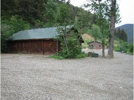
The campground offers group site that can accommodate up to 100 people. It can be used for overnight camping or day-use picnicking. A large shelter is on-site, with picnic tables and a campfire ring. Vault toilet provided. Drinking water and trash collection are not available at the campground. Campers must bring their own water and pack out all garbage. Firewood available at Langohr campground for $6.00 per bundle.

Gate will be unlocked but closed on day of arrival. If assistance is needed please see host at Langohr Campground or call (406)646-1012 option 2.

Natural Features

The group site sits next to Hyalite Creek, at an elevation of 5,000 feet. A forest of fir, pine and spruce trees covers the surrounding mountains.

Nearby Attractions

Hyalite Reservoir is just 6.5 miles from the campground. The scenic 206-acre lake offers many recreational activities, including boating, canoeing, fishing, hiking, climbing and picnicking.

The popular Hyalite Peak Trail begins near the reservoir. The 7.5-mile one-way trail gains 3,450 feet in elevation as is climbs past numerous waterfalls to beautiful Hyalite Lake and Hyalite Peak.

Reservation

More from CampingHiking.net:

SIBLEY LAKE, Wyoming Campground Images, Info & Reservations

Listen Directions From Dayton, Wyoming, take U.S. Highway 14 southwest about 25 miles to the campground. Phone 406-587-9054 Activities BIKING, BOATING, FISHING, HIKING, VISITOR CENTER, WILDLIFE VIEWING, CANOEING, BIRDING Keywords SIBL,BIGHORN NF – FS Related Link(s) Rec Area Info & Images Overview Sibley Lake Campground is located at Sibley Lake

CAMEL LAKE CAMPGROUND, Florida Campground Images, Info & Reservations

Listen Directions Take SR 20 west from Tallahassee through Hosford to Bristol. Turn south on SR 12. Continue south to the Apalachicola National Forest boundary sign and look for a sign for Camel Lake soon after you pass the work station and trailhead on the left. Turn left on Forest

BUNCOMBE CREEK, Oklahoma Campground Images, Info & Reservations

Listen Directions From Madill, OK, travel south on Highway 99 for 17 miles to Willis, OK, then east for one mile on paved access road. Physical address: 1010 West Buncombe Creek Road, Willis, OK 75020. Phone 580-564-2901 Activities BOATING, CAMPING Keywords BUNC,TEXOMA LAKE,TEXOMA LAKE Related Link(s) Rec Area Info &

PHILIPSBURG BAY CAMPGROUND, Montana Campground Images, Info & Reservations

Listen Directions The campground is located in southwestern Montana, about 11 miles south of Philipsburg. Follow U.S. Route 1 south and take a right on Georgetown Lake Road. The campground is on the left adjacent to the lake. Phone 406-210-8199 Activities BIKING, BOATING, CAMPING, FISHING, HIKING, HUNTING, WATER SPORTS, WILDLIFE

ST LUCIE SOUTH, Florida Campground Images, Info & Reservations

Listen Directions From I-95, take Exit 101 (Stuart/Indiantown), following SR 76 W for 0.5 miles to Locks Road. Turn right onto Locks Road for 1.3 miles to SW Canal Street and turn left into the campground. Phone 772-287-1382 Activities BOATING, CAMPING, FISHING, HIKING, VISITOR CENTER, DAY USE AREA, CANOEING, BIRDING

DOE LAKE GROUP SITE, Florida Campground Images, Info & Reservations

Listen Directions Doe Lake Recreation Area is between Moss Bluff and Umatilla, Florida. From I-75, west of Ocala, Florida, take the exit for State Route 40 east. Continue 11 miles to Forest Corners, then turn right on County Road 314-A. After about 9 miles, pass through a blinking light at