SHELL KNOB REC SITE PAVILION, MO Campground Reservation, Info, Images, Map, Directions

SHELL KNOB REC SITE PAVILION, Missouri Campground Images, Info & Reservations

Listen

Directions

From Shell Knob, take Highway 39 to Highway YY. Follow Highway YY 1 mile east to entrance on the right (south) side of the road.

Phone

417-683-4428

Activities

HISTORIC & CULTURAL SITE, HIKING, PICNICKING, DAY USE AREA, OBSERVATION SITE

Keywords

SHLK,MARK TWAIN NF -FS

Related Link(s)

Rec Area Info & Images

Missouri State Road Conditions

Missouri State Tourism

Overview

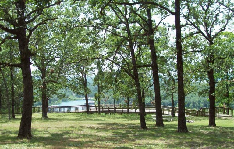
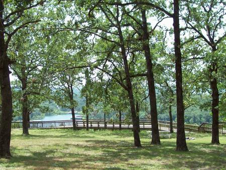
Shell Knob Recreation Site is situated along a bluff overlooking the White River arm of beautiful Table Rock Lake, in an unincorporated portion of Shell Knob. It is a great location to relax and enjoy being away from it all. The site can best be described as resembling a city park with a view. Even though it is near numerous subdivisions, Shell Knob is an unincorporated community.

Recreation

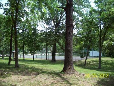
A tennis court, sand volleyball court, a double horseshoe pit and a playground are available. A short walking trail leads to a scenic overlook of Table Rock Lake.

Facilities

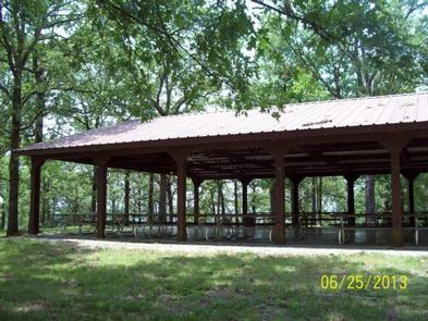
The site includes a lighted pavilion with kitchen facilities, numerous picnic tables and two parking areas. Accessible vault toilets are provided. Drinking water is available only during warm weather months. Only the pavilion can be rented, not the entire site. There is no stove or refrigerator available in the kitchen. There is a sink with hot/cold water available in kitchen. Grill is available outside for use. When picking up key at Harter House for gate and kitchen, a $25 deposit is required and will be refunded when key is returned to Harter House.

Natural Features

The pavilion was once the site of Civilian Conservation Corps camp, which operated from 1936 to 1942. Several historic features are still visible within the site. The surrounding area is heavily wooded and provides scenic forest views.

Nearby Attractions

Table Rock Lake, which offers all kinds of recreational opportunities, is adjacent to the Shell Knob Recreation Site.

Reservation

More from CampingHiking.net:

OHANAPECOSH CAMPGROUND, Washington Campground Images, Info & Reservations

Listen Directions Located on State Route 123, four miles north of State Route 12. Phone 360-569-2211 x6627 Activities CAMPING, HIKING, PICNICKING, DAY USE AREA Keywords CG45,Ohana,Mount Rainier National Park Related Link(s) Rec Area Info & Images Washington State Road Conditions Washington State Tourism Overview Ohanapecosh Campground, on the southeast side

POWER CREEK CABIN, Alaska Campground Images, Info & Reservations

Listen Directions Access to the cabin is by hiking only. Visitors must hike 4.2 miles on the Power Creek Trail to reach the facility. Due to construction along the beginning of Power Creek trail, hikers and cabin users are being detoured onto the new Power Creek Valley access road. This

RAINBOW BAY, Oregon Campground Images, Info & Reservations

Listen Directions From Klamath Falls travel 33 miles northwest on Highway 140. Turn south on Forest Road 3701 and continue .6 miles to the campground. Phone 866-201-4194 Activities BIKING, BOATING, CAMPING, FISHING, HIKING, SWIMMING SITE Keywords RABA,LAKE OF THE WOODS,WINEMA NF – FS Related Link(s) Rec Area Info & Images

PORCUPINE (ID), Utah Campground Images, Info & Reservations

Listen Directions From U.S. Highway 89, turn west onto St. Charles Canyon Road/Forest Road 412. Follow for approximately 7 miles to the campground on the left side of the road. Phone 541-351-1182 Activities BIKING, BOATING, HISTORIC & CULTURAL SITE, CAMPING, FISHING, HIKING, HORSEBACK RIDING, HUNTING, WATER SPORTS, WILDLIFE VIEWING, SWIMMING

Windy Point Campground, Washington Campground Images, Info & Reservations

Listen Directions From Naches, Washington, take Route 12 west for 4.4 miles to the intersection with State Route 410. Turn left at the intersection, staying on Route 12. Travel 8 miles to campground on the left. Phone 541-338-7869 Activities CAMPING, FISHING, HIKING Keywords WIND,RIMROCK LAKE,TIETON RIVER,OKANOGAN – WENATCHEE NF -FS