WALNUT RIDGE RECREATION AREA, IA Campground Reservation, Info, Images, Map, Directions

WALNUT RIDGE RECREATION AREA, Iowa Campground Images, Info & Reservations

Directions

Use address 9125 NW Beave Drive, Johnston IA 50131. From I-35/80 north of Des Moines, take Johnston/Saylorville Lake Exit (131). Go north on Merle Hay Rd for 2.7 miles, then turn left onto NW Beaver Drive for 3.1 miles. Recreation area is 0.3 miles ahead on the right.

Phone

515-276-4656

Activities

BIKING, CAMPING, FISHING, HIKING, WILDLIFE VIEWING

Keywords

WALNUT RIDGE RECREATION AREA (IA)

Related Link(s)

Rec Area Info & Images

Iowa State Road Conditions

Iowa State Tourism

Overview

Walnut Ridge Recreation Area is a day-use facility located on the 26,000-acre Saylorville Lake Project, which stretches over 50 miles up the Des Moines River Valley. The lake provides a wide variety of recreational activities, including boating, swimming, fishing, hiking and hunting.

Recreation

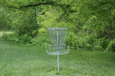
The 18-hole Walnut Ridge Disc Golf Course runs throughout the recreation area. The beautifully manicured course contains both open and wooded fairways with blind pins and tunnel shots.

Visitors come to Saylorville Lake for its great boating, sailing and swimming opportunities. Anglers fish for walleye, wiper, largemouth bass, catfish, crappie and northern pike.

The paved Neal Smith Trail winds 24 miles from Des Moines to Big Creek State Park and connects the campgrounds on the east side of the lake. It is designated as a National Recreation Trail and is used for biking, hiking, jogging, walking and in-line skating.

Facilities

This day-use area offers three group picnic shelters with water and electricity. Amenities include flush toilets, a playground, and hiking trails.

Natural Features

The area is situated on a wooded ridgeland on the west side of Saylorville Lake. Large shade trees cover the area.

Wildlife is abundant throughout the project. White-tailed deer, turkeys, pheasants, waterfowl, and other small game animals roam the lands around the lake.

Reservation

More from CampingHiking.net:

BROYLES, Georgia Campground Images, Info & Reservations

Directions From Interstate 85, take exit 11 to Highway 24 headed towards Anderson, SC. Turn right onto Hattens Ford Road and follow signs to the facility. 900 SMYZER ROAD, TOWNVILLE, SC 29689 Phone 888-893-0678 HARTWELL PROJECT OFFICE Activities BOATING, FISHING, PICNICKING, DAY USE AREA, SWIMMING SITE, SWIMMING, WATER ACCESS Keywords

KIRBY LANDING, Arkansas Campground Images, Info & Reservations

Directions From Hot Springs, Arkansas, take Highway 70 west to Kirby Landing Access Road. Turn left and continue into the campground. Phone 870-285-2151 Activities BOATING, CAMPING, FISHING, HUNTING, SWIMMING SITE Keywords KLAN,LAKE GREESON,KIRBY,CRUMP MARINA,LAKE GREESON Related Link(s) Rec Area Info & Images Arkansas State Road Conditions Arkansas State Tourism Overview

MINERAL LAKE, Wisconsin Campground Images, Info & Reservations

Directions From Mellen, Wisconsin, take County Highway GG west for about 9 miles to the campground sign. Turn right and drive less than a mile to the campground. From Clam Lake, Wisconsin, take County Highway GG north for about 9 miles to the campground sign and turn left. Phone 715-264-2511

JUNCTION CREEK CAMPGROUND, Colorado Campground Images, Info & Reservations

Directions From Main Street in Durango, travel west on 25th Street (across from the fairgrounds entrance) for just over three miles, to the forest boundary. Continue just over a mile to the campground entrance. The day-use area loops to the left. Phone 661-702-1420 Activities BIKING, BOATING, CAMPING, FISHING, HIKING, WILDLIFE