RICHARDSON LAKE CAMPGROUND, WI Campground Reservation, Info, Images, Map, Directions

RICHARDSON LAKE CAMPGROUND, Wisconsin Campground Images, Info & Reservations

Directions

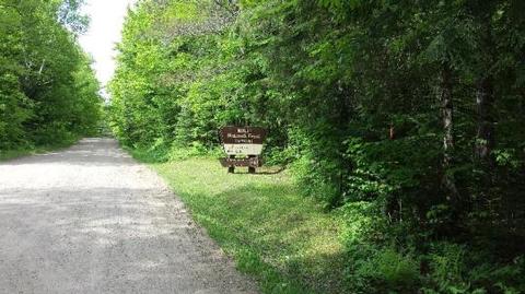
From Wabeno, drive north 0.8 miles on Highway 32 to Highway 52. Turn left (west) on Highway 52 and drive 2.4 miles to Richardson Lake Road (FR2880). Turn right (north) on Richardson Lake Road and continue 0.4 miles to the campground.

Phone

715-674-4481

Activities

CAMPING

Keywords

Related Link(s)

Rec Area Info & Images

Wisconsin State Road Conditions

Wisconsin State Tourism

Overview

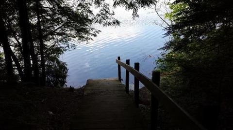
Richardson Lake Campground sits on its namesake lake in beautiful Forest County Wisconsin. This campground’s 26 sites are located on the south shore of Richardson Lake, well known to anglers for its bass, northern pike, and pan fish. Relax on the sandy swim beach or take in the views of the lake from the picnic area above the beach. Take your boat or canoe out on Richardson Lake in search of wildlife along the shoreline.

Recreation

The Chequamegon-Nicolet National Forest has an abundance of outdoor recreation opportunities. Those most enjoyed at Richardson are fishing, swimming, and canoeing.

Facilities

Richardson Lake Campground offers 26 campsites of various sizes that can accommodate tents and RVs. Drinking water, vault toilets, swim beach, and boat landing are also provided at this location.

Natural Features

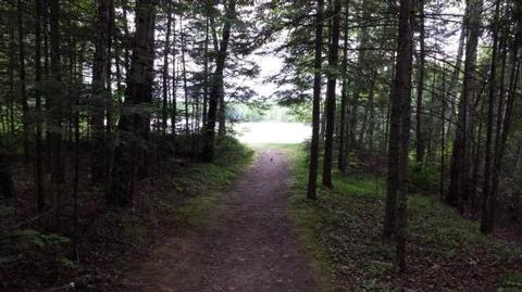
The campground lies in a lush maple dominated northern hardwood forest on the south shore of 47-acre Richardson Lake. Richardson Lake Campground is best known for its spectacular fall color.

Nearby Attractions

The communities of Wabeno to the east and Crandon to the north offer some services and community events throughout the year.

Reservation

More from CampingHiking.net:

BAY VIEW, Michigan Campground Images, Info & Reservations

Directions 19456 W Lakeshore Drive, Brimley MI 49715 From Brimley, Michigan, travel west on County Road 42/Whitefish Bay Scenic Byway for approximately 8 miles. Bay View is on the north side of the road. Phone 906-203-9872 Activities HISTORIC & CULTURAL SITE, CAMPING, HIKING, SWIMMING SITE Keywords BYVW,Superior Lake Campground,Lake Superior

NOTREBES BEND PARK, Arkansas Campground Images, Info & Reservations

Directions From DeWitt Arkansas, take US-165 south for 8.1 miles. Exit onto State Route 44 east and continue south for 5.3 miles to Tichnor. Take Tichnor Blacktop Road for 10 miles, cross the Arkansas Post Canal Bridge, and turn right onto Wilbur D. Mills Road. Continue for 6.5 miles and

GREENBRIER PICNIC PAVILION, Tennessee Campground Images, Info & Reservations

Directions There is no street address for the picnic pavilion. From Gatliinburg, TN: Proceed east on U.S. 321 North about 6 miles. Turn right (south) at the Greenbrier sign. Picnic pavilion is about 3.5 miles from U.S. 321. Phone 865-436-1261 Activities HISTORIC & CULTURAL SITE, CAMPING, FISHING, HIKING, WILDLIFE VIEWING

WILSON H FOX, Texas Campground Images, Info & Reservations

Directions From I-35 take Highway 79 east to Highway 95. Go north to FM 1331 then go east on FM 1331 for approximately 7 miles to the entrance of Granger Dam. Turn left and take next left into the park Phone 512-859-2668 Activities CAMPING, VISITOR CENTER, SWIMMING SITE Keywords WILS,GRANGER

PARKSIDE, Montana Campground Images, Info & Reservations

Directions From U.S. Highway 212, turn off at Rock Creek Road (Forest Road 2421). Go 0.3 miles to the campground entrance on the right. Phone 406-587-9054 Activities BIKING, BOATING, CAMPING, FISHING, HIKING Keywords PKSD,CUSTER NF – FS Related Link(s) Rec Area Info & Images Overview Parkside Campground is located 12