
Directions
From Spartanburg – Follow Interstate 26 east towards Charleston for 92 miles and then take Exit 116 for Interstate 77 north towards Charlotte (on the left). Follow Interstate 77 for approximately five miles to Exit 5, Bluff Road. Follow directions below from I 77, Exit 5. (Approximate travel time: 2 hours)
From Charleston – Follow Interstate 26 west (towards Columbia) for approximately 75 miles. Take Exit 145, US 601 north towards St. Matthews. Follow US 601 for 23 miles. Turn left onto Route 48 (Bluff Road) and follow for 11 miles to Mt. View Road. Turn left and follow Mt. View Road to Old Bluff Road. Turn right on Old Bluff Road for half a mile to the park entrance, which will be on your left. (Approximate travel time: 2 hours)
From Charlotte – Take Interstate 77 south towards Columbia for approximately 95 miles to Exit 5, Bluff Road. Follow directions below from Interstate 77, Exit 5. (Approximate travel time: 2 hours)
From Augusta, GA – Follow Interstate 20 east towards Columbia for 65 miles to Exit 64B. Merge onto Interstate 26 and follow for 8 miles to Exit 116, Interstate 77 north towards Charlotte (on the left). Follow Interstate 77 for 5 miles to Exit 5, Bluff Road. Follow directions below from Interstate 77, Exit 5. (Approximate travel time: 1 hour 45 minutes)
From Interstate 77, Exit 5 At Exit 5 turn onto SC Hwy 48 East/Bluff Road. Following the brown and white "Congaree National Park" directional signs, travel approximately 8 miles on and then take a slight right onto Old Bluff Road. Follow Old Bluff Road for 4.5 miles to the park entrance sign, which will be on the right. Proceed one mile to the Harry Hampton Visitor Center. Parking lots will be on the right.
Phone
(803) 776-4396
Activities
BOATING, HISTORIC & CULTURAL SITE, CAMPING, INTERPRETIVE PROGRAMS, FISHING, HIKING, VISITOR CENTER, WILDLIFE VIEWING
Keywords
Longleaf Bluff
Related Link(s)
South Carolina State Road Conditions
Overview
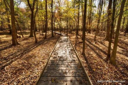
Longleaf and Bluff campgrounds are located above the floodplain in the upland region of Congaree National Park. Many of the park trails can be accessed from the campgrounds.
Recreation
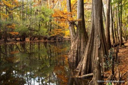
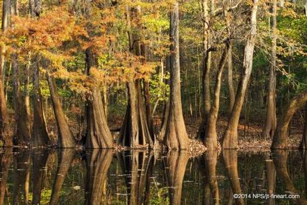
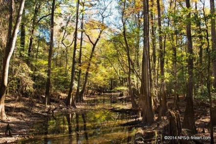
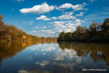
Congaree National Park offers a wide range of opportunities to explore and experience the great outdoors. Many miles of hiking trails can be found in the park ranging from easy to moderately strenuous. Old growth forests, teeming with wildlife can be accessed by park trails or by exploring the many miles of waterways in a canoe or kayak. Interpretive programs including guided hikes, canoe tours and special ranger-led programs are offered throughout the year. Book a reservation now to join a Park Ranger-Guided Canoe Tour during your stay.
Facilities
The campgrounds accommodate tents only and are primitive with no electrical hookups or access for RVs. Picnic tables and fire rings are provided. Water is not available at either location. Water is available 24 hours a day at filling stations located at the Harry Hampton Visitor Center Longleaf Campground has two vault toilets located at the entrance of the campground. Bluff Campground is a one mile hike from the registration station and does not have have restroom facilities.
Natural Features
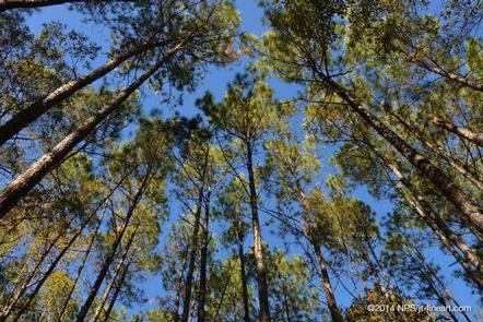
The campgrounds are located in a spectacular wooded setting, nestled in the upland pine forests of Congaree National Park.
Nearby Attractions
Congaree National Park is located near many attractions including state parks, forests and parks. The city of Columbia is a short drive from the park and offers access to many attractions including museums, city parks and shopping.