
Directions
From Poplar Bluff, take Highway 67 north for 14 miles, then drive west on Highway 49 for 9 miles (about 3 miles past the town of Williamsville). Take the first right after crossing the Black River to enter Markham Springs Recreation Area. The drive way to the Fuchs House will be the first Forest Road on the left.
Phone
573-341-5488
Activities
CAMPING
Keywords
Related Link(s)
Missouri State Road Conditions
Overview
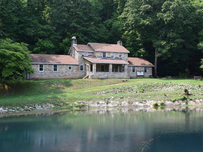
In the late 1930s, Rudolph Fuchs built a five bedroom concrete and native stone house for his family, and also built the present wheel house to produce electricity for his needs. Power was obtained by building a dam in a semi-circle below a large spring forming a small pond. The water was to pour through a chute on the wheel to produce electricity; however, electricity arrived to the site before the wheel ever needed to do its job. The area had an undershot wheel providing power to a grist mill in the late 19th century.
Recreation
The Black River boasts bass, sunfish, walleye and catfish. Many anglers fish from boats, but others fish from the riverbanks. Canoeing and kayaking is also possible on the river. Various day hikes within the Markham Springs Trail System are accessible from the campground. Eagle Bluff Trail is a one and a half mile loop along the river, where birding and wildlife viewing are favorite pastimes. The day use area has a two-acre, 20 foot deep mill pond that dates back to the 1800s, several picnic sites, open fields; river access for boating, fishing and float tubes and canoes; and short hiking trails that provide views of the river, the pond, the springs and the uplands.
Facilities
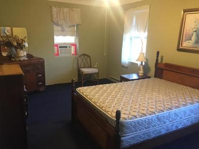
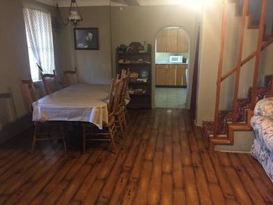
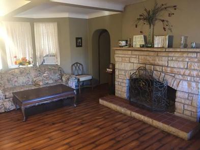
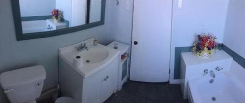
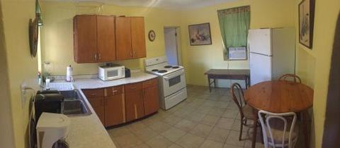
The house has two downstairs bedrooms with queen beds, a single bed and a shared bathroom. Upstairs has a bathroom and three bedrooms each with a bunk bed and twin bed. The kitchen comes fully furnished as well as all the other rooms; however, you must bring your own linens, pillows and towels.
Natural Features
Located adjacent to the Black River, the recreation area contains a small pond that dates back to the 1800s. The area is covered by a dense forest of colorful trees, including ash, elm, maple and poplar. Six springs pour almost five million gallons of water per day into the pond, and the bubble spring, a smaller outlet of Markham Spring outside of the pond that has air with it which rises in the soft sand forming unique air bubbles.
Nearby Attractions
The Fuchs House is located in the Markham Springs Recreation Area. Camping with both electric sites and primitive sites, day use, and pavilion rental is available. The town of Williamsville is three miles from the Fuchs House and offers a general store ad fuel station.