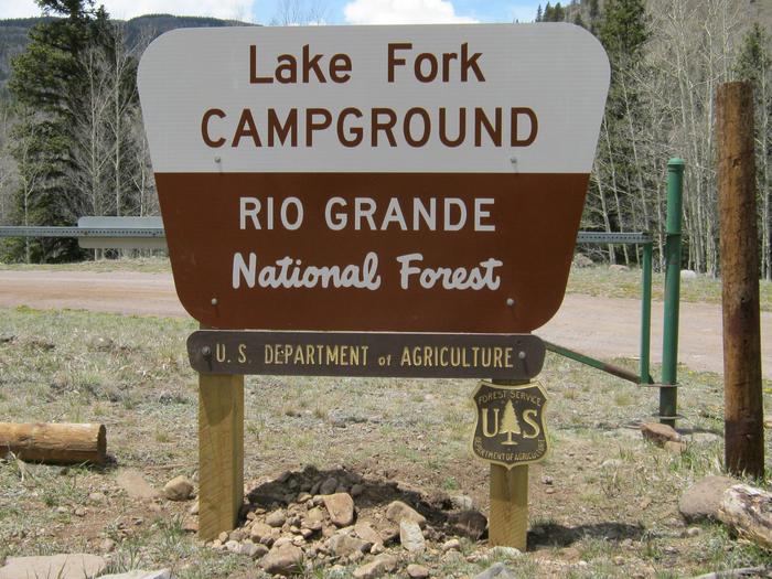
LAKE FORK(RIO GRANDE NATL FORE, CO Campground Reservation, Info, Images, Map, Directions

LAKE FORK(RIO GRANDE NATL FORE, Colorado Campground Images, Info & Reservations

Directions

From Antonito, travel west on Highway 17 approximately 24 miles to the junction of Highways 17 and 250. Turn on Highway 250 and travel 18 miles on a gravel road to Lake Fork Campground.

Phone

719-852-5941

Activities

CAMPING, FISHING, HIKING

Keywords

LAKF,LAKE FORK RIO GRANDE NATL FORE,RIO GRANDE NF- FS

Related Link(s)

Rec Area Info & Images

Colorado State Tourism

Colorado State Road Conditions

Overview

Lake Fork Campground sits in the Rio Grande Forest, 40 miles northwest of Antonito, Colorado. The campground is a true getaway from any city, and requires an 18-mile drive on a gravel road. This high elevation campground boasts limitless beauty with mountain peaks, alpine wildlife spotting and several varieties of birds.

Recreation

The campground is convenient to several trails, such as Lake Fork to Big Lake and Conejos Peak to Blue Lake.

The Conejos River is a Gold Medal River, meaning it offers the greatest potential for trophy trout fishing. Rainbow and brown trout are the most common species in the river.

Facilities

Some campsites overlook the river. There is one centrally located drinking water spigot. All parking spurs are gravel. Firewood can be purchased on-site. No electric hookups are available.

Campers will find an old-fashioned steel tub bath at Brummel’s Rocky Mountain Lodge about 10 miles south.

Natural Features

The campground is located in south central Colorado on the banks of the Conejos River. It is shaded by spruce, aspen and a few cottonwoods and willows at an elevation of 9,500 feet.

A variety of wildlife makes its home in the area, including black bears, deer and marmots. Wildflowers dot the region, creating colorful landscapes for photography enthusiasts.

Nearby Attractions

Take in spectacular views of the Conejos Canyon and River along Forest Road 250.

Reservation

More from CampingHiking.net:

POSEY LAKE CAMPGROUND, Utah Campground Images, Info & Reservations

Directions From Highway 12 in Escalante, turn north at 300 East at the elementary school at the Posey Lake/Hell’s Backbone sign. Travel 14 miles to junction of Forest Roads 153 and 154, keep left and travel 2 miles to Posey Lake Campground. Site access can be difficult; about 14 miles

DAVIDOF LAKE CABIN, Alaska Campground Images, Info & Reservations

Directions Accessible early June through October. Located 40 air miles southeast of Sitka, east of Whale Bay, within South Baranof Wilderness Area. Access is by float plane only, and takes 35 minutes from Sitka. For geographic features surrounding cabin, refer to USGS topographic map Port Alexander C-3. Phone 907-747-6671 Activities

Adirondack Shelters, Maryland Campground Images, Info & Reservations

Directions GPS information is provided as verification of Shelter # 1, which is near Shelter #2. Users are asked to help protect park resources by using the trail system when accessing the shelters or other park features. Trail maps can be obtained at the park Visitor Center or downloaded from

MIDDLE FORK, Wyoming Campground Images, Info & Reservations

Directions From Buffalo, Wyoming, take U.S. Highway 16 west 13 miles. Phone 406-587-9054 Activities BIKING, CAMPING, FISHING, HIKING, HORSEBACK RIDING, WILDLIFE VIEWING Keywords MIDD,BIGHORN NF – FS Related Link(s) Rec Area Info & Images Overview Middle Fork Campground is located 14 miles west of Buffalo, Wyoming, adjacent to the Cloud

PAT MAYSE WEST, Texas Campground Images, Info & Reservations

Directions From Paris, TX, take HWY 271 north for 12 miles to FM 906 W, then 4 miles to FM 197. Turn west for 3 miles to CR 35810, turn left 1 mile to CR 35800, then left into the park. Phone 903-732-4956 Activities CAMPING, FISHING, HUNTING, SWIMMING, WATER ACTIVITIES,