AMANITA, ID Campground Reservation, Info, Images, Map, Directions

AMANITA, Idaho Campground Images, Info & Reservations

Listen

Directions

From Boise, Idaho, take Highway 55 north for 95 miles to Donnelly. Turn west on West Roseberry Road and travel 1.5 miles to Norwood Road. Turn south and continue one mile to Tamarack Falls Road. From there, turn west and go just over a mile to West Mountain Road. Turn south and go a mile to the campground.

Phone

208-382-7400

Activities

BOATING, CAMPING, FISHING, WATER SPORTS, WILDLIFE VIEWING, SWIMMING SITE

Keywords

AMAN,BOISE NF – FS

Related Link(s)

Rec Area Info & Images

Idaho State Tourism

Idaho State Road Conditions

Overview

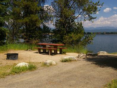
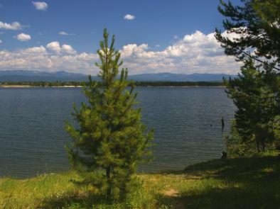
Amanita Campground is located next to scenic Lake Cascade in west-central Idaho. It is near the town of Donnelly, at an elevation of 4,850 feet. Boating, fishing, swimming and hiking are popular activities in this scenic region.

Recreation

Lake Cascade offers excellent opportunities for boating, water skiing, canoeing, windsurfing and sailing. Anglers enjoy casting for rainbow trout, coho salmon, smallmouth bass and perch. A boat ramp is located at the neighboring Rainbow Point Campground. Many hiking and ATV trails are in the area as well.

Facilities

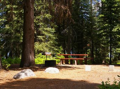
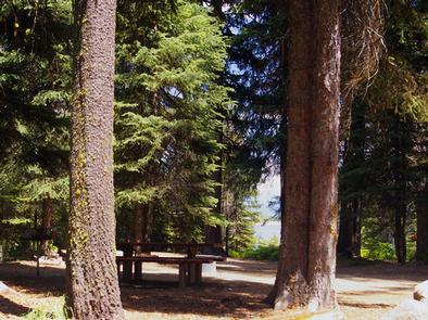
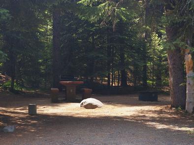
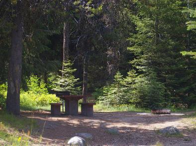
This small campground contains single-family campsites, with picnic tables, campfire rings and grills. Some sites have lake views and shoreline access.

Vault toilets, drinking water and trash collection are provided, but there is no electricity at the campground. Roads and parking spurs within the facility are gravel. A campground host can be located at Rainbow Point Campground.

Natural Features

The campground is situated on the west shore of the lake, among a mixed-growth conifer forest that towers over the campground. Summer wildflowers are abundant in the area.

A wide variety of wildlife makes its home around the lake. Waterfowl and songbirds can also be seen in the area, as well as pelicans and bald eagles.

Reservation

More from CampingHiking.net:

FOURMILE CABIN, Montana Campground Images, Info & Reservations

Listen Directions From Big Timber, travel 25 miles south on Highway 298 to the National Forest Boundary. At this point, the paved road becomes county-maintained gravel road (Main Boulder Road or Forest Road 6639). Continue on this gravel road another 17 miles. The cabin is on the west (right) side

THREE CREEKS MEADOW HORSE CAMP, Oregon Campground Images, Info & Reservations

Listen Directions From Sisters, OR: Travel 15.2 miles south on Forest Road 16 (Elm Street in Sisters). Phone 541-323-1746 Activities CAMPING Keywords THREE CREEKS MEADOW HORSE CAMP Related Link(s) Rec Area Info & Images Oregon State Road Conditions Oregon State Tourism Overview Three Creeks Meadow Horse Camp is one of

LAGUNA, California Campground Images, Info & Reservations

Listen Directions Located 50 miles east of San Diego, California. Take I-8 to Sunrise Highway exit. Go approximately 15 miles to Laguna/El Prado Campground, just beyond the 26 mile marker. Stop at the entrance station for campground information and site location. Phone 619-473-2082 Activities BIKING, CAMPING, HIKING, DAY USE AREA

FLATWOODS GROUP PICNIC AREA, Virginia Campground Images, Info & Reservations

Listen Directions From Coeburn, VA, go south on State Route 72 for 2.3 miles. The Flatwoods Picnic Area will be on the right (west) side of Route 72. Phone 276-679-8370 Activities BIKING, FISHING, HIKING, PICNICKING, DAY USE AREA, PHOTOGRAPHY, SCENIC DRIVE Keywords Related Link(s) Rec Area Info & Images Virginia

MCCLINTIC POINT, Virginia Campground Images, Info & Reservations

Listen Directions From Warm Springs, Virginia take US 39 west 12 miles to state route (SR) 600, turn left (south)on SR 600. Continue 10 miles on SR 600 (2.25 miles past entrance of Bolar Flat Marina) to the McClintic Point Sign. Turn right at the McClintic Point Sign. Phone 540-279-4144