GREEN SPOT EQUESTRIAN GROUP CAMP, CA Campground Reservation, Info, Images, Map, Directions

GREEN SPOT EQUESTRIAN GROUP CAMP, California Campground Images, Info & Reservations

Directions

From the Big Bear Ranger Station, turn left on Highway 38 and proceed 3 miles east to Greenway. Turn right and continue past the airport to the signal at Big Bear Boulevard. Turn right and continue on Highway 38 for almost 4 miles to Forest Route 2N93. Turn right on Forest Route 2N93 and continue a half-mile to the second dirt road on the left (not marked). Proceed up the road about 50 yards to the campground.

Phone

909-866-8550

Activities

BOATING, CAMPING, FISHING, HIKING, SWIMMING SITE

Keywords

GRES,SAN BERNARDINO NF – FS

Related Link(s)

Rec Area Info & Images

California State Tourism

California State Road Conditions

Overview

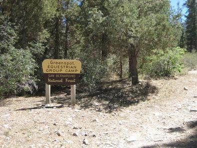
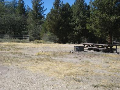
Green Spot Equestrian Group Campground provides access to a number of recreational activities in the area, namely horseback riding trails. The large campground gives campers and horses ample space to move around and enjoy the scenic surroundings.

Recreation

Visitors enjoy a variety of recreational opportunities, including fishing, boating and swimming at the nearby Big Bear Lake. Access to the Sugarloaf National Recreation Trail is also available near the campground. It is a fairly difficult trek to the highest point in Big Bear Valley, and a climb to an altitude of 9,952 feet.

Facilities

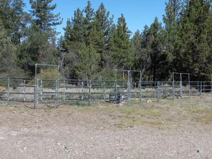
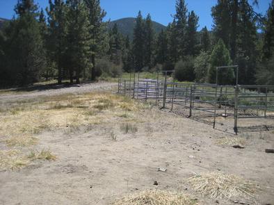
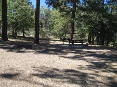
The campground offers just one large group campsite that can accommodate up to 25 people and eight vehicles. The site is equipped with tables and campfire rings with grills. Vault toilets are provided, but drinking water and trash collection are not available. The campground offers five horse corrals that can hold up to 10 horses. Non-potable water is available for livestock.

Natural Features

The campground is located in the San Bernardino Mountains at an elevation of 7,224 feet. It is situated in a pinyon pine and juniper forest carpeted with grassy meadows. The road to the campground is rough and rocky, suitable for four-wheel drive vehicles.

Nearby Attractions

The campground is approximately 45 minutes from San Bernardino.

Reservation

More from CampingHiking.net:

CAMP THREE CAMPGROUND, California Campground Images, Info & Reservations

Directions From Highway 99 in Bakersfield, California, take Highway 178 east to Lake Isabella. From Lake Isabella take Highway 155 around the west side of the lake to the town of Kernville. Turn north on Sierra Way/Mountain 99 and continue 5 miles to the campground. Phone 760-376-1815 Activities BOATING, CAMPING,

LITTLE CRATER LAKE, Oregon Campground Images, Info & Reservations

Directions From Sandy, travel east on Highway 26 for approximately 40 miles to Skyline Road (Road 42). Turn right and travel south for 4 miles. Turn right on Forest Road 58 and travel 2 miles to the campground. Phone 503-630-5721 Activities HISTORIC & CULTURAL SITE, CAMPING, FISHING, HIKING, WILDLIFE VIEWING

SARDINE LAKE, California Campground Images, Info & Reservations

Directions From Sierra City, travel north on Highway 49 for 5 miles. Turn left at Bassett Station on Gold Lake Highway and continue just over a mile to Packer Lake Road and turn left. Continue for about 1 mile and turn left into the campground. Phone (530)478-6253 Activities BOATING, CAMPING,

KELLY DAHL, Colorado Campground Images, Info & Reservations

Directions From Denver, go north on Interstate 25 to US Highway 36 west to Boulder. Take Colorado Highway 119 (Canyon Boulevard) west for 22 miles to Nederland. Continue south for 4 miles to the campground. Phone 303-541-2500 Activities CAMPING, HIKING, HORSEBACK RIDING Keywords KELD,KELLY DAHL,ARAPAHO AND ROOSEVELT NF – FS

BOOMER PARK SHELTER, North Carolina Campground Images, Info & Reservations

Directions From Charlotte, North Carolina, take I-77 North (approximately 60 miles) before merging onto Highway 421 North towards Wilkesboro/Boone. Continue to Exit 286B (approximately 20 miles), turn left onto Highway 268 and continue for approximately 6 miles. Turn left onto Boomer Road and the park will be on the right

EAST FORK CABIN, Montana Campground Images, Info & Reservations

Directions From Sula, travel northwest on Highway 93 for less than a mile. Turn northeast (right) onto East Fork Road/County Road 472 and continue about 16 miles to the cabin. Maps may be purchased by calling the Darby-Sula Ranger District at 406-821-3913. Phone 406-821-3913 Activities HISTORIC & CULTURAL SITE, CAMPING,