ZILPO - DANIEL BOONE NAT. FOR., KY Campground Reservation, Info, Images, Map, Directions

ZILPO – DANIEL BOONE NAT. FOR., Kentucky Campground Images, Info & Reservations

Directions

In Salt Lick, KY, at the intersection of State Route 211 and U.S. Route 60, take Route 211 south for 3.6 miles to the Forest Recreation sign. Turn left at the sign, onto Clear Creek Road and go 3.9 miles to Zilpo Campground sign. Turn left at the sign onto Forest Route 918 and drive 8.7 miles to the campground.

Phone

606-768-2722

Activities

BOATING, HISTORIC & CULTURAL SITE, CAMPING, HIKING, SWIMMING SITE

Keywords

ZILP,CAVE RUN LAKE,CAVE RUN PARK,ZILPO,ZILPO DANIEL BOONE NAT FOR,DANIEL BOONE NF-FS

Related Link(s)

Rec Area Info & Images

Kentucky State Road Conditions

Forest Service Concessionaire

Kentucky State Tourism

Overview

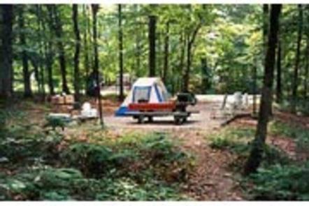
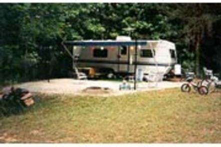
Zilpo, a large, fun-filled campground on Cave Run Lake, is a prime destination for families. The scenic campground offers a cabin rental, tent camping, RV sites with electric hookups and a selection of lakefront sites.

Views of the lake are enjoyed by those who relax on the sandy beach. Tater Knob, a fire tower open to the public, is nearby, offering outstanding views of the area.

Recreation

Water skiing and swimming are wonderful ways to enjoy the lake. Muskie, large and smallmouth bass, bluegill, crappie and catfish attract avid anglers. Hikers are fans of the Zilpo Mountain Loop Trail that extends for 2.25 miles, connecting to a network of other trails around the lake.

Nature programs are regularly scheduled during peak season and wildlife watching is rewarding.

Facilities

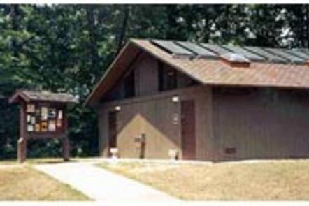
Electric hookups are provided at some campsites. Drinking water is located centrally within the loops. Flush toilets and showers are spread throughout the campground as well. Each site has a picnic table and campfire ring. A dump station and concrete boat ramp are also included.

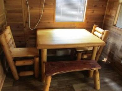
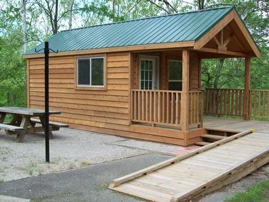
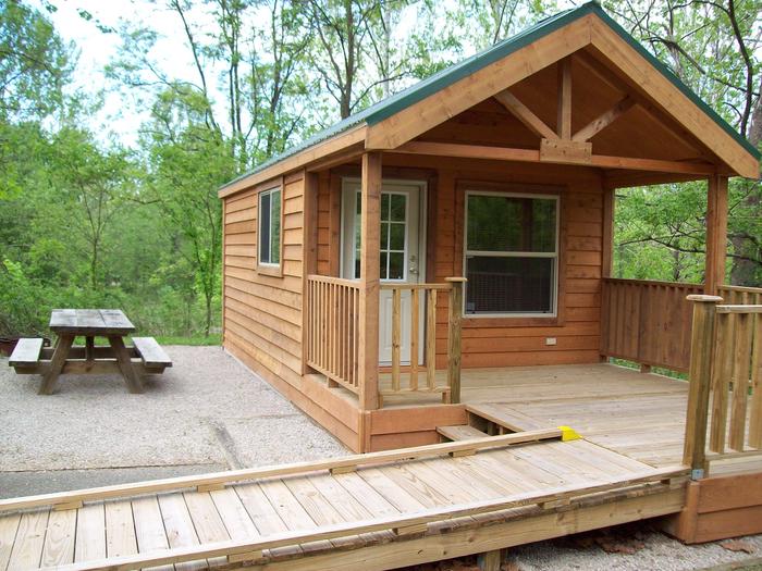
Each of the 12 cabins can accommodate up to six guests. They each have a table, two chairs and a sleeping area with two sets of bunk beds (4 beds). A picnic table, lantern post and campfire ring are provided outside. Pets may reside only in cabins 41,120,121 and 123. Cabins 109, 123 and 136 have ramps that can accommodate wheel chairs.

A campground store with ice, firewood, camping gear and food is on-site. Roads are paved and level tent pads are gravel.

Natural Features

Zilpo sits on a peninsula in the middle portion of Cave Run Lake at an elevation of 800 feet. The lake spans 8,270 acres with soft, sandy beaches. The campground is shaded by a stand of mixed hardwoods, and campsites have good privacy.

Nearby Attractions

The nearest community is 12 miles away.

Reservation

More from CampingHiking.net:

BALD BUTTE LOOKOUT, Oregon Campground Images, Info & Reservations

Directions From the Paisley District Office, travel 0.5 miles north on Highway 31 and turn left on Mill Street. Stay on Mill Street to the Y junction (turns into gravel at this point) , then turn right on Forest Road 3315. Continue on Forest Road 3315 for 21 miles. Turn

ADMIRALTY COVE CABIN, Alaska Campground Images, Info & Reservations

Directions Access to Admiralty Cove Cabin is by floatplane or boat with anchor. Admiralty Cove is a small, open cove within Young Bay, on the north end of Admiralty Island. Upon arrival, look for a large pruned opening in the beach fringe visible from the water while approaching the east

DINKEY CREEK, California Campground Images, Info & Reservations

Directions From Clovis, California, travel east on Highway 168 to Shaver Lake. Turn southeast onto Dinkey Creek Road and travel 13 miles to the campground. Phone 559-841-2705 Activities BIKING, CAMPING, INTERPRETIVE PROGRAMS, FISHING, HIKING, DAY USE AREA, SWIMMING SITE Keywords DINK,SIERRA NF – FS Related Link(s) Rec Area Info &

MAGRUDER RANGERS HOUSE, Montana Campground Images, Info & Reservations

Directions From Darby, Montana, travel south on Highway 93 for 4 miles to West Fork Road/Highway 473. Continue on this road for approximately 14 miles to the Nez Perce Road/Magruder Corridor Road and go another 34 miles on the one-lane gravel, and partially paved road. Just before the Deep Creek

NORTH CAMPGROUND, Utah Campground Images, Info & Reservations

Directions From Highway 89 approximately 7 miles south of Panguitch, Utah, travel east on Highway 12 for about 14 miles. Turn south on Highway 63 to the main entrance of Bryce Canyon National Park. North Campground is the first left turn after passing through the fee station. Phone 435-834-5322 Activities

BIG CREEK LAKES CAMPGROUND, Colorado Campground Images, Info & Reservations

Directions From Walden, follow Route 125 north for 9 miles into Cowdrey. Turn left (west) onto CR 6W and travel 18 miles to Pearl. Turn onto Forest Road 600 and drive for 6 miles, following signs to campground. Phone 970-723-2700 Activities BOATING, CAMPING, FISHING, HIKING, WILDLIFE VIEWING Keywords BIGL,MEDICINE BOW-ROUTT