ECHO LAKE, CO Campground Reservation, Info, Images, Map, Directions

ECHO LAKE, Colorado Campground Images, Info & Reservations

Directions

Take I-70 westbound, Idaho Springs exit #240 – Hwy 103. Go south 14 miles to the intersection of Hwy 103 and Hwy 5 (Mt Evans Road). Turn right on Hwy 5 then turn left to enter the campground.

Phone

801-226-3564

Activities

CAMPING, FISHING, HIKING, WILDLIFE VIEWING, SCENIC DRIVE

Keywords

ECH1,ARAPAHO AND ROOSEVELT NF – FS

Related Link(s)

Rec Area Info & Images

Colorado State Tourism

Forest Service Concessionaire

Colorado State Road Conditions

Overview

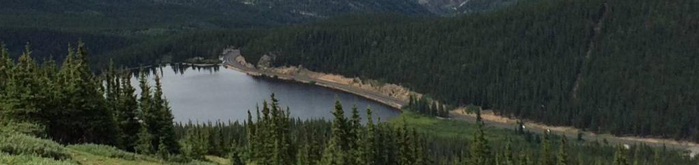
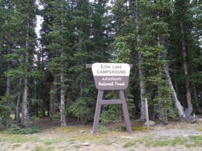
Echo Lake Campground is located on the Arapaho and Roosevelt National Forests in central Colorado near its namesake lake at the base of Mount Evans along Hwy 103. Visitors enjoy hiking, fishing and taking scenic drives along Mount Evans Road.

Recreation

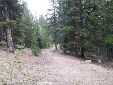
Activities in the area include hiking in the Mount Evans Wilderness, fishing, scenic driving and wildlife viewing. Several trails leave directly from the campground.

Facilities

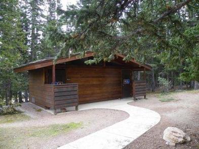
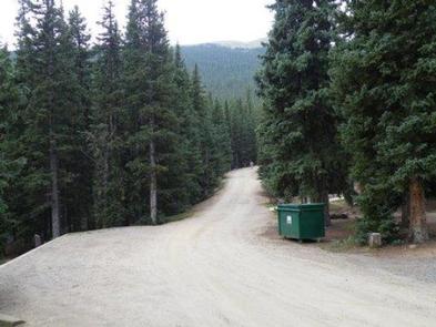
The campground offers 11 sites more suited to RV camping and seven sites designated for tent camping only. Each site is equipped with a picnic table and campfire ring. Also, there are vault toilets, hand pumps with potable water and trash service.

Natural Features

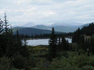
Echo Lake sits in a spruce forest near the shores of Echo Lake. The campground’s 10,600′ elevation creates cool to chilly nights, even in summer, and its location on a mountain pass makes for windy conditions year-round.

The Arapaho and Roosevelt National Forests and Pawnee National Grassland on the foothills and slopes of the Rocky Mountains in Colorado. The forests and grassland cover 1.5 million acres and extend north to the Wyoming border, south to Mount Evans and west across the Continental Divide.

The area encompasses mountains, lakes and five scenic byways, designated by Congress for their scenery, wildlife or history, including the highest road in North America. Mount Evans Road, also known as Colorado Highway 5, allows visitors to drive from 10,500′ to 14,130′ above sea level in just 14 miles.

Nearby Attractions

Nearby Idaho Springs, a former mining town, makes for a nice outing. History buffs will appreciate the Argo Gold Mine and Mill Museum. The City and County of Denver Mountain Park, Echo Lake and Echo Lake Lodge are located adjacent to the campground.

Reservation

More from CampingHiking.net:

SKULL CREEK, Utah Campground Images, Info & Reservations

Directions Located off Highway 44, just west of the junction of Highways 44 and 191 in the Flaming Gorge area, about 35 miles north of Vernal, Utah. Phone 435-784-3445 Activities BIKING, BOATING, CAMPING, FISHING, HIKING, WILDLIFE VIEWING Keywords SKUL,SKULL CREEK,FLAMING GORGE,ASHLEY NF – FS,Flaming Gorge National Recreation Area Related Link(s)

RUEDI MARINA CAMPGROUND, Colorado Campground Images, Info & Reservations

Directions Take I-70 west of Denver to Glenwood Springs Exit 116, Highway 82 to Basalt. At Basalt, take Frying Pan Road 15 miles to the Ruedi Complex Entrance. Phone 970-927-0107 Activities BIKING, CAMPING, INTERPRETIVE PROGRAMS, FISHING, HIKING, WATER SPORTS, WILDLIFE VIEWING Keywords Related Link(s) Rec Area Info & Images Forest

DEER HAVEN, Utah Campground Images, Info & Reservations

Directions From Cedar City, Utah, take Highway 14 east for 16 miles. Turn south on Webster Flat Road and travel 3 miles to the campground. Phone 801-226-3564 Activities BIKING, CAMPING, HIKING, WILDLIFE VIEWING, DAY USE AREA Keywords DEEH,DIXIE NF – FS Related Link(s) Rec Area Info & Images Utah State

LITTLE CRATER CAMPGROUND, Oregon Campground Images, Info & Reservations

Directions From Bend, travel 23.5 miles south on Hwy 97, then 14.5 miles east on Road 21, and 0.5 miles north on Forest Road 2100 570. Phone 541-383-5300 Activities CAMPING Keywords Related Link(s) Rec Area Info & Images Oregon State Road Conditions Oregon State Tourism Overview Situated on the edge

GOOSEBERRY GROUP, Utah Campground Images, Info & Reservations

Directions From Fairview, Utah, travel north about a mile on Highway 89, to the junction with Highway 31. Travel east on Highway 31 for about nine miles, to the junction with Forest Development Road 124. Go north on Forest Development Road 124 for one mile to the campground. Phone (435)283-4151