


Directions
From Seattle, Washington, go north on I-5 to Bellingham. Take exit 255 onto Sunset Drive/Mt. Baker Highway SR 542. Continue on SR 542 past the town of Glacier near mile 33 and continue approximately 2 miles to the campground. The campground is on the left (west) side of the highway just after crossing the bridge over the North Fork Nooksack River.
Phone
360-804-1103
Activities
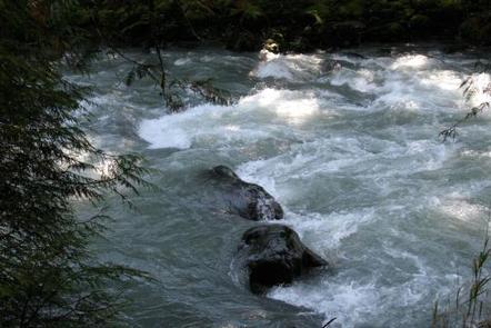
FISHING, HIKING, WHITEWATER RAFTING
Keywords
DOUG,MT. BAKER-SNOQU NF – FS,DOUGLAS FIR,DOUGLAS FIR CAMPGROUND
Related Link(s)
Washington State Road Conditions
Overview
Situated on the banks of North Fork Nooksack River in Mt. Baker-Snoqualmie National Forest, Douglas Fir Campground offers stunning scenery and access to numerous recreational activities popular in the north Cascades Mountains in Washington.
Recreation
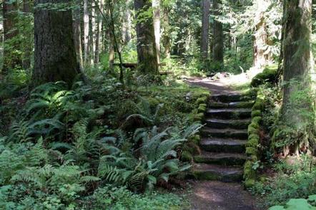
The campground provides a prime location for hiking and picnicking in summer and early fall. Horseshoe Bend Trail is an easy forest hike along the Mt. Baker Scenic Byway, highlighting old-growth forests, gushing whitewater and forest wildflowers. Whitewater rafting enthusiasts put in at the trailhead, and experienced kaykers can be seen on rapids as the trail follows the North Fork of the Nooksack River upstream past a stunning view of Church Mountain. Hikers and backpackers are especially fortunate to have access to a variety of trails near the campground and in the surrounding Mt. Baker Wilderness area. One of the most popular hikes in the Mt. Baker Ranger District is the Skyline Divide Trail. This trail climbs steadily for two miles through forest into lush, open meadows with sweeping views of glacier-draped Mt. Baker. The trail then wanders along Skyline Divide for another 2 miles, offering views of rivers, forests and countless peaks.
Facilities
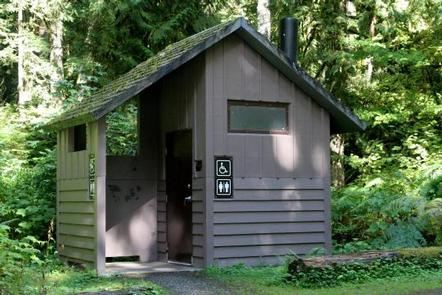
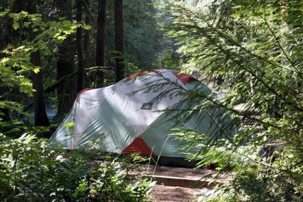
Douglas Fir Campground offers standard sites, accomodating tents and RVs. Several campsites are located at the river’s edge, while others are shaded by a mature, mixed conifer forest. A historic sheltered picnic area, constructed by the Civilian Conservation Crew, is also available for reservation. Vault toilets and drinking water are available Individual sites are equipped with picnic tables, campfire rings and tent pads.
Natural Features
Hemmed in by several designated wilderness areas, the Mt. Baker-Snoqualmie National Forest showcases rugged peaks, sparkling alpine lakes and old-growth forests, providing visitors with a variety of scenic landscapes. On a clear day visitors can spot Mt. Baker, the most prominent feature of the Mt. Baker Wilderness Area. Rising to an elevation of 10,781 feet, this active volcano is perpetually snow-capped and mantled with an extensive network of creeping glaciers. Mt. Baker’s summit, Grant Peak, is actually a 1,300-foot-deep mound of ice, which hides a massive volcanic crater. Wildlife in the area include a variety of salmon species, elk, bald eagle and black tail deer. Migratory birds and black bears find ample habitat in the surrounding ecosystems.
Nearby Attractions
Visitors enjoy hiking, picnicking and photography in the Heather Meadows area located along the upper reaches of the Mt. Baker Scenic Byway, SR 542. Many popular hikes and climbing routes are located in the surrounding Mt. Baker Wilderness and backpackers enjoy visiting the northern reaches of North Cascades National Park.