SENECA SHADOWS, WV Campground Reservation, Info, Images, Map, Directions

SENECA SHADOWS, West Virginia Campground Images, Info & Reservations

Directions

From Elkins WV, take US 33 east 34 miles. Turn right into the campground.

From Petersburg, WV, take State Hwy 28 south 22 miles. Turn right into the campground.

From Franklin, WV, take US 33 west 24 miles. Turn left into the campground.

Phone

304-567-3082

Activities

BOATING, CLIMBING, CAMPING, FISHING, DAY USE AREA, SWIMMING SITE

Keywords

SENE,JESS JUDY,THE BIG BEND GROUP SITES,MONONGAHELA NF -FS

Related Link(s)

Rec Area Info & Images

West Virginia State Tourism

Forest Service Concessionaire

West Virginia State Road Conditions
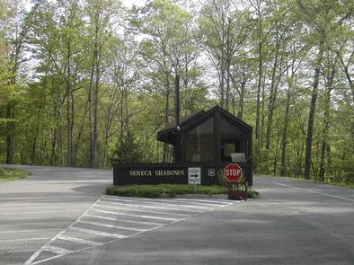
Overview

Seneca Shadows Campground overlooks Seneca Rocks and is surrounded by mountains on both the east and west. Hiking and nature study at Seneca Rocks are just a couple of the popular activities in the area. The North Fork South Branch Potomac River is nearby, making fishing a popular pastime.

Two local caves beckon ambitious explorers, and the 900-foot high Seneca Rocks can be viewed from most campsites.

Recreation

Rock climbers and hikers adore Seneca Rocks. Both sports will take visitors to the top of the impressive rocky tops with rewarding views of the mountains and valleys beyond. The hiking trail can be accessed across the street from the Seneca Shadows Campground.

Seneca Rocks Visitor Center provides a catch-and-release fishing area, viewing platforms, educational displays and a gift shop.
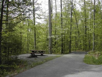
Facilities

Seneca Shadows is a modern campground with flush toilets, lantern posts, picnic tables and campfire rings. The large facility has a selection of walk-to tent sites, standard RV sites and tent-only group sites. Loop C has electric hookups. Firewood is available for sale on-site.

Natural Features

The campground sits in the river valley within the Monongahela National Forest, which extends over the north central highlands of the state, straddling many of the region’s highest peaks. Elevations range from 1,000 to 4,863 feet above sea level.

Variations in terrain and precipitation have created one of the most ecologically diverse national forests in the country.

Nearby Attractions

Campers make Seneca Shadows a convenient base camp while traveling through the Potomac Highlands. Explore the scenic roadways, especially when fall colors are at their peak.

Reservation

More from CampingHiking.net:

BRIDGES CAMPGROUND, Utah Campground Images, Info & Reservations

Directions From Huntington, Utah, travel north on Utah Highway 31 for 23 miles, to the campground. It is on the west side of Highway 31, at the mouth of Day Canyon. Phone (435)384-2372 Activities BIKING, CLIMBING, CAMPING, FISHING, HIKING, HUNTING, WILDLIFE VIEWING Keywords BRID,BRIDGES CAMPGROUND,DAY CANYON CAMPGROUND,MANTI-LASAL NF -FS Related

CURTIS CREEK, Kansas Campground Images, Info & Reservations

Directions Take I-70 to the 290 exit and proceed north 5 miles to 837. Continue west on 837 for 6 miles to reach the park entrance. Phone 785-238-5714 Activities CAMPING Keywords CURC,MILFORD LAKE,MILFORD LAKE Related Link(s) Rec Area Info & Images Kansas State Tourism Kansas State Road Conditions Overview Curtis

POINT SUPREME CAMPGROUND, Utah Campground Images, Info & Reservations

Directions Routes to Cedar Breaks National Monument Traveling south on I-15: Take exit 78 to Parowan Travel south on Main Street for 1.3 miles Turn left onto E. Center Street. Travel 0.3 Miles Turn right onto Utah Highway 143 East Continue approximately 15 miles to Cedar Breaks National Monument Traveling

TAHKENITCH CAMPGROUND, Oregon Campground Images, Info & Reservations

Directions From Reedsport, drive north 7.5 miles on Highway 101. Campground is on the west (left) side of Highway 101. Phone 541-271-6000 Activities BOATING, CAMPING, FISHING, WILDLIFE VIEWING, SWIMMING SITE, BIRDING Keywords TAHK,OREGON DUNES,SIUSLAW NF – FS Related Link(s) Rec Area Info & Images Oregon State Road Conditions Oregon State

WALDE LOOKOUT CABIN, Idaho Campground Images, Info & Reservations

Directions From Kooskia, ID, take Highway 12 East to Kamiah. Turn left onto Woodland Road for half a mile, then take the second right onto Glenwood Road (Road 100). Stay on this paved road until you reach the junction with Yakus Creek Road (Road 519). Park here (be sure to